
Der Totengrund, das mystische Heide-Tal mitten im autofreien Naturschutzgebiet Lüneburger Heide, ist ein Muss im Urlaub.
Der Totengrund
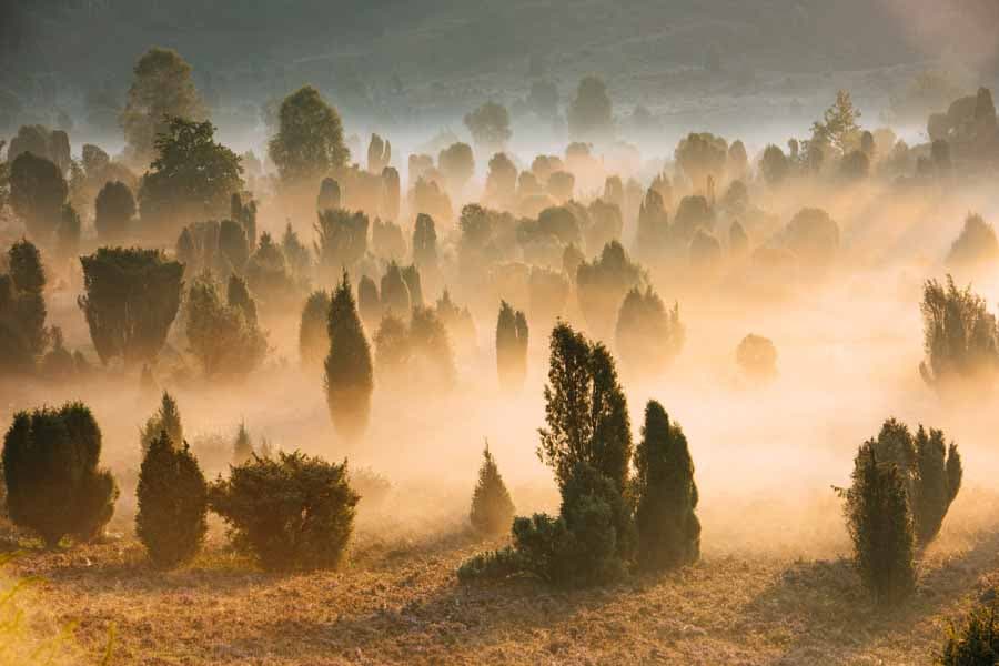
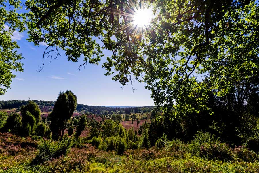
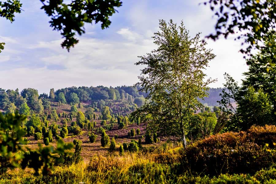
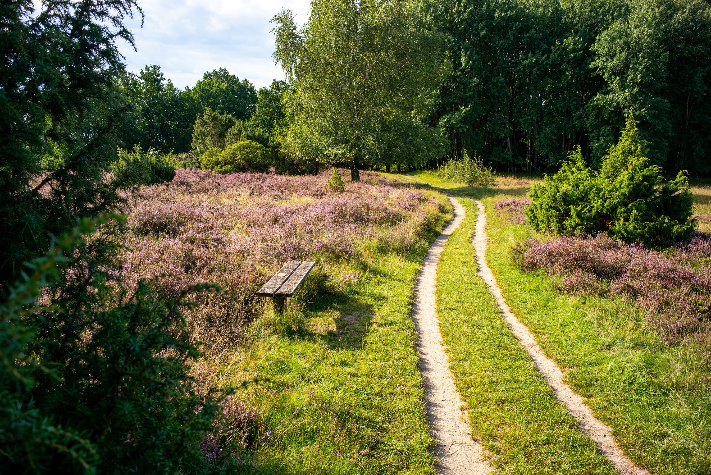
Das mystische Tal mitten im Naturschutzgebiet Lüneburger Heide, einen Kilometer südöstlich von Wilsede. Spukt es hier? Nein, was sich so mystisch anhört, ist in Wirklichkeit eine der schönsten Heideflächen überhaupt.
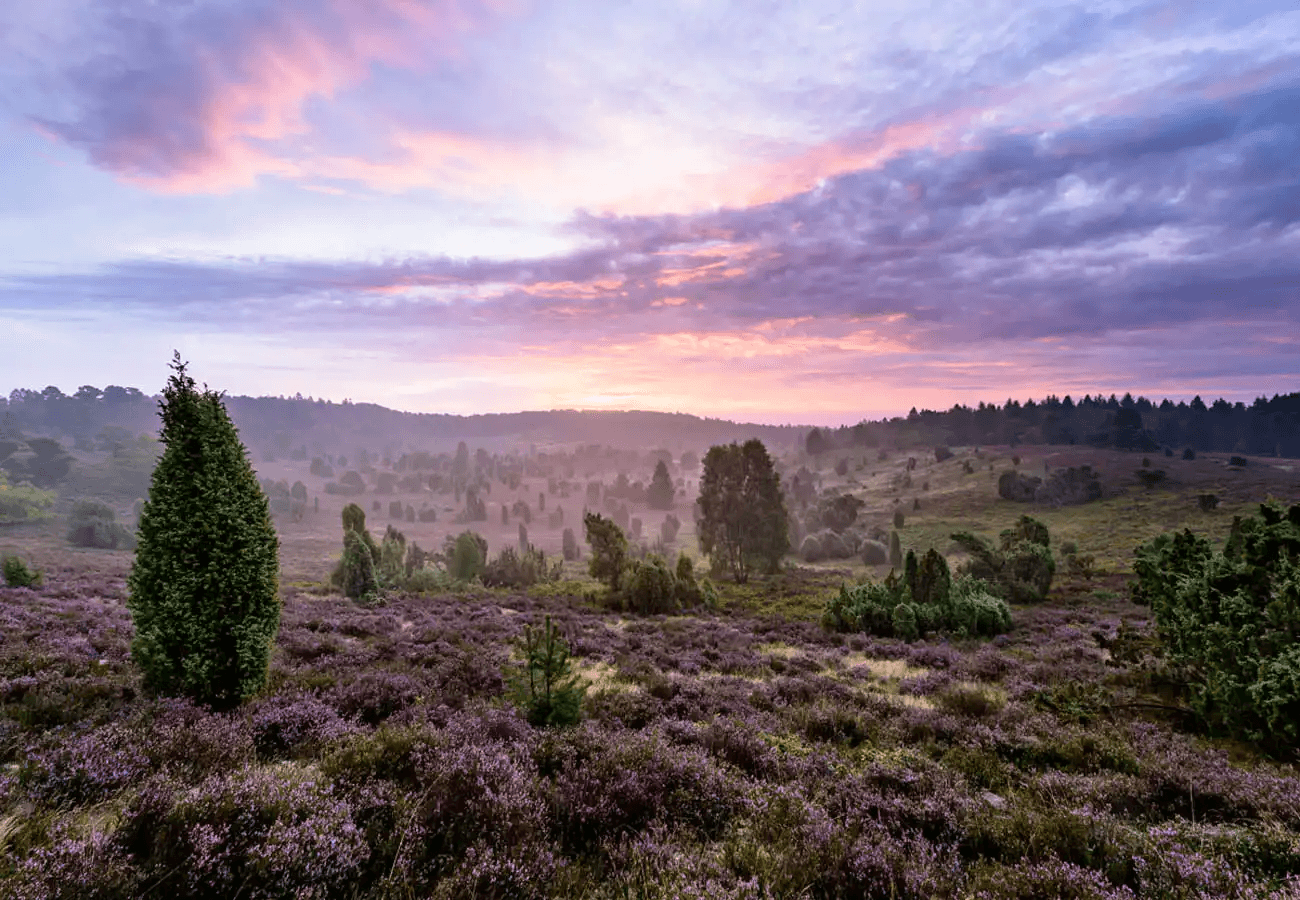
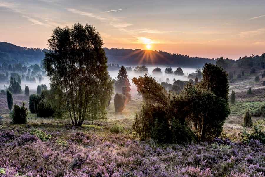
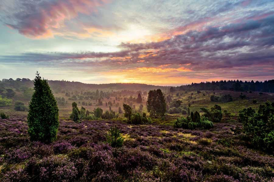
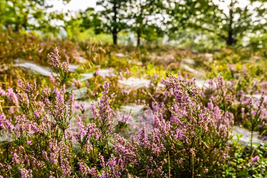
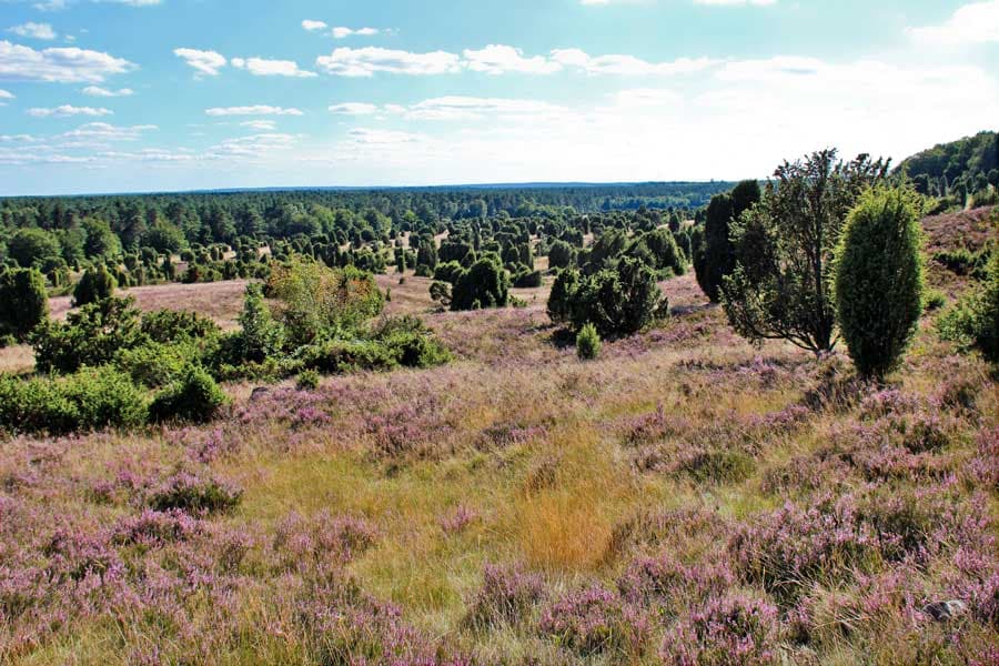
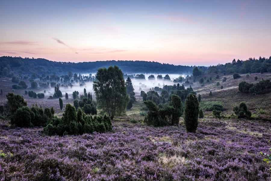
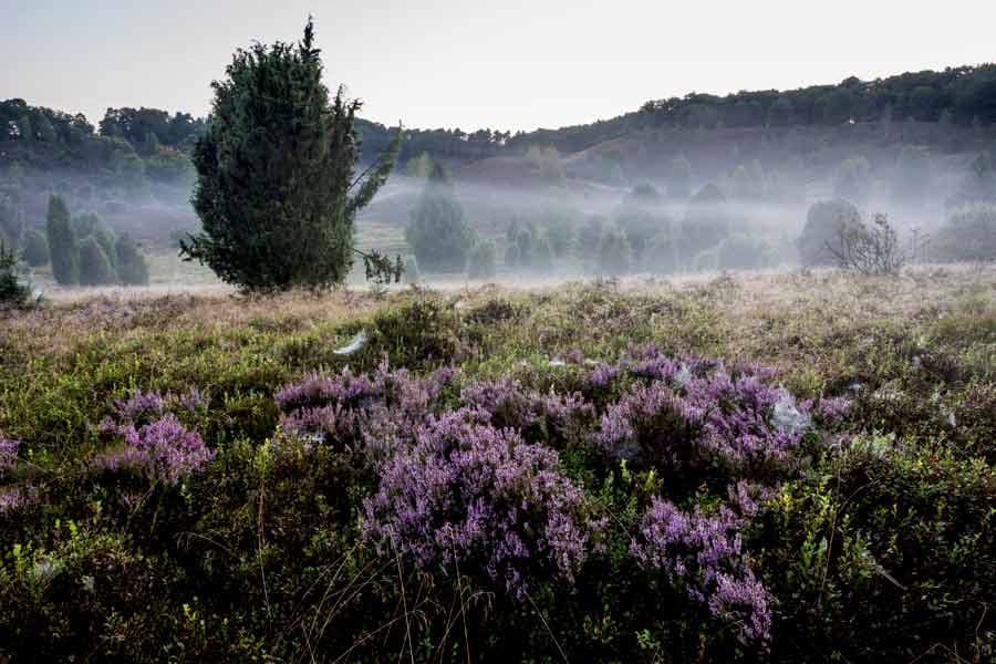
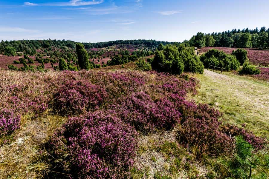
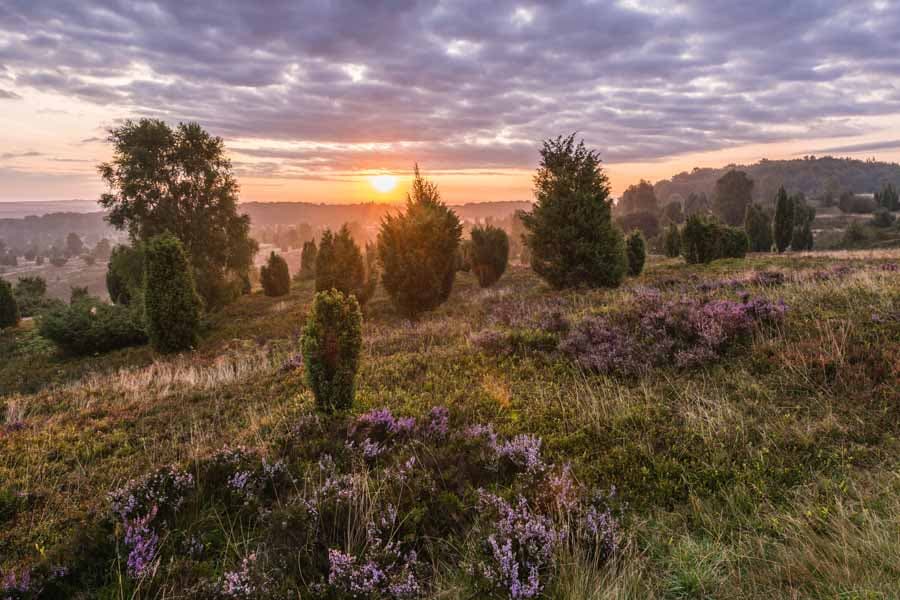
Wenn hier im August die Heide blüht, hat man von den Talrändern einen wunderbaren Blick auf das Blütenmeer. Die lila Heidepracht bringt den Kessel bildhaft zum Überlaufen.
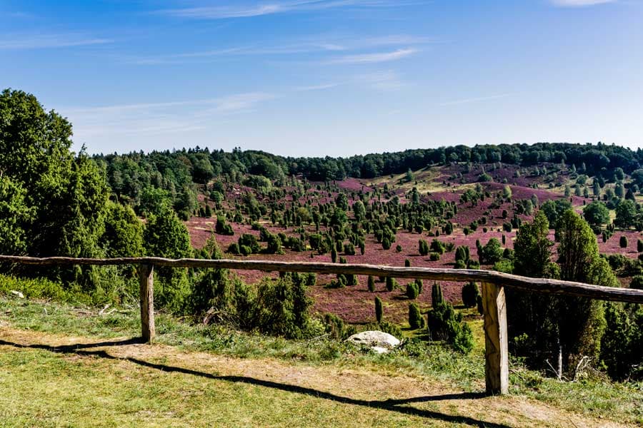
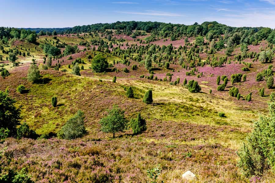
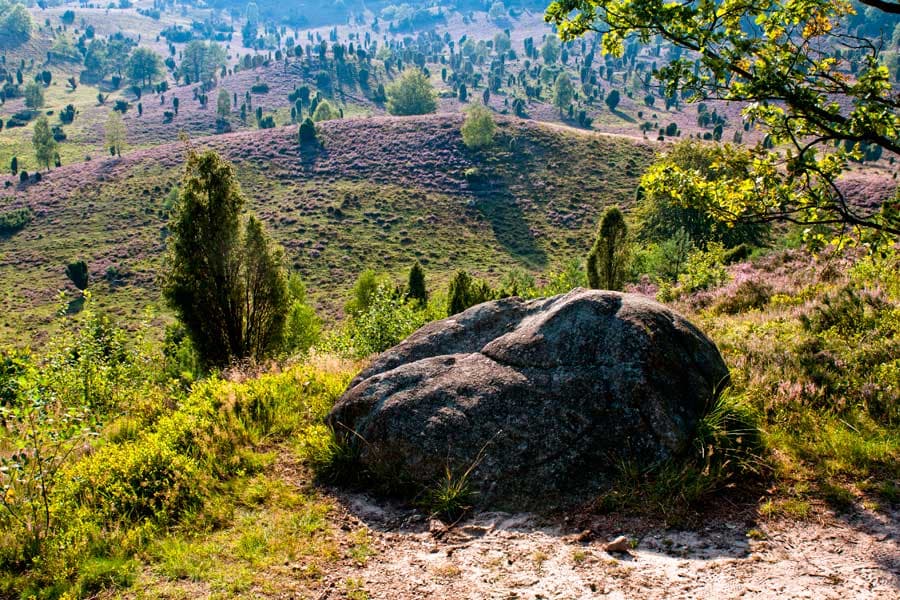
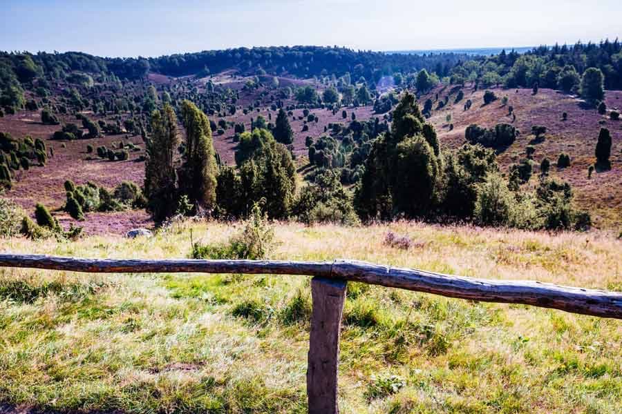
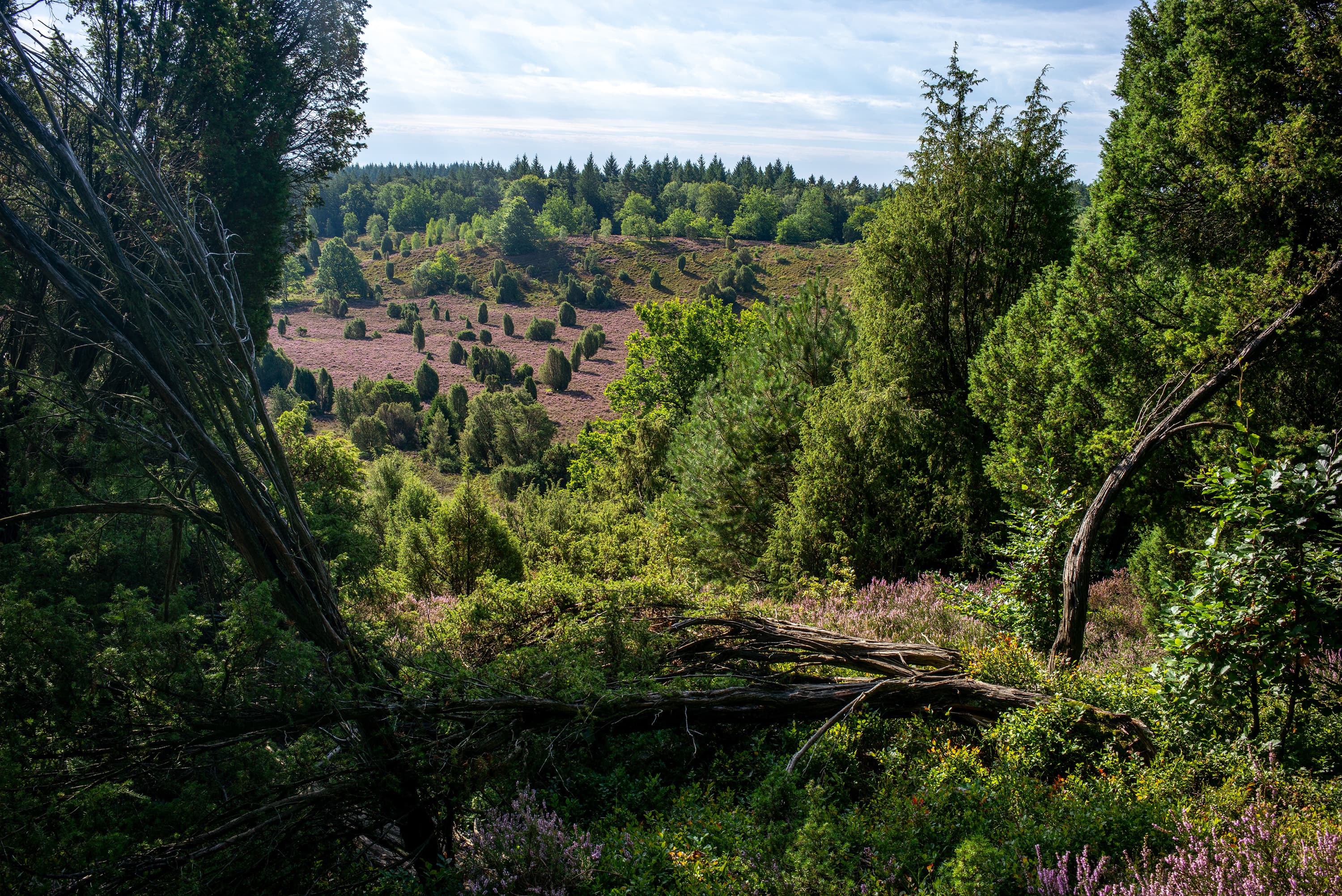
Der Totengrund ist ein 30 Hektar großer Talkessel und kann nur auf den ausgeschilderten Wegen betreten werden. Wanderwege führen aber an seinem oberen Rand entlang und gewähren eine besondere Aussicht in das Tal. Sie können einmal rund um den Totengrund wandern, was sehr zu empfehlen ist.
Der Totengrund - ein Naturschauspiel zu allen Jahreszeiten
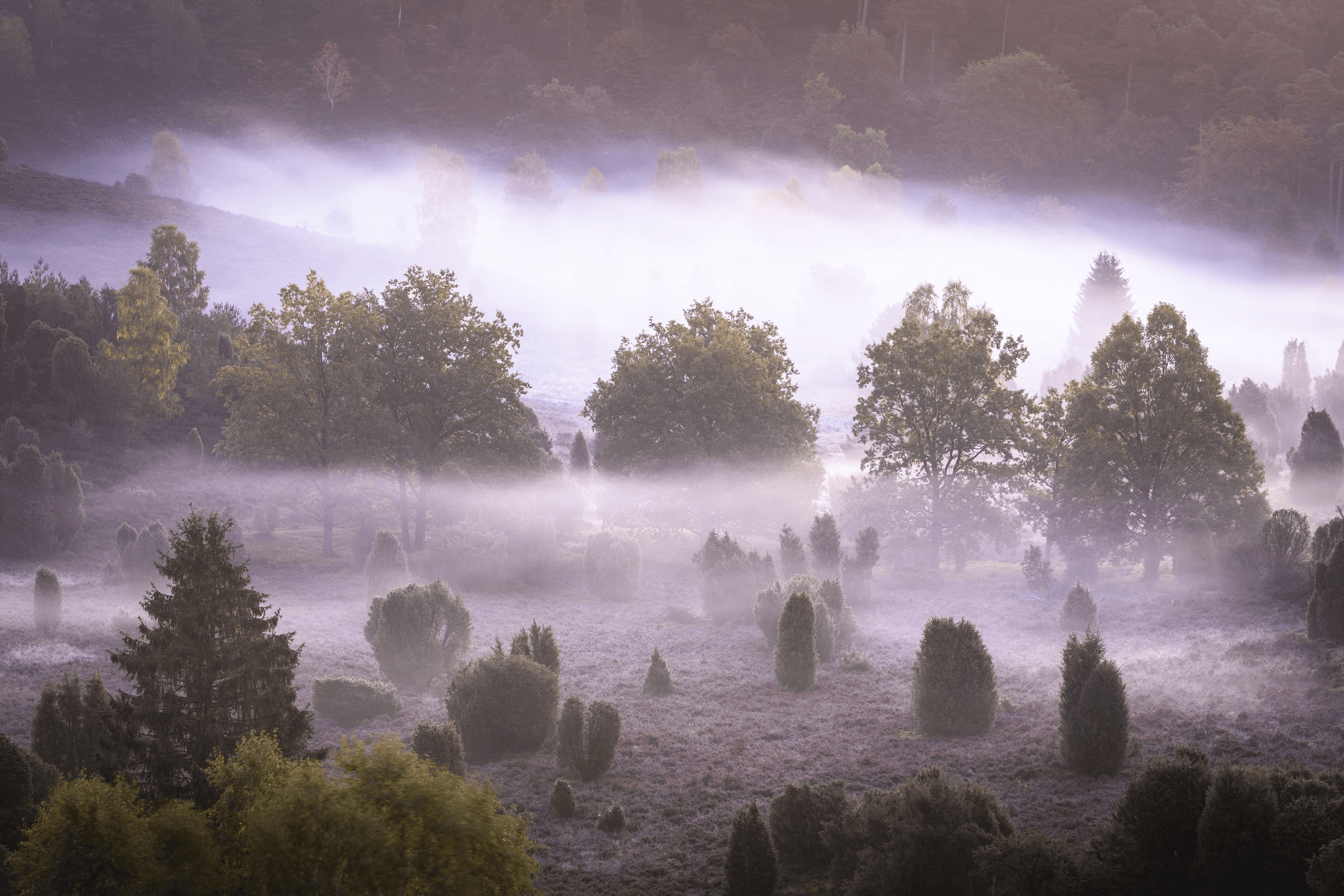
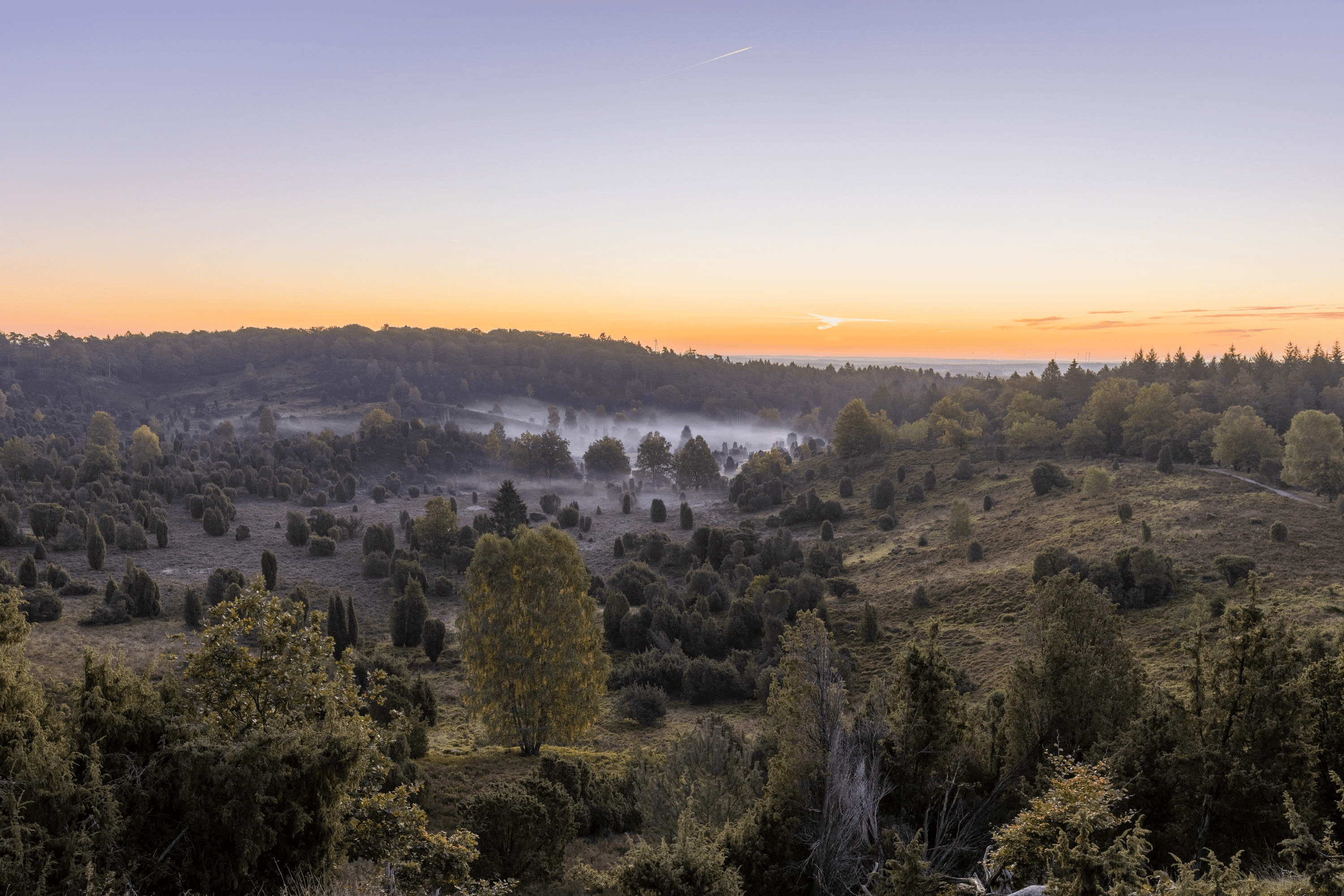
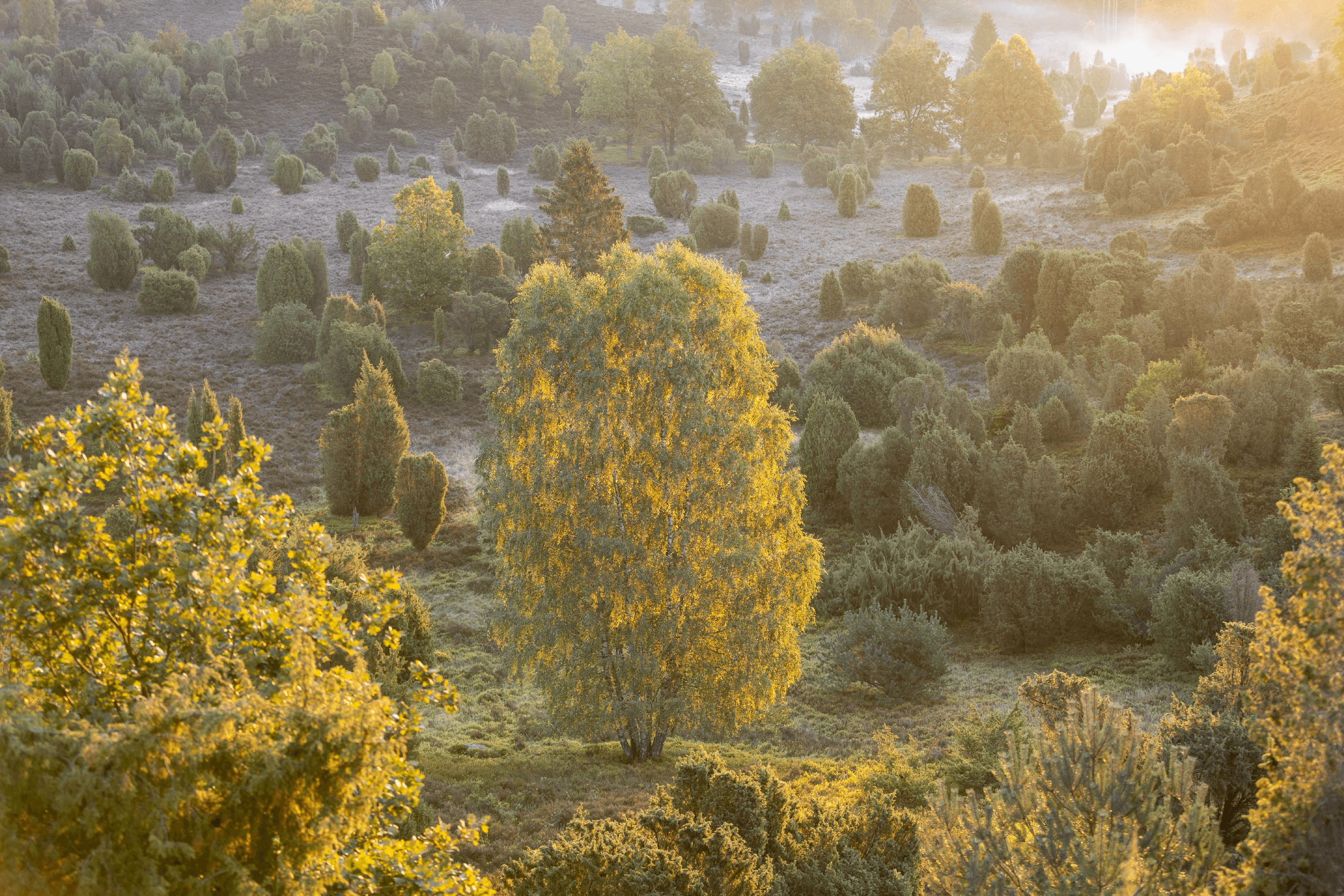
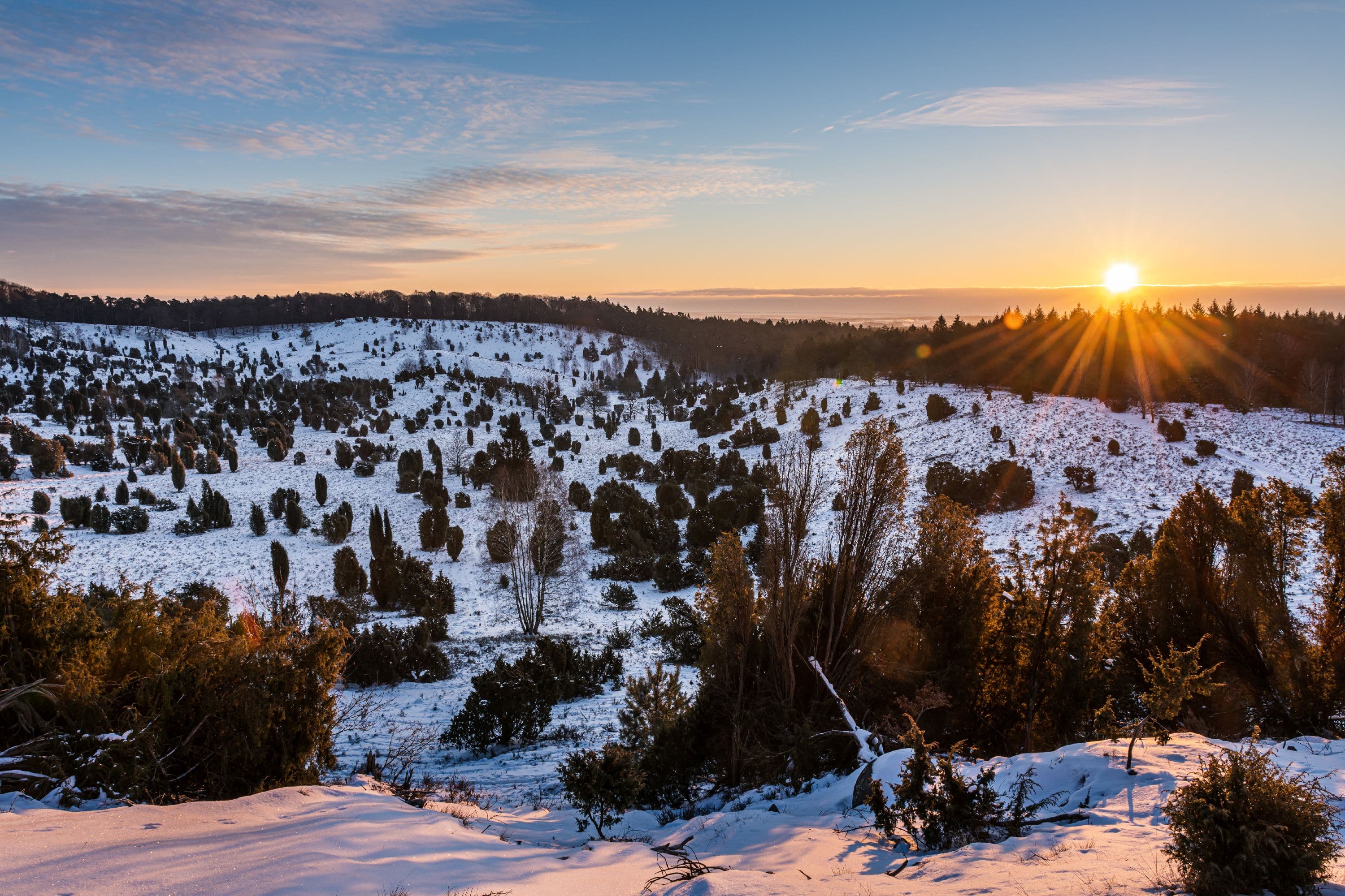
Doch der Totengrund ist nicht nur zur Heideblüte ein Traum. Auch im Frühjahr, wenn die Natur erwacht, ist der Totengrund ein lohnendes Ziel. Liebhaber schätzen den Totengrund besonders im Winter oder bei Nebel, da sich dann das mystische Bild einstellt. Eben eine Landschaft wie ein Aquarellbild, fast unrealistisch. Deshalb gehört der Totengrund auch zu den meistfotografierten Bereichen der Lüneburger Heide.
Heidepastor Bode und das Naturschutzgebiet
Bereits 1906 rettete der Heidepastor Wilhelm Bode den Totengrund vor geplanten Baumaßnahmen Hamburger Investoren und besiegelte so die Entstehung des ersten Naturschutzgebietes in Deutschland. Im Jahre 1921 wurde dann die Heidefläche unter Naturschutz gestellt und ist damit eines der ersten Naturschutzgebiete Deutschlands. Heute zählt der Totengrund zu den schönsten und meistbesuchten Heideflächen in der gesamten Lüneburger Heide. Die Heidenatur ist sehr sensibel, bitte bleiben Sie daher auf den Wegen.
Warum heißt der Totengrund so?
Hier scheiden sich die Geister, wobei "Geister" bereits das Stichwort für die erste Theorie ist ...
Die Leichenzug-Theorie
Getreu den alten Sitten wurden früher die Toten in einem Leichenzug durch das Tal des Totengrundes "kutschiert". Die eigentlichen Straßen sollten für diesen Transport nicht genutzt werden und so musste ein größerer Umweg über den Totengrund genommen werden. Die Geister von damals sollen sich noch heute im Totengrund aufhalten.
Die Toteisblock-Theorie
Der eigenartige Kessel des Totengrundes mit uralten Wacholderhainen gehört zur flachwelligen Moränenlandschaft. Durch stetiges Abtauen eines riesigen, mit Sand überlagerten Toteisblockes, der noch lange nach dem Rückgang der Gletschermassen existierte, scheint dieses sogenannte Trockental entstanden zu sein. Aus dem Abschmelzen des Toteisblockes blieb dann der Totengrund übrig.
Die Meteoriten-Theorie
Der Totengrund ist durch einen heftigen Meteoritenaufprall entstanden, der alles Leben in diesem Gebiet auf einen (Ein)schlag auslöschte. Zurück blieb nur der "Totengrund".
Die Toter-Grund-Theorie
Da im Totengrund, wie im übrigen Heidegebiet übrigens auch, nur wenige Nährstoffe im Boden enthalten waren und auch keine Quelle und kein Bach vorhanden war, konnte im Bereich des Totengrundes weder Vieh- noch Feldwirtschaft betrieben werden. Der Totengrund wurde früher von den Heidebauern auch „Toter Grund“ genannt. Die einzigen Pflanzen waren Wachholder und Heide. Davon konnten die Menschen aber nicht (über)leben.
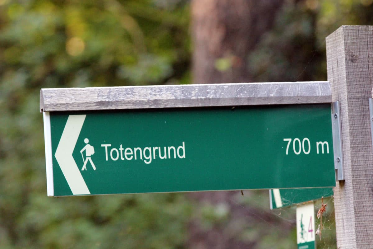
Wanderwege am Totengrund
Der Totengrund bietet ideale Möglichkeiten die Natur zu genießen. Schließlich sind im gesamten Naturschutzgebiet keine Autos erlaubt. Erwandern Sie die Region und entdecken Sie die typischen Heidschnuckenherden und Bienenzäune am Wegesrand. Besonders während der Heideblüte im Spätsommer offenbaren sich Ihnen hier die typischen Heideflächen mit Wachholdersträuchern und reetgedeckten Schafställen am Horizont.
Unser Tipp: Wanderweg Lila Krönung
Erleben Sie die Heidelandschaft in ihrem ganzen Zauber. Der Wanderweg „Lila Krönung“ durchquert das größte zusammenhängende Heidegebiet im Naturpark von Ost nach West und verbindet mit Amelinghausen und Schneverdingen die beiden Orte, in denen jedes Jahr eine Heidekönigin gekürt wird. Am Weg liegen der Totengrund mit seinen zahlreichen Wacholderbüschen, das typische Heidedorf Wilsede und die Niederung der Haverbeeke. Eine Krönung Ihrer Wanderung ist der Wilseder Berg, die mit 169 Metern höchste Erhebung in der nordwestdeutschen Tiefebene.
Weitere Infos zum Wanderweg "Lila Krönung" mit Tourenbeschreibung finden Sie hier!
Von Totengrund zum Wilseder Berg
Ungefähr 35 Minuten zu Fuß (Fahrrad 11 min) sind es vom Totengrund zum zweiten Höhepunkt im Naturschutzgebiet Lüneburger Heide, dem 169 Meter hohen Wilseder Berg. Ungefähr auf halber Strecke liegt das Dorf Wilsede, in dem Sie einkehren können. Der Weg ist zum Teil naturbelassen, ab Wilsede dann auch ein Stück Kopfsteinpflaster.
Steingrund, der kleine Bruder des Totengrunds
Neben dem Totengrund gibt es ein weiteres, länger gezogenes Heidetal, den Steingrund. Auch er ist sehr sehenswert und kann wunderbar mit dem Totengrund kombiniert werden. Es gibt einen Höhenweg, der rechts neben dem Aussichtspunkt am Totengrund beginnt und über den Steingrund wieder zurück nach Wilsede führt.
Anreise zum Totengrund
Hinweis:
Der Totengrund und der Heideort Wilsede liegen im autofreien Naturschutzgebiet Lüneburger Heide und können nicht mit dem Auto angefahren werden. Das Befahren des Naturschutzgebietes steht unter Strafe.
Navi-Adressen der Parkplätze am Rande des Naturschutzgebietes / Parkplätze für einen Ausflug zum Totengrund:
- Besucherparkplatz Undeloh: Wilseder Straße, 21274 Undeloh (Parkplatz ist am Ende der Straße). Koordinaten: N53.192311 E9.977018
- Besucherparkplatz Döhle: Dorfstraße - Ecke Hörpeler Weg, 21272 Döhle. Koordinaten: N53.163745 E10.035300
- Besucherparkplatz Niederhaverbeck: direkt an der L211, Niederhaverbeck 14, 29646 Niederhaverbeck. Koordinaten: N53.150891 E9.908516
- Besucherparkplatz Oberhaverbeck: direkt an der L211, 29646 Oberhaverbeck. Koordianten: N53.143027 E9.919340
- Besucherparkplatz Volkwardingen: an der K34 im Ort Volkardingen, 29646 Volkwardingen. Kooridnaten: N53.134477 E9.997257
Alle Parkplätze sind kostenpflichtig, das Geld wird für den Erhalt der Heide eingesetzt. Bitte parken Sie nicht wild am Straßenrand, dort werden Sie abgeschleppt.
Der kürzeste Weg zu Totengrund:
Der Totengrund liegt mitten im autofreien Naturschutzgebiet Lüneburger Heide. Parken Sie bitte auf den oben genannten Parkplätzen und bewegen Sie sich im Naturschutzgebiet nur zu Fuß, per Fahrrad, oder mit der Kutsche. Die Natur ist hier sensibel, bitte bleiben Sie auf den Wegen.
Entfernungen zum Totengrund (jeweils kürzeste Route)
Undeloh Parkplatz - Totengrund: zu Fuß ca. 65 Minuten
Niederhaverbeck - Totengrund: zu Fuß ca. 60 Minuten
Oberhaverbeck - Totengrund: zu Fuß ca. 50 Minuten
Volkwardingen - Totengrund: zu Fuß ca. 55 Minuten
Döhle - Totengrund: zu Fuß ca. 90 Minuten
Egestorf Sudermühlen - Totengrund: zu Fuß ca. 100 Minuten
Schneverdingen - Totengrund: zu Fuß ca. 2 Std. 50 Minuten
Bahnhof Wintermoor - Totengrund: zu Fuß ca. 2 Std. 40 Minuten
Kutschfahrt zum Totengrund
Den Totengrund erreicht man auch mit der Pferdekutsche von Oberhaverbeck, Niederhaverbeck, Undeloh, Döhle oder Sudermühlen oder zu Fuß sowie mit dem Rad. Die Kutschen fahren bis zum Kutschenparkplatz in Wilsede, den restlichen Weg (1 km) legt man dann zu Fuß zurück.
Für Ihre Kutschfahrt zum Totengrund empfehlen wir Ihnen die Qualitätskutscher Lüneburger Heide. Alle Qualitätskutscher haben an umfangreichen Schulungen teilgenommen und können Ihnen auch beantworten, welche der Theorien zum Totengrund am wahrscheinlichsten ist. Sie erkennen die Kutscher an der beigen Weste mit Namensschild und dem Logo "Lüneburger Heide" sowie dem Logo "Lüneburger Heide" direkt auf der Kutsche.
Gastronomie am Totengrund
Die nächste Gastronomie inklusive Toiletten finden Sie im 1 km entfernten Wilsede.
Übernachten in der Nähe des Totengrunds
Ideale Übernachtungsorte, um den Totengrund und das Naturschutzgebiet zu besuchen: Bispingen, Egestorf, Handeloh, Hanstedt, Schneverdingen.
Koordinaten Totengrund:
N53.15487 E9.96781
Zur Einstimmung:
Das dürfte Sie interessieren
Wilseder Berg - Herz der Heide
BispingenDer Wilseder Berg liegt in der Lüneburger Heide, mitten im autofreien Naturschutzgebiet und ist der höchste Berg der Region.
Wilsede
BispingenInmitten des Naturschutzgebietes Lüneburger Heide liegt der idyllische und autofreie Heideort Wilsede.
8 ausgesuchte Hotels in Bispingen
Bispingen Hotel für Ihren UrlaubBispingenUrlaub in Bispingen Die Gemeinde Bispingen ist bekannt durch ihre Lage am Naturschutzgebiet Lüneburger Heide und die Attraktionen SnowWorld, Kart Bahn, Abenteuerland, Modellbaueisenbahn, Abenteuerlabyrinth, Battle Kart und verrücktes Haus. Die Natur-Attraktionen Wilseder Berg und Totengrund sind Hö…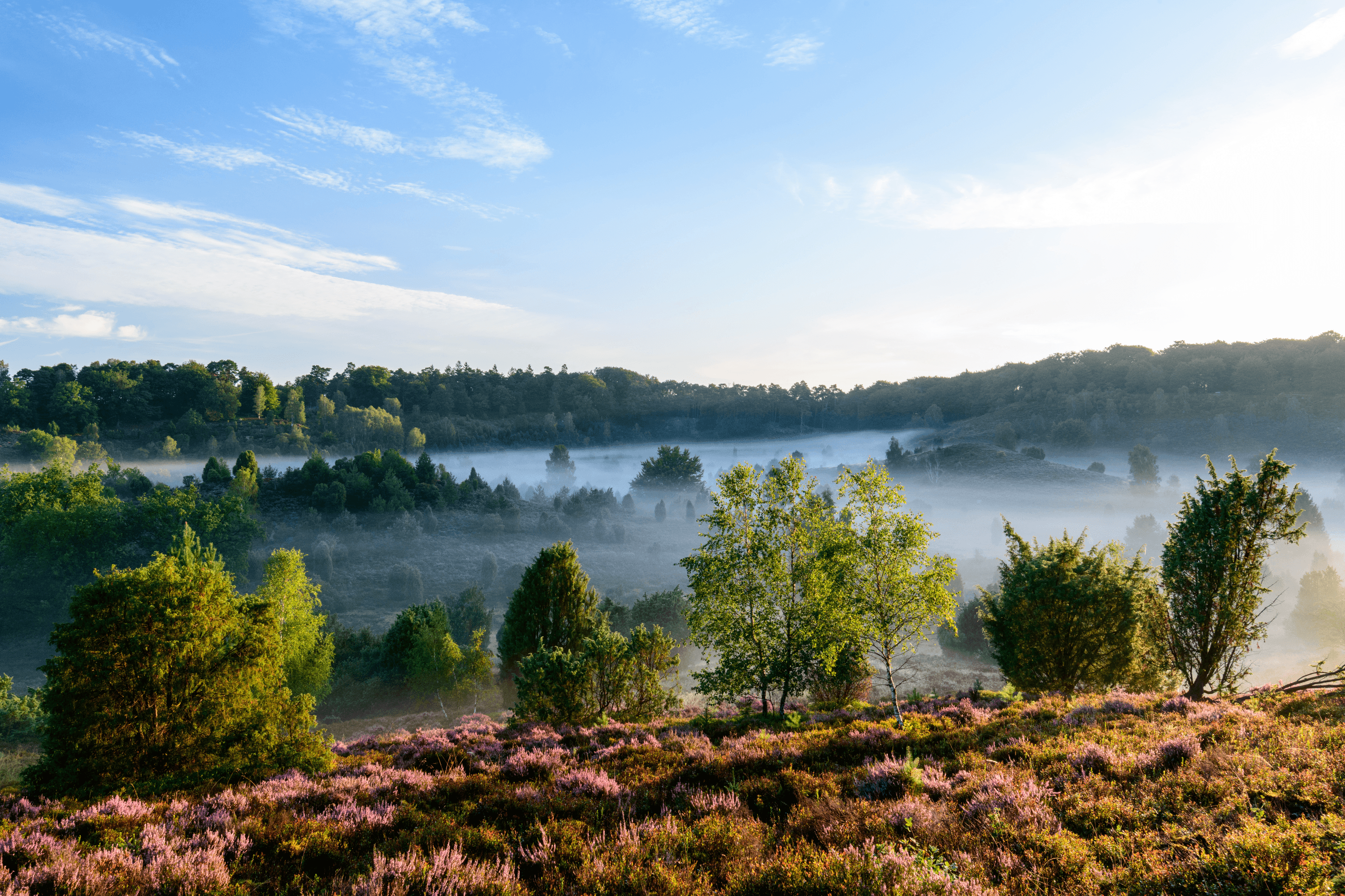
4 Wanderwege zum Totengrund
Tipps für eine Wanderung zum TotengrundBispingenDer Totengrund Schon 1906 für den Schutz der Natur aufgekauft und später als Keimzelle eines der ersten Naturschutzgebiete Deutschlands, hatte der Totengrund stets eine besondere Rolle. Ganz sicher gehört zu jedem Urlaub in der Lüneburger Heide ein Besuch des Totengrunds. Jeder verliebt sich sofort…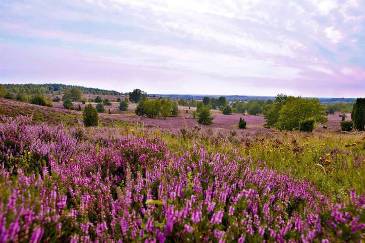
Autofreies Naturschutzgebiet
Das Herz der Heide ist autofreiAutofreies Naturschutzgebiet Lüneburger Heide Die Lüneburger Heide verfügt über ein Naturschutzgebiet. Es wurde erstmals 1922 ausgewiesen und ist damit das älteste und größte Naturschutzgebiet Niedersachsens. Man bezeichnet dieses Gebiet auch als "Herz der Heide". Es erstreckt sich von Hanstedt im…