
©Lüneburger Heide GmbH/Thorsten Link

©Thorsten Link/Lüneburger Heide GmbH
©Partner der Lüneburger Heide GmbH

©Thorsten Link/Lüneburger Heide GmbH
©Partner der Lüneburger Heide GmbH
©Partner der Lüneburger Heide GmbH
©Partner der Lüneburger Heide GmbH
©Partner der Lüneburger Heide GmbH
©Partner der Lüneburger Heide GmbH
©Partner der Lüneburger Heide GmbH
©Partner der Lüneburger Heide GmbH
©Partner der Lüneburger Heide GmbH
©Partner der Lüneburger Heide GmbH
©Partner der Lüneburger Heide GmbH
©Partner der Lüneburger Heide GmbH
©Partner der Lüneburger Heide GmbH
©Partner der Lüneburger Heide GmbH
©Partner der Lüneburger Heide GmbH
©Partner der Lüneburger Heide GmbH
©Partner der Lüneburger Heide GmbH

©Thorsten Link/Lüneburger Heide GmbH
Die Schwindebecker Heide liegt in Soderstorf bei Amelinghausen. Ein gut ausgeschilderter Parkplatz erleichtert die Anreise.
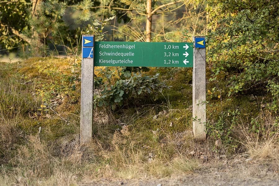
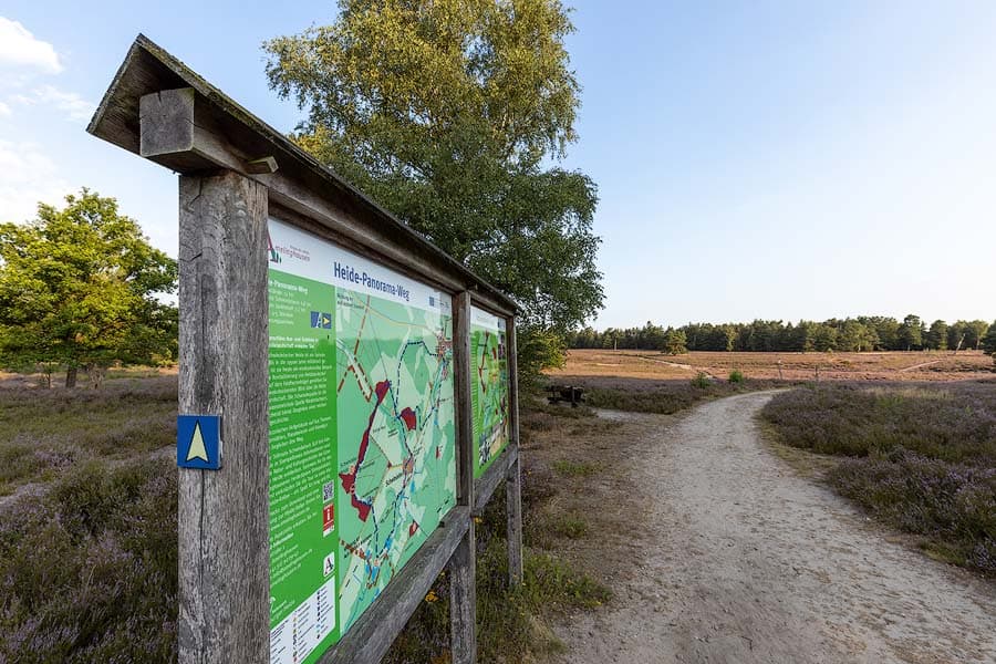
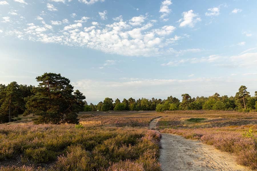
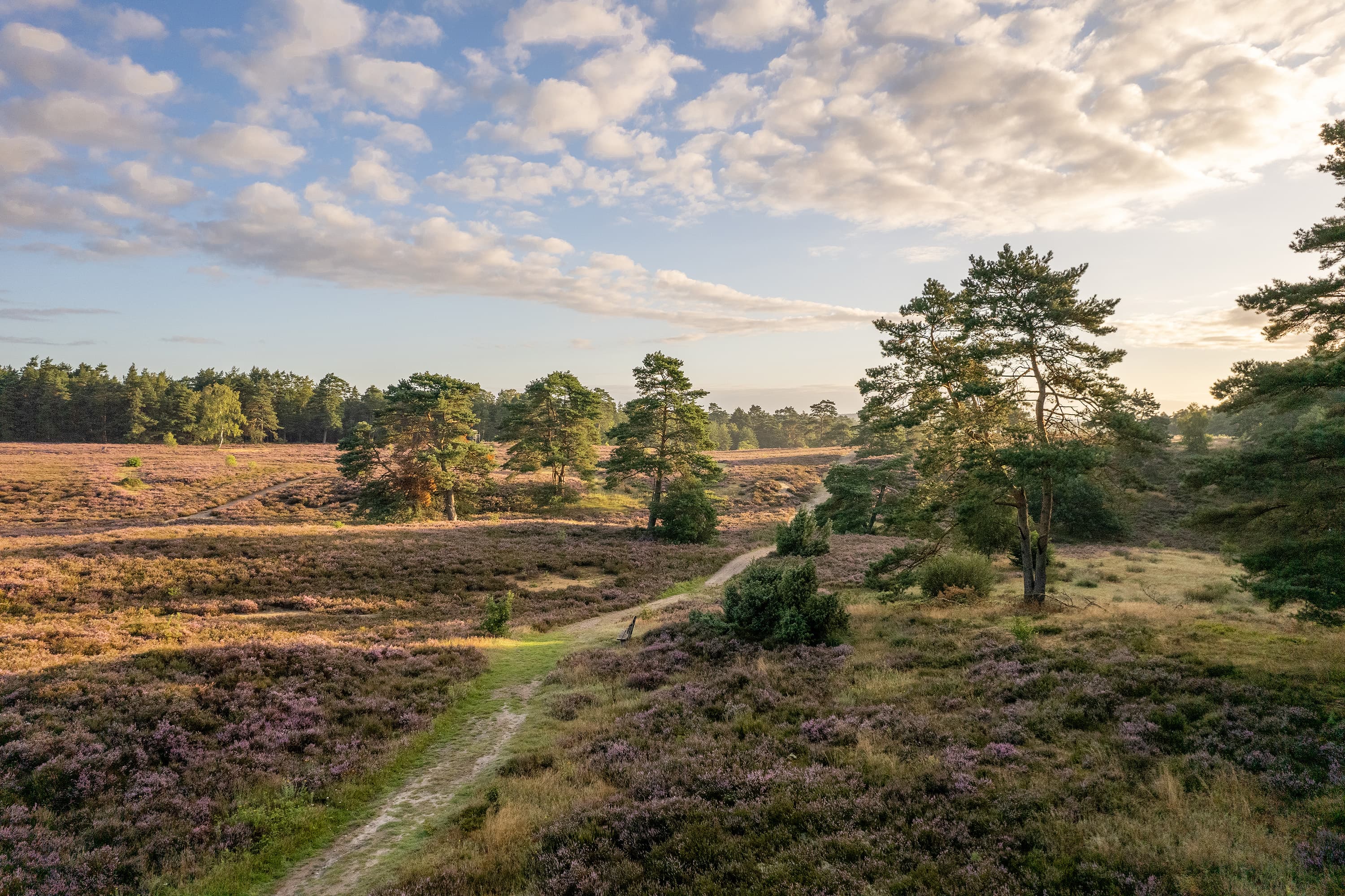
Über den ausgeschilderten Heide-Panorama-Weg (Wanderweg), der durch die Schwindebecker Heide führt, können Sie entweder die ganzen 14 km wandern, oder kürzere Routen über zwei Teilstrecken. Kartenmaterial erhalten Sie in der Tourist Information Amelinghausen.
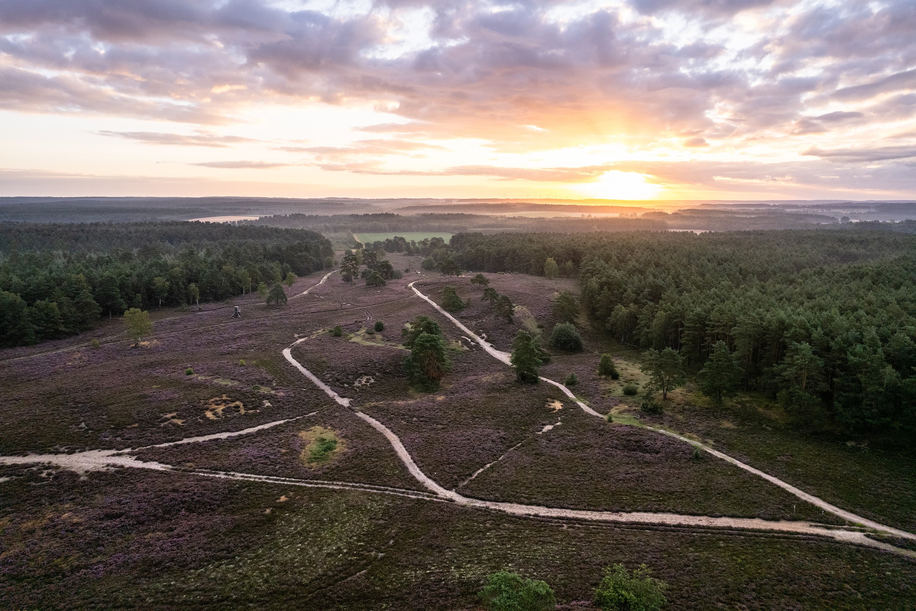
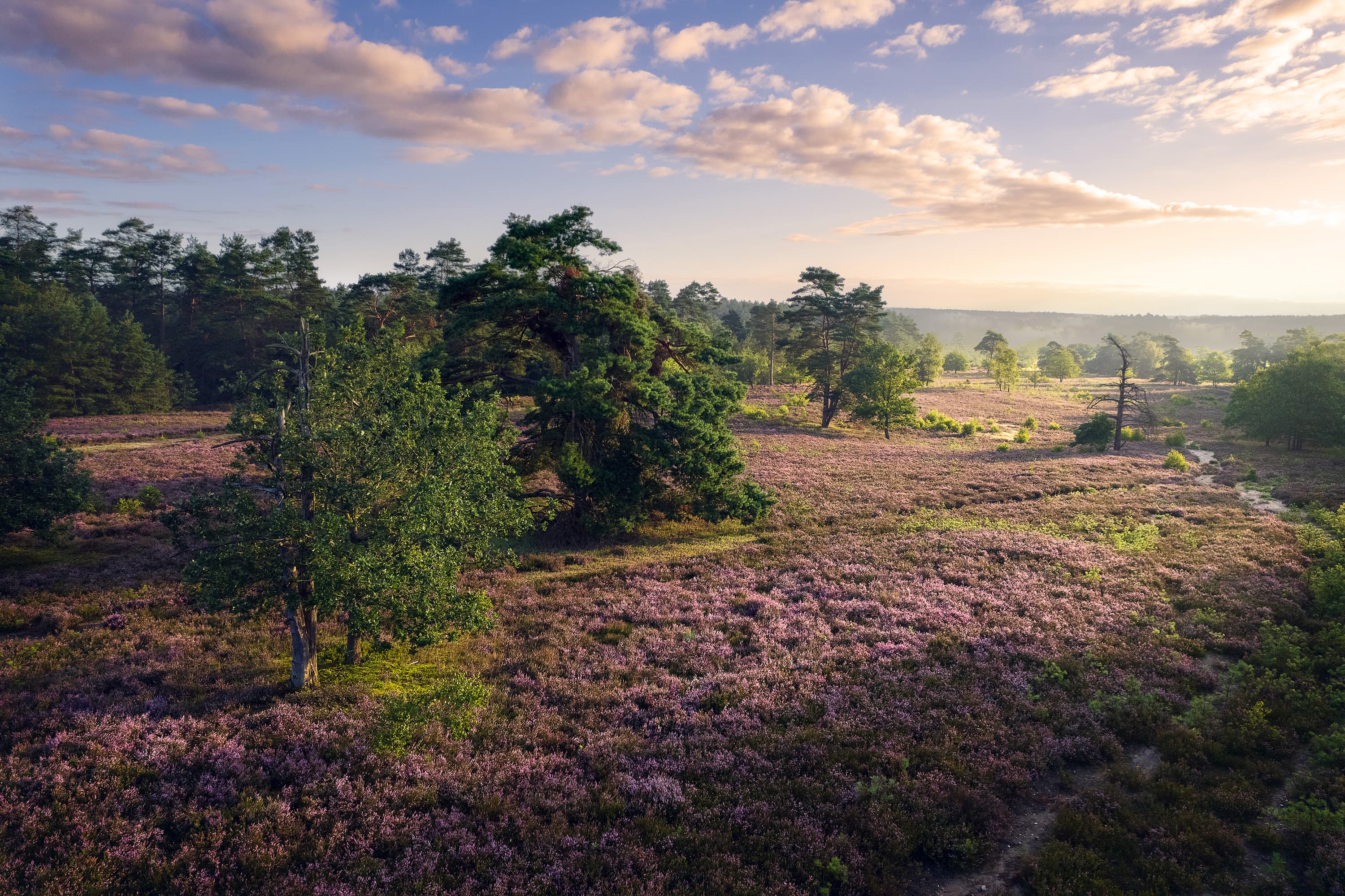
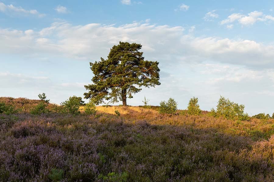
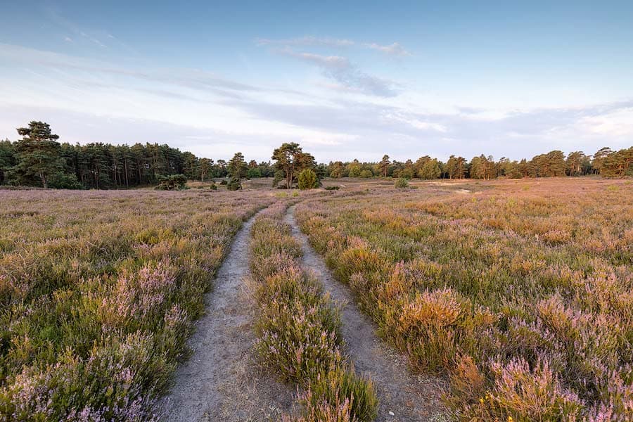
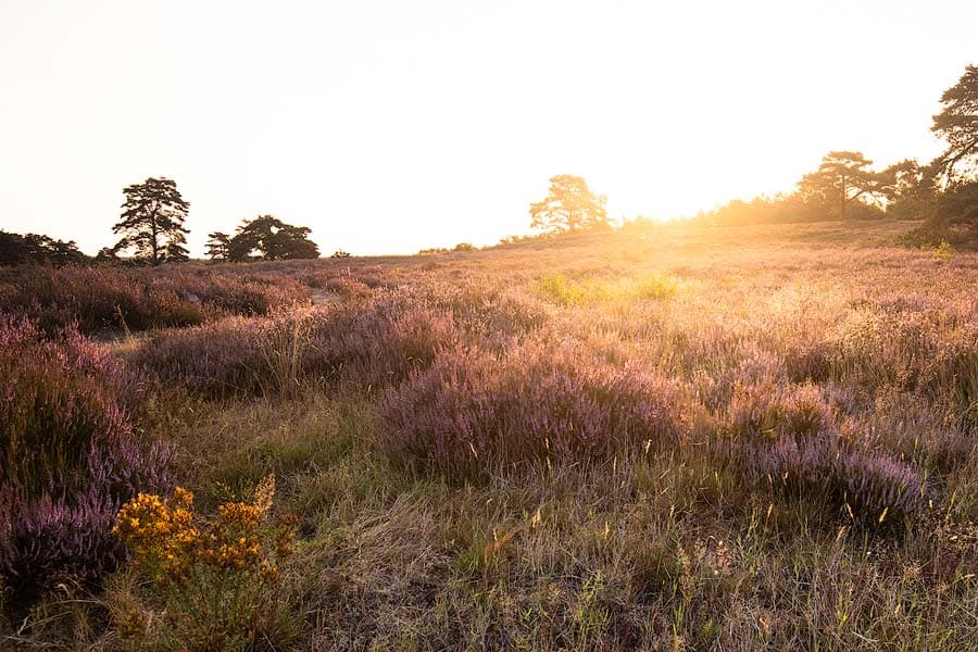
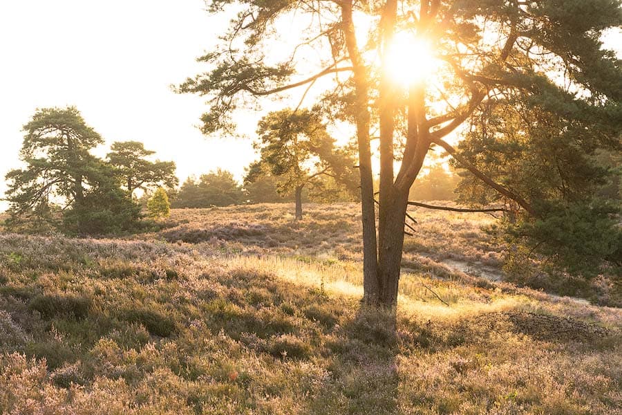
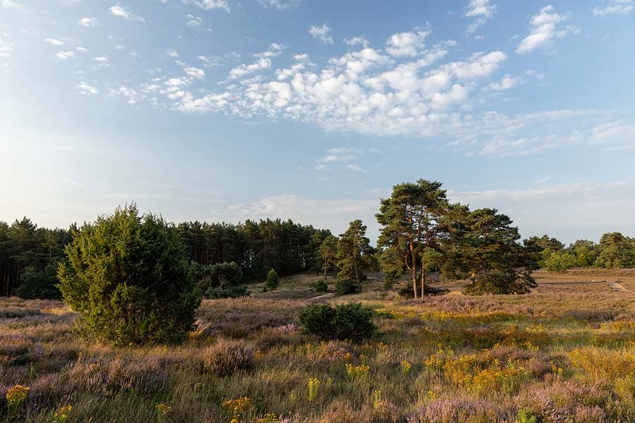
Bis in die 1990er Jahre wurde dieser Bereich der Heide militärisch genutzt und danach revitalisiert. Die Schwindebecker Heide ist leicht hügelig, hinter jeder Kurve des Wanderweges wartet eine neue, beeindruckende Naturkulisse.
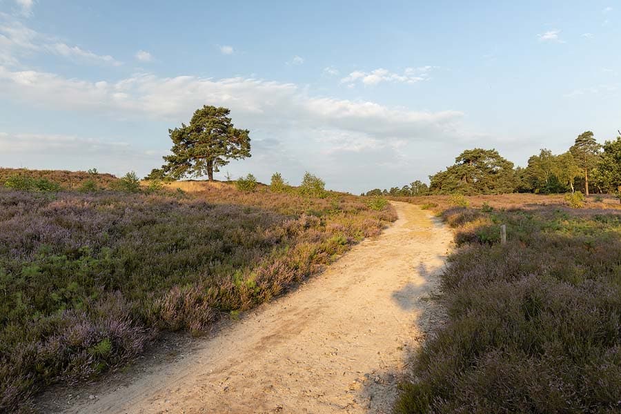
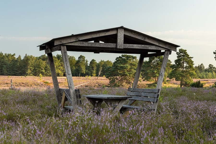
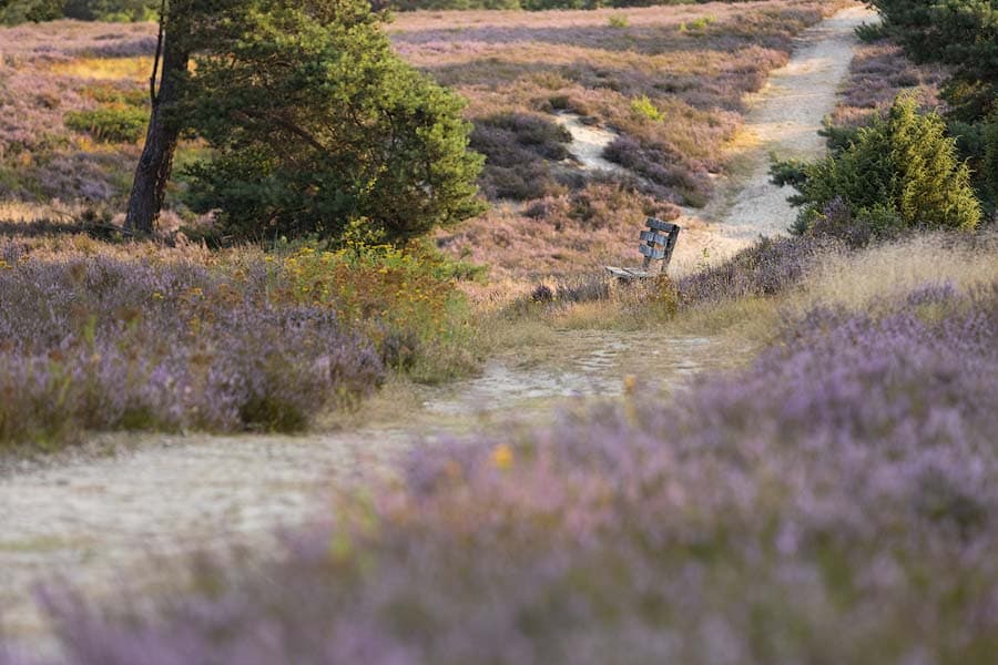
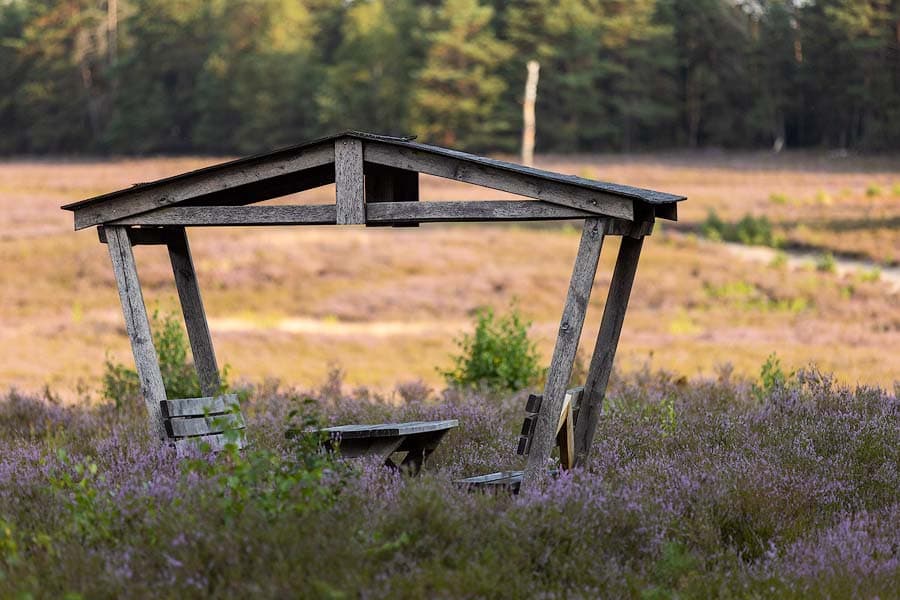
Vom Feldherrenhügel aus haben Sie eine fantastische Sicht über die Heidefläche der Schwindebecker Heide. Picknickhäuschen bieten mitten in der Heidefläche einen guten Grund für eine Brotzeit.
Über den ausgeschilderten Heide-Panorama-Weg (Wanderweg), der durch die Schwindebecker Heide führt, können Sie entweder die ganzen 14 km wandern, oder kürzere Routen über zwei Teilstrecken. Kartenmaterial erhalten Sie in der Tourist Information Amelinghausen.
Bis in die 1990er Jahre wurde dieser Bereich der Heide militärisch genutzt und danach revitalisiert. Die Schwindebecker Heide ist leicht hügelig, hinter jeder Kurve des Wanderweges wartet eine neue, beeindruckende Naturkulisse.
Vom Feldherrenhügel aus haben Sie eine fantastische Sicht über die Heidefläche der Schwindebecker Heide. Picknickhäuschen bieten mitten in der Heidefläche einen guten Grund für eine Brotzeit.
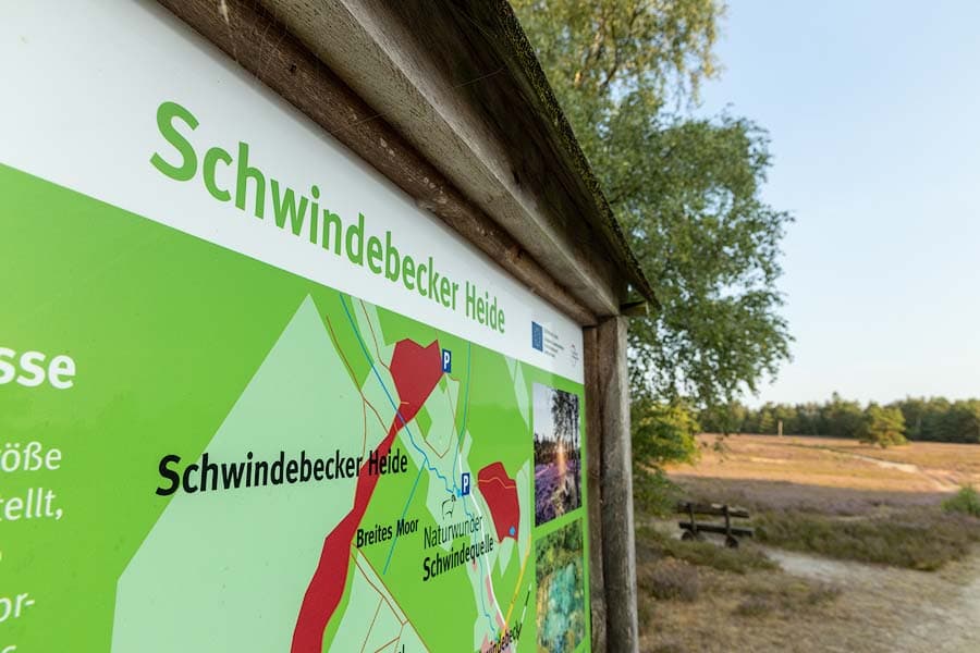
Schwindebecker Heide
Die Heide nahe des Örtchens Schwindebeck hat zwischen den angrenzenden Wäldern nur eine Ausbreitung von wenigen hundert Metern, zieht sich dafür auf sandigen Pfaden jedoch kilometerweit in die Länge. Die Wege führen auf den Feldherrenhügel, von wo aus sich ein toller Weitblick über die langgestreckte Schwindebecker Heide und die umliegende Landschaft bietet.
Der Name der Erhebung weist auf die frühere Nutzung als militärische Übungsfläche hin, als britische Panzer die Fläche in eine sandige Mondlandschaft verwandelten. Seit 1990 ist die Schwindebecker Heide ein gelungenes Beispiel für die Revitalisierung von Heidelandschaften.
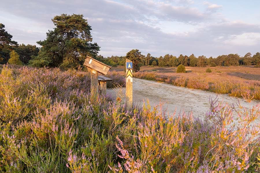
Wanderweg
Durch die Schwindebecker Heide führt der ausgewiesene Wanderweg Heide-Panorama-Weg.Die gelben Richtungspfeile auf blauem Grund führen auch zur Schwindequelle einem wahren Naturwunder.
Schwindebeck
Der schöne Ort liegt zwischen Soderstorf und Bispingen, 8 Autominuten von Amelinghausen entfernt. Sowohl an der Schwindequelle als auch an der Kreisstraße 44 bilden Parkplätze einen ideal nahegelegenen Ausgangspunkt für die Wanderung durch die Schwindebecker Heide.
Für naturbegeisterte Wohnmobilisten empfehlen wir den Stellplatz direkt an der Schwindebecker Heide.
Anreise:
Fahren Sie nach 21388 Soderstorf und folgenden Sie dort der Ausschilderung in die Schwindebecker Heide.