
©Lüneburger Heide GmbH / Markus Tiemann
©Thorsten Link/Lüneburger Heide GmbH
©Thorsten Link/Lüneburger Heide GmbH
©Thorsten Link/Lüneburger Heide GmbH
©Markus Tiemann/Lüneburger Heide GmbH
©Markus Tiemann/Lüneburger Heide GmbH
©Partner der Lüneburger Heide GmbH
©Partner der Lüneburger Heide GmbH
©Lüneburger Heide GmbH/Dominik Ketz
©© Dominik Ketz
©Lüneburger Heide GmbH/Dominik Ketz
©Lüneburger Heide GmbH/Dominik Ketz
©Lüneburger Heide GmbH/Markus Tiemann
©Lüneburger Heide GmbH/Markus Tiemann
©Partner der Lüneburger Heide GmbH
©Partner der Lüneburger Heide GmbH
©Lüneburger Heide GmbH/ALEXANDER KASSNER
©Lüneburger Heide GmbH/Dominik Ketz
©Partner der Lüneburger Heide GmbH
©Lüneburger Heide GmbH/Dominik Ketz
©Lüneburger Heide GmbH/ALEXANDER KASSNER
©Lüneburger Heide GmbH/ALEXANDER KASSNER
©Partner der Lüneburger Heide GmbH
©Lüneburger Heide GmbH/Alexander Kassner
©Lüneburger Heide GmbH / Markus Tiemann
©Lüneburger Heide GmbH / Markus Tiemann
©Lüneburger Heide GmbH/ Markus Tiemann
©Markus Tiemann/Lüneburger Heide GmbH
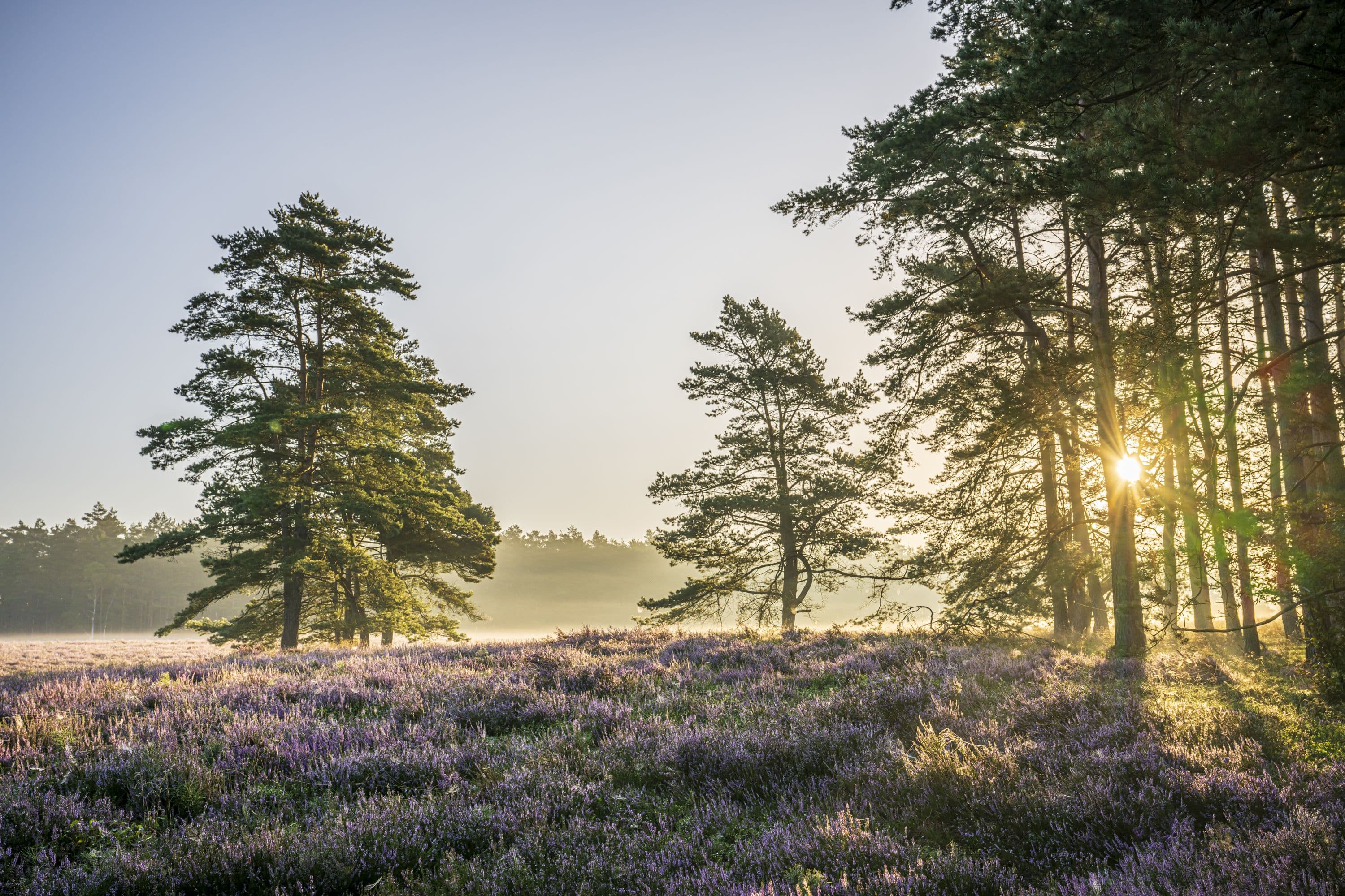
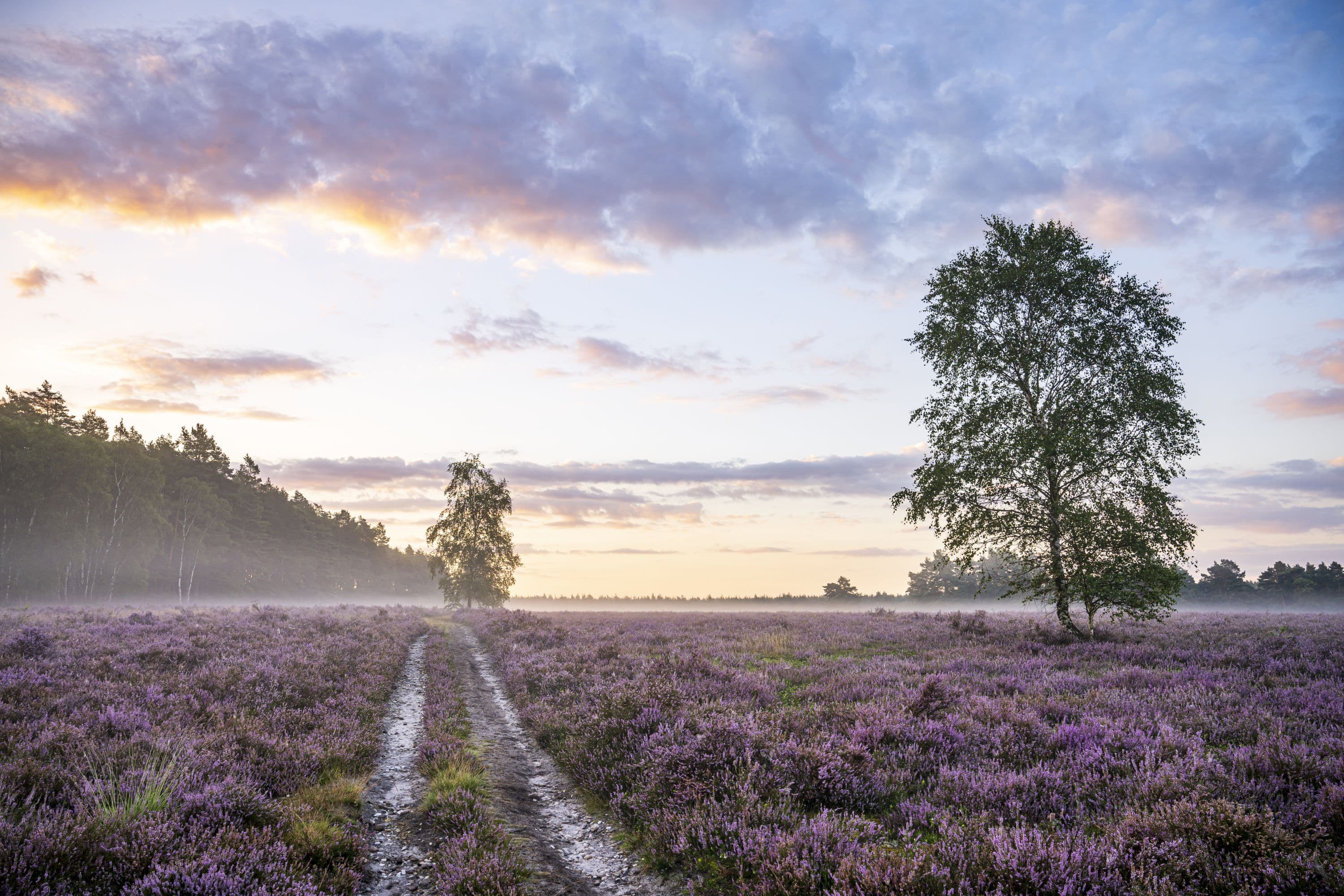
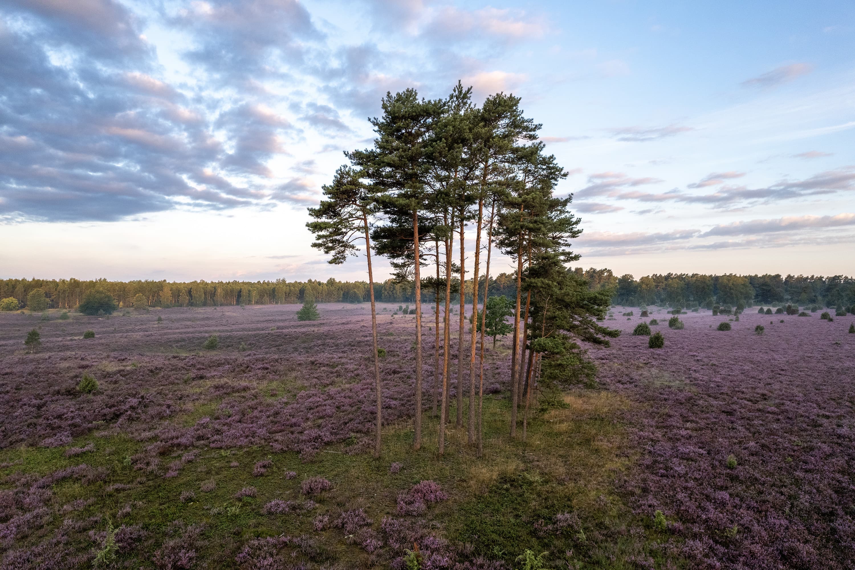
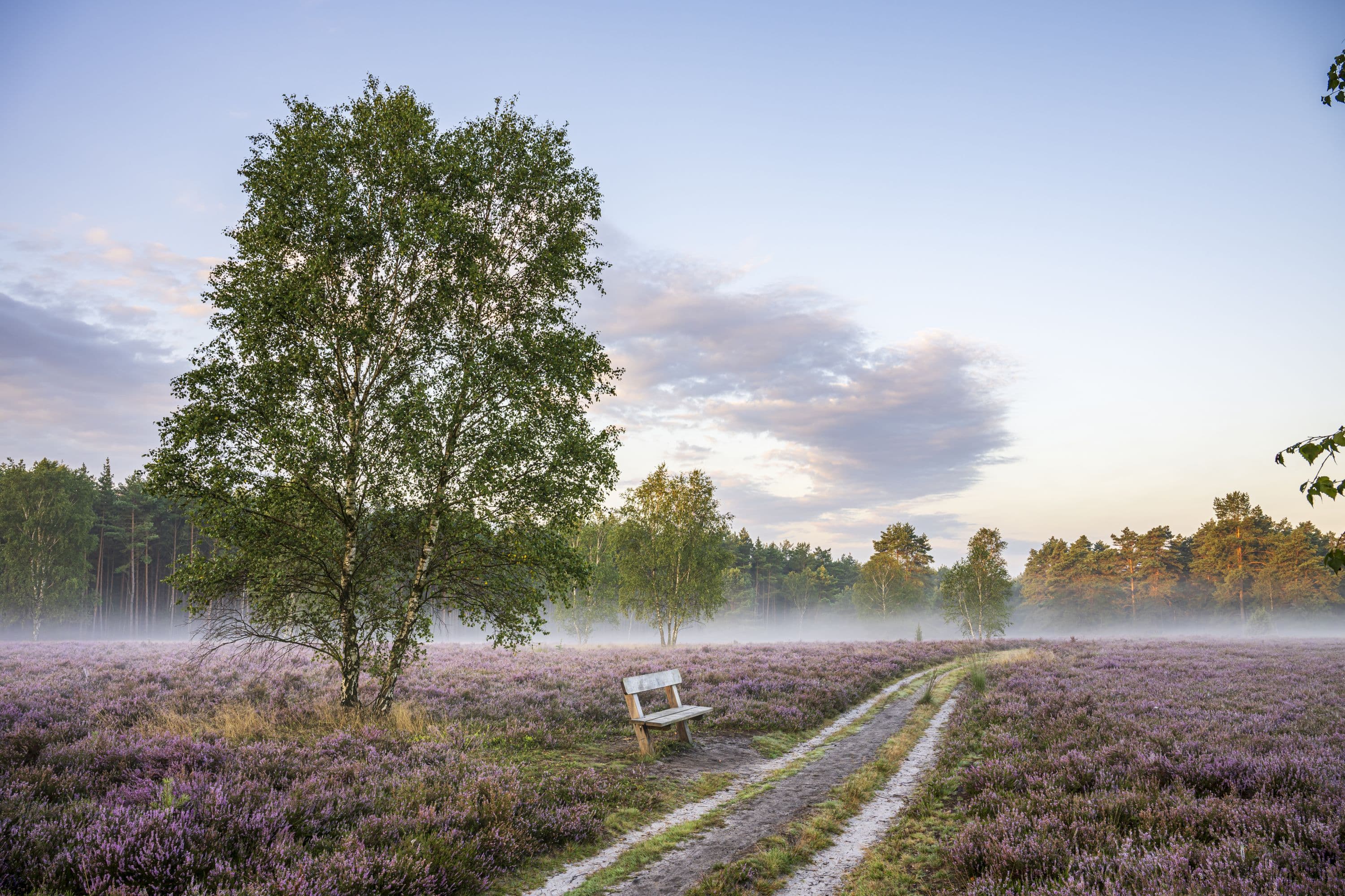
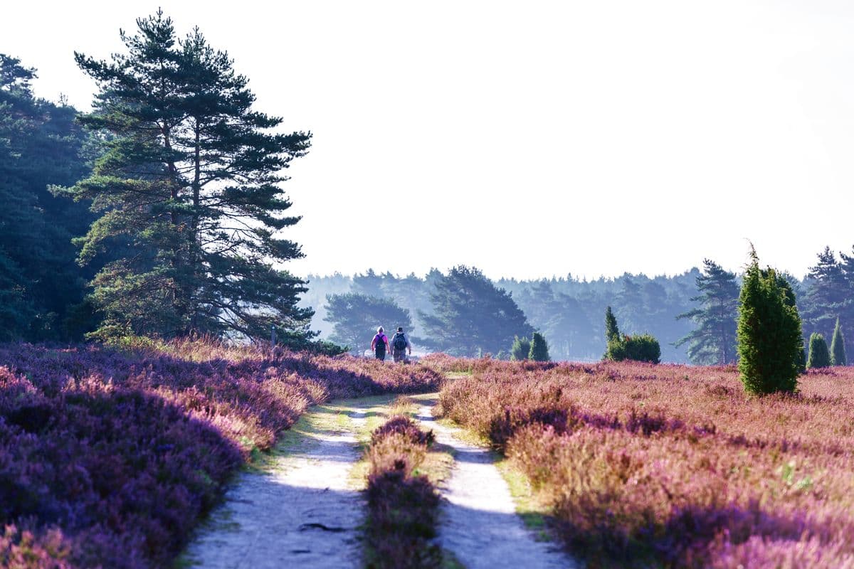
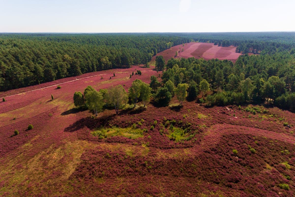
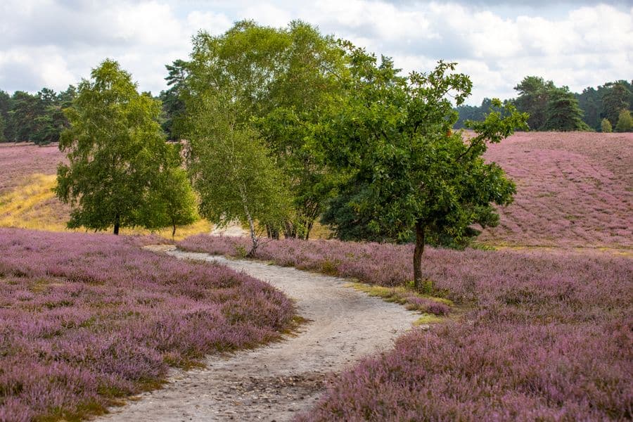
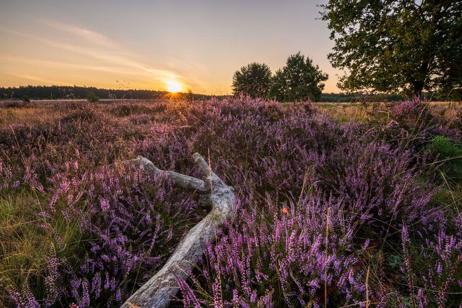
Die Misselhorner Heide mit dem Tiefental gehört zu den schönsten Heideflächen des Naturparks Südheide. Sanfte Hügel und weitläufige Heideflächen, die immer wieder von knorrigen Wacholdern durchsetzt werden prägen die Landschaft. Die Heidefläche beginnt 1,5 km östlich von Hermannsburg.
Sie ist ein Teil des "mittleren Lüßplateau", ein Naturschutzgebiet im Naturpark Südheide.
Sie ist ein Teil des "mittleren Lüßplateau", ein Naturschutzgebiet im Naturpark Südheide.
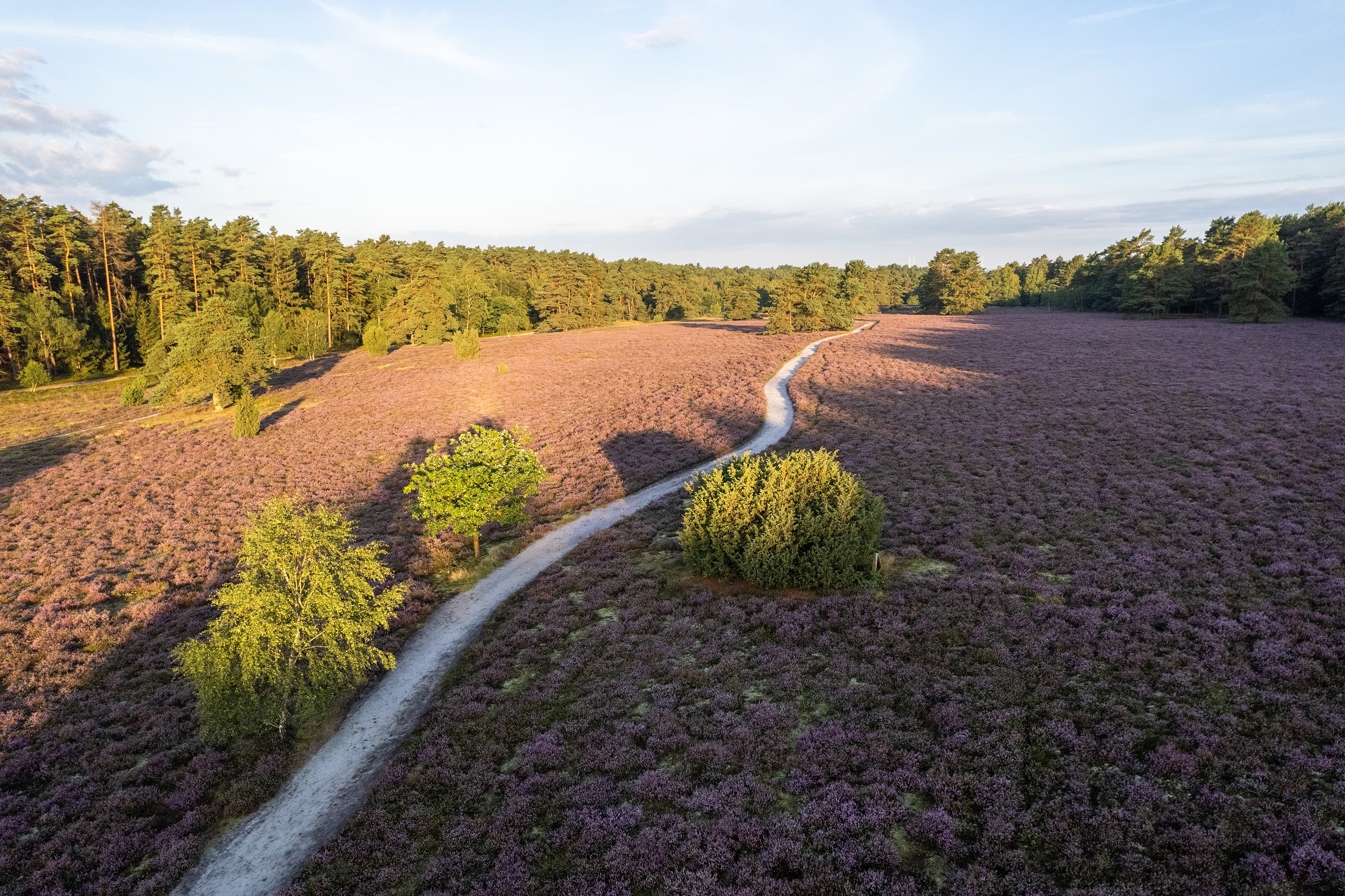
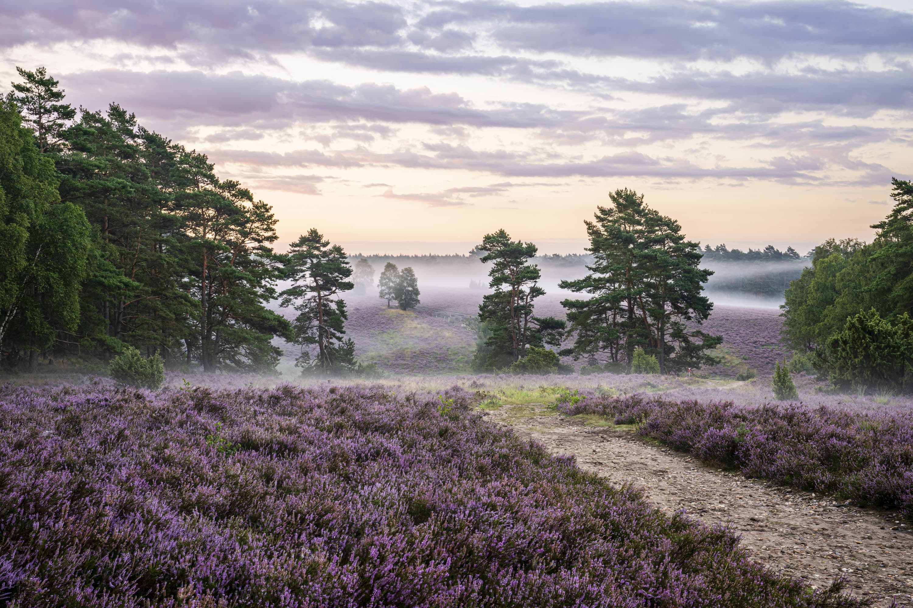
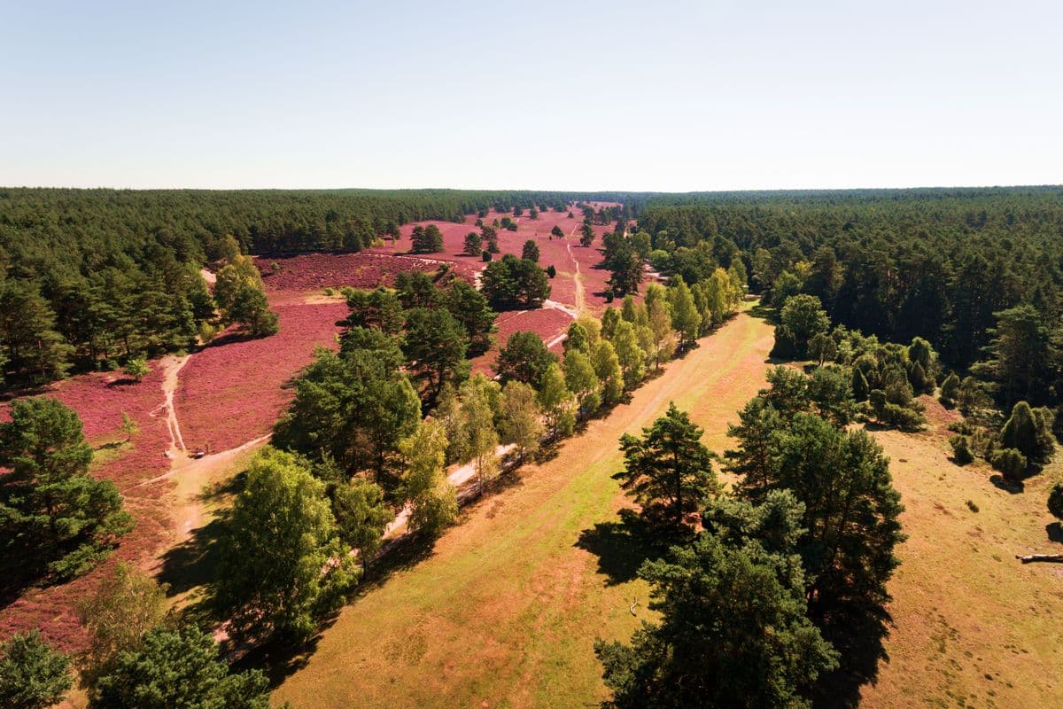
Hier gehen zwei große Heideflächen fließend ineinander über: die Misselhorner Heide und das Tiefental, welches oft auch "Heidefläche am Eicksberg" genannt wird.
Einige in Deutschland gefährdete Pflanzenarten findet man im geschützten Bereich der Misselhorner Heide:
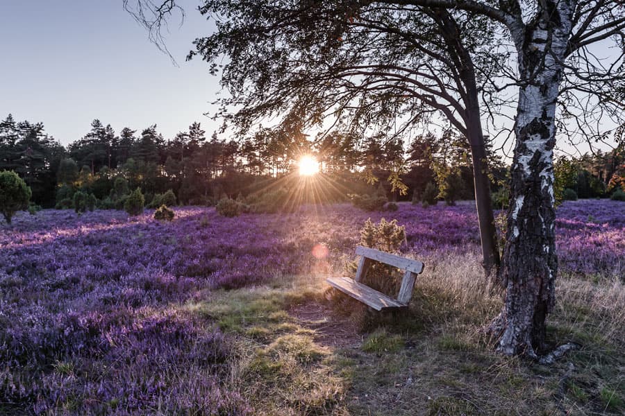
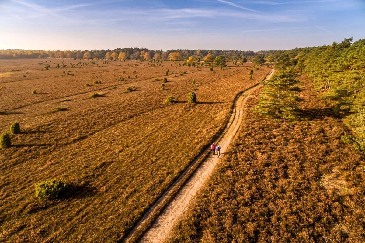
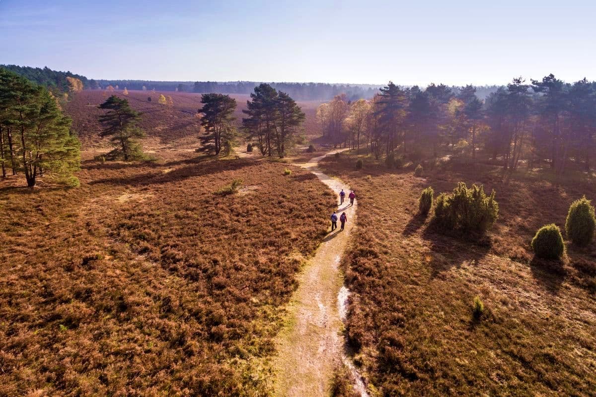
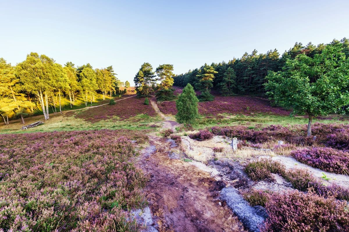
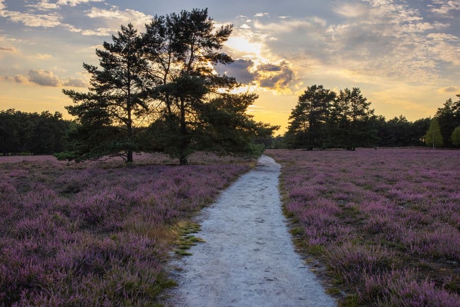
Obwohl das Tiefental nur wenige hundert Meter breit ist, beeindruckt es mit einem einmaligen Panorama. Vor dieser einmaligen Kulisse hielt um 1860 der bekannte Missionsgründer und Hermannsburger Pastor Ludwig Harms viele seiner Predigten. Eine Hinweistafel am Weg des Heidepanoramaweges gibt hierüber zahlreiche Informationen. Auch geführte Wanderungen auf den Spuren Ludwig Harms ins Tiefental werden angeboten.
Position: N52.823210 E10.136225
Position: N52.805569 E10.145545
Mit öffentlichen Verkehrsmitteln ist der Parkplatz leider nicht erreichbar.
Besonderheiten der Landschaft um die Misselhorner Heide
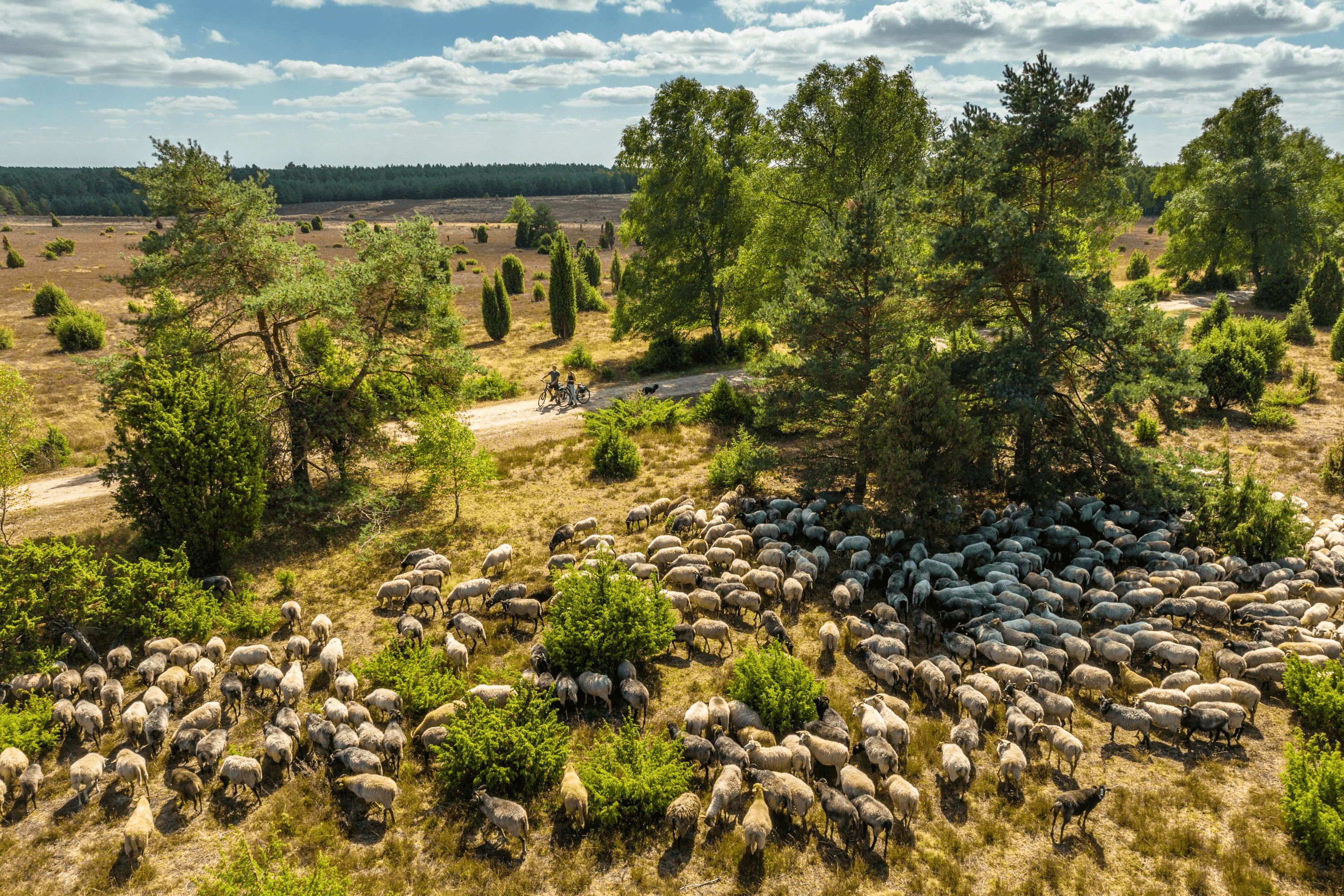
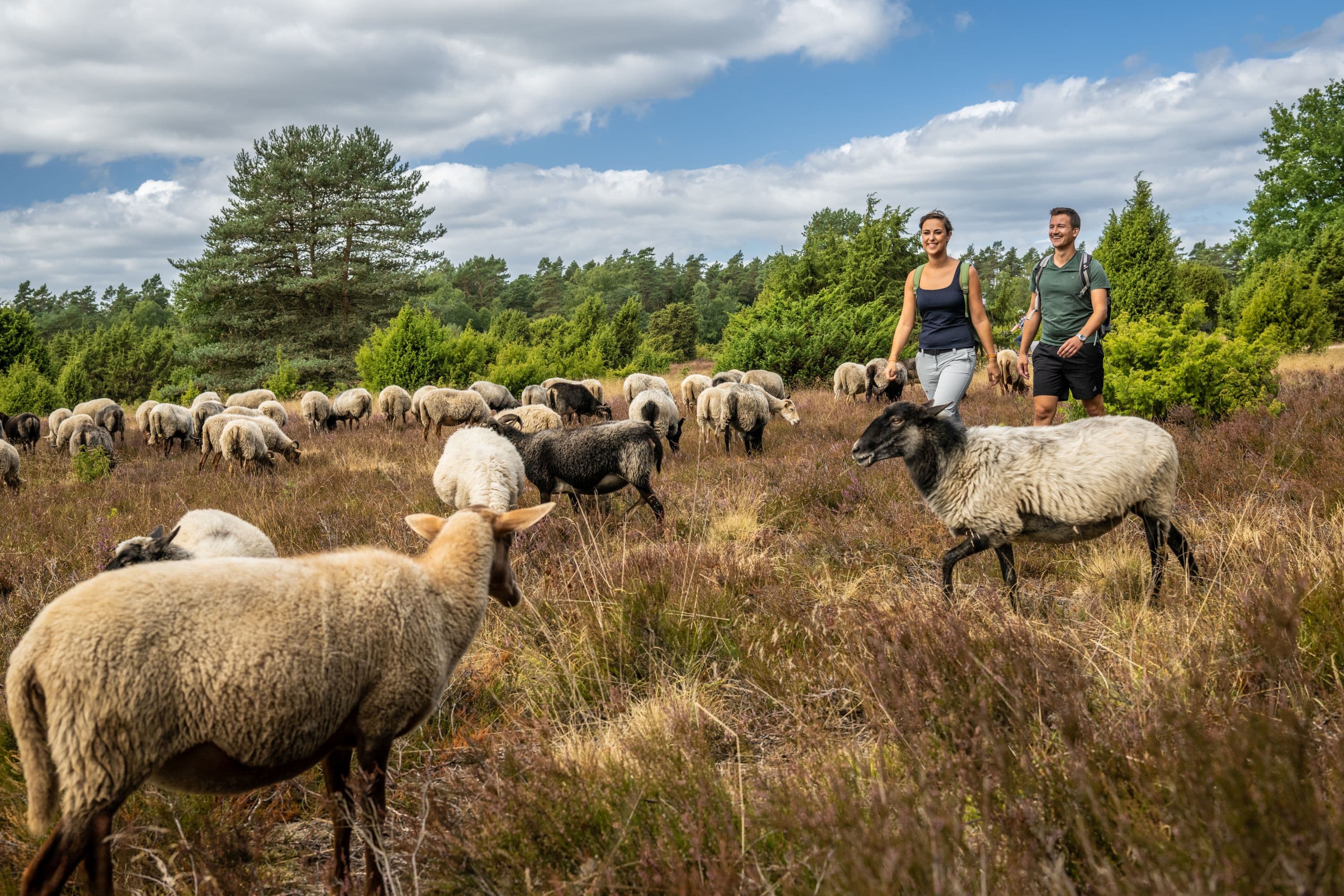
Die Heideflächen sind alte Kulturlandschaften, entstanden durch die Landwirtschaft früherer Jahrhunderte. Heute stehen sie dank ihrer ganz eigenen Flora und Fauna unter Naturschutz. Charakteristisch für diese vielfältige Landschaft sind die nährstoffarmen Sandböden, auf denen Birken- und Kiefernwälder gedeihen - und natürlich das Heidekraut: Die Gemeine Besenheide (Calluna vulgaris).Einige in Deutschland gefährdete Pflanzenarten findet man im geschützten Bereich der Misselhorner Heide:
- Mittler Sonnentau (übrigens eine fleischfressende Pflanze!)
- Wald-Läusekraut
- Lungen-Enzian
- Wollgräser
Ein ganz besonderer Tipp:
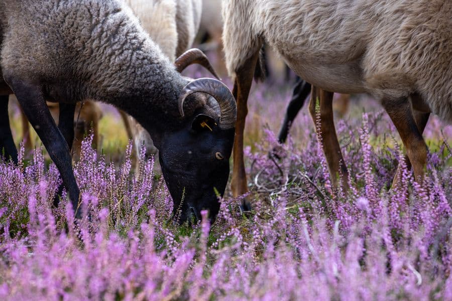
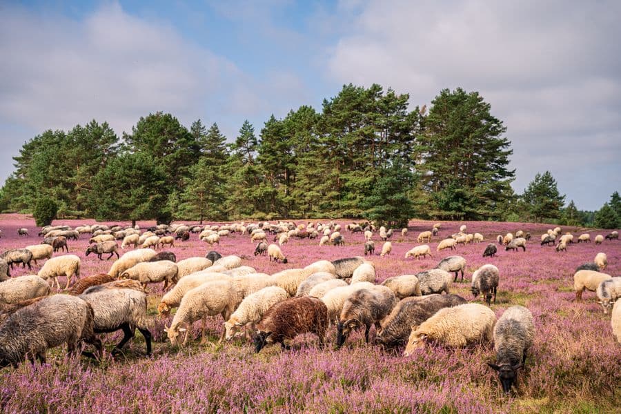
Über die Sommermonate können Sie jeweils donnerstags bis sonntags um 17:00 Uhr den Heidschnucken-Eintrieb in den Schafstall erleben. Vom Parkplatz Misselhorner Heide sind es nur ca. 200 m bis zum Schafstall. Informationen zum Schnuckeneintrieb und zu Gästeführungen in der Misselhorner Heide finden Sie unter diesem Artikel unter "Das dürfte Sie interessieren".Das Tiefental
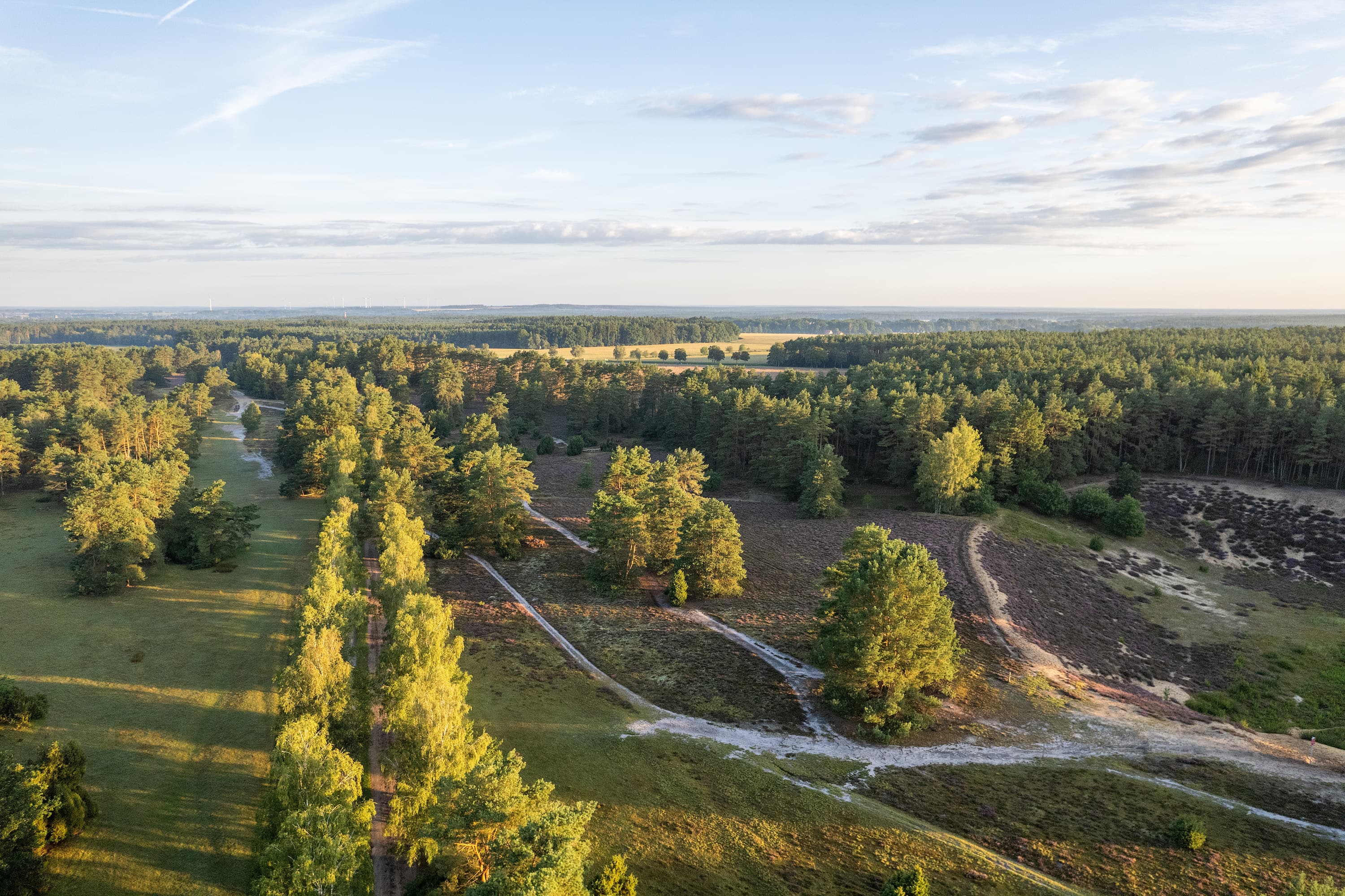
Das Tiefental grenzt direkt an die Misselhorner Heide. In der Eiszeit entstand hier ein tiefes Trockental, das sich landschaftlich besonders facettenreich zeigt.Obwohl das Tiefental nur wenige hundert Meter breit ist, beeindruckt es mit einem einmaligen Panorama. Vor dieser einmaligen Kulisse hielt um 1860 der bekannte Missionsgründer und Hermannsburger Pastor Ludwig Harms viele seiner Predigten. Eine Hinweistafel am Weg des Heidepanoramaweges gibt hierüber zahlreiche Informationen. Auch geführte Wanderungen auf den Spuren Ludwig Harms ins Tiefental werden angeboten.
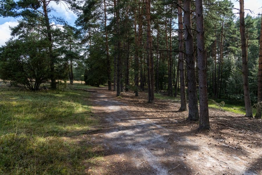
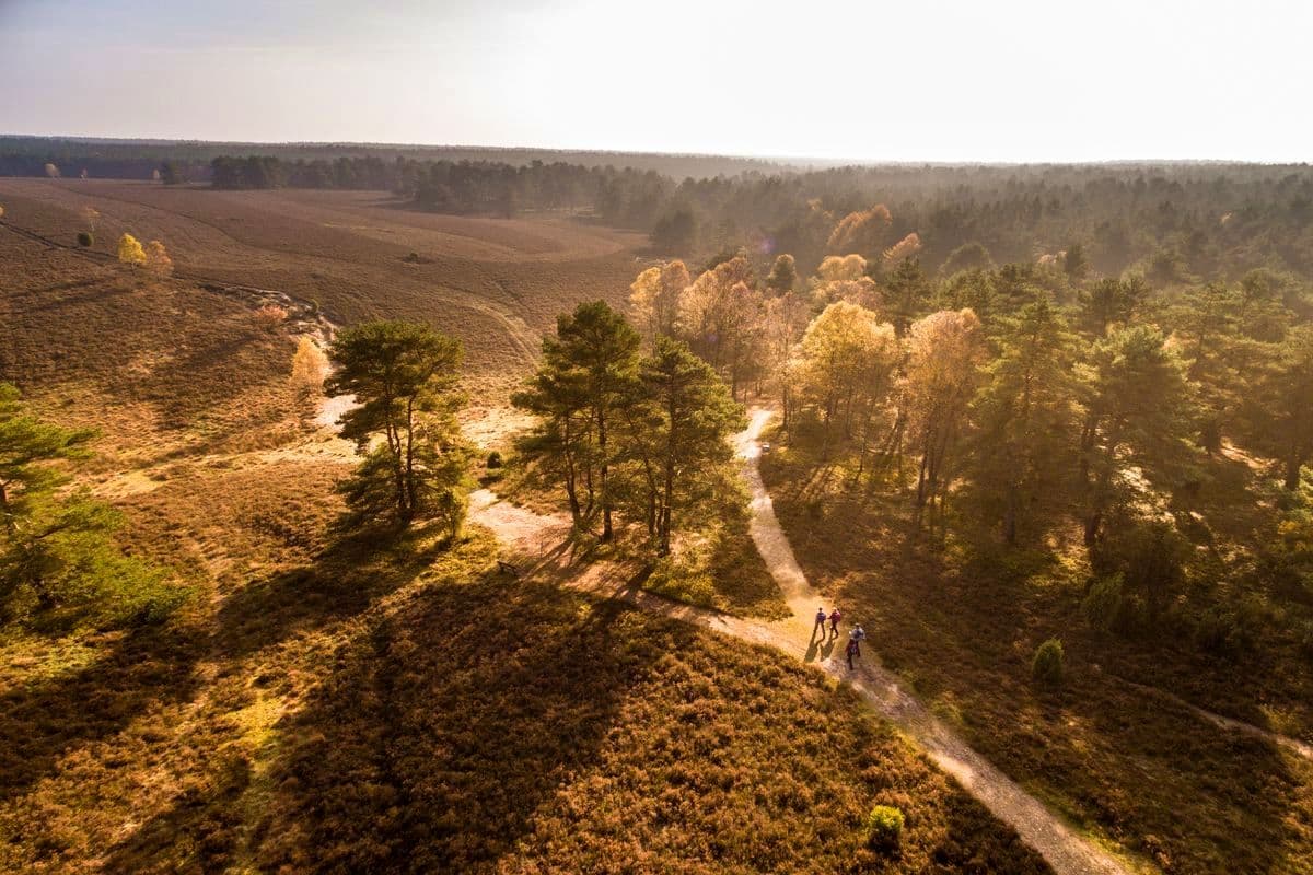
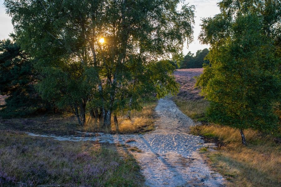
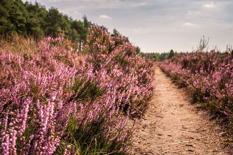
Wander- und Radwege
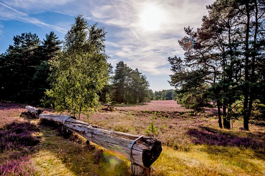
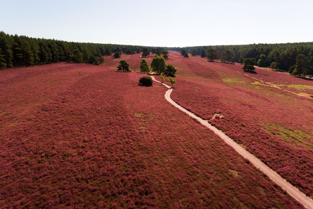
Auf gut ausgeschilderten Wander- und Radwegen unterschiedlicher Länge können Sie das Gebiet für sich entdecken. Einen Überblick finden Sie unten unter "Das dürfte Sie interessieren". Auch der bekannte Heidschnuckenweg führt durch dieses Gebiet. Der Qualitäts-Fernwanderweg ist 2014 zu Deutschlands schönstem Wanderweg gewählt worden.So finden Sie die Misselhorner Heide und das Tiefental:
Der Parkplatz "Misselhorner Heide" liegt direkt an den Heideflächen der Misselhorner Heide und ist mit einer Schutzhütte sowie Picknickbänken und -tischen ausgestattet. Darüber hinaus ist der Parkplatz auch als Park&Ride-Station für Reiter geeignet. Im Sommer ist der Platz mit WCs ausgestattet.Anfahrtsbeschreibung Parkplatz "Misselhorner Heide":
Den Parkplatz Misselhorner Heide erreichen Sie über die K 17 Hermannsburg Richtung Unterlüß. Ca. 1,5 km nach Ortsausgang Hermannsburg liegt rechts der Parkplatz. Der Parkplatz ist mit dem Hinweis "Misselhorner Heide" ausgeschildert.Position: N52.823210 E10.136225
Sie erreichen den Parkplatz „Misselhorner Heide“ auch mit dem örtlichen Beförderungsunternehmen CeBus Linie 260 und dem Bürgerbus Südheide aus Richtung Hermannsburg und Unterlüß. Die Haltestelle befindet sich beim Gasthof Misselhorner Hof. Von dort aus gehen Sie an der K 17 entlang ca. 15 Min. (1,1 km) in Richtung Unterlüß. Fahrzeiten und weitere Verbindungen entnehmen Sie bitte der Reiseauskunft der Deutschen Bahn.
Während der Heideblüte (9.8. - 28.9.25) fährt an den Wochenenden zusätzlich der Südheide-Shuttle Linie 270 als Ringlinie vom Bahnhof Unterlüß zum P Misselhorner Heide. Den Fahrplan finden Sie im Anhang.
Der Parkplatz "Eicksberg" liegt ebenfalls an wunderschönen Heideflächen, dazu liegt er besonders nah am Tiefental. Auch der Parkplatz Eicksberg verfügt über einen schönen schattigen Rastplatz mit Schutzhütte und Picknickplätzen und herrlichem Blick in die Heide. Auch dieser Parkplatz ist im Sommer mit WCs ausgestattet.Während der Heideblüte (9.8. - 28.9.25) fährt an den Wochenenden zusätzlich der Südheide-Shuttle Linie 270 als Ringlinie vom Bahnhof Unterlüß zum P Misselhorner Heide. Den Fahrplan finden Sie im Anhang.
Anfahrtsbeschreibung Parkplatz Eicksberg:
Der Parkplatz am Eicksberg (Nähe Tiefental) ist von Oldendorf aus über die L281 in Richtung Eschede zu erreichen. Nach ca. 3 km geht es links ab (gegenüber dem Abzweig zum Dehningshof und Hof Severloh). Nach weiteren 200 m führt der Weg rechts ab und ca. 2 km den Eicksberg hinauf bis zum Parkplatz. Der Parkplatz ist an der L 281 mit dem Hinweis "Heide am Eicksberg" ausgeschildert.Position: N52.805569 E10.145545
Mit öffentlichen Verkehrsmitteln ist der Parkplatz leider nicht erreichbar.
Anhänge
Das dürfte Sie interessieren
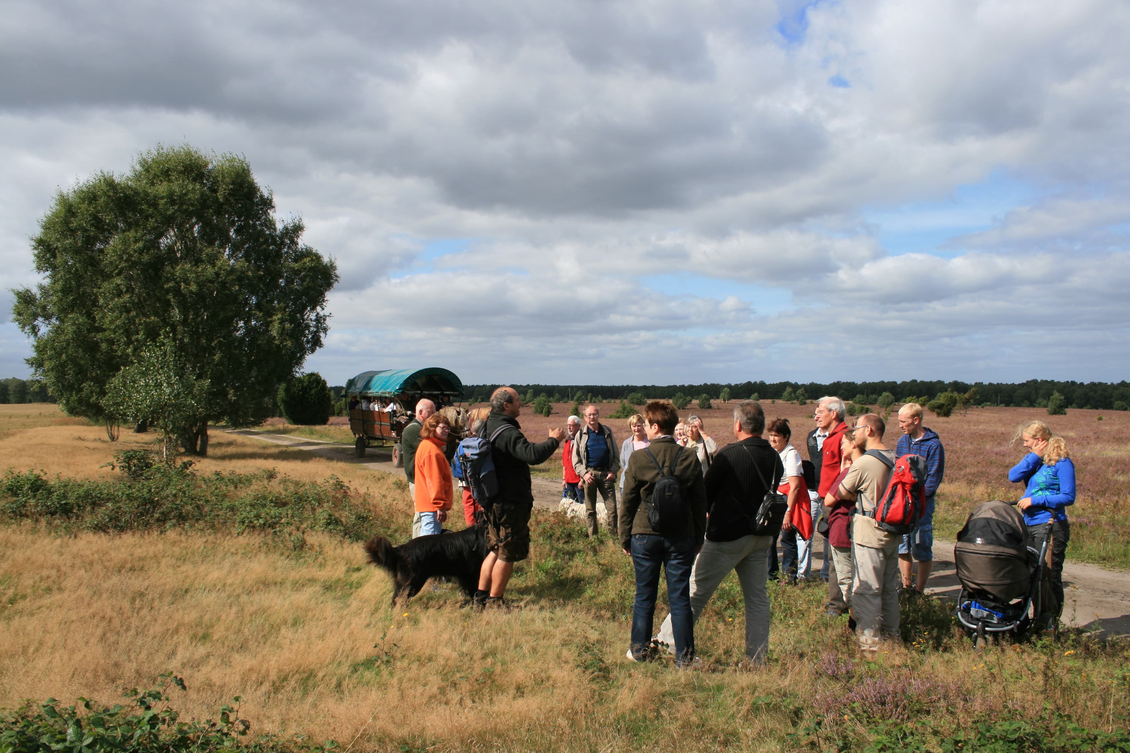
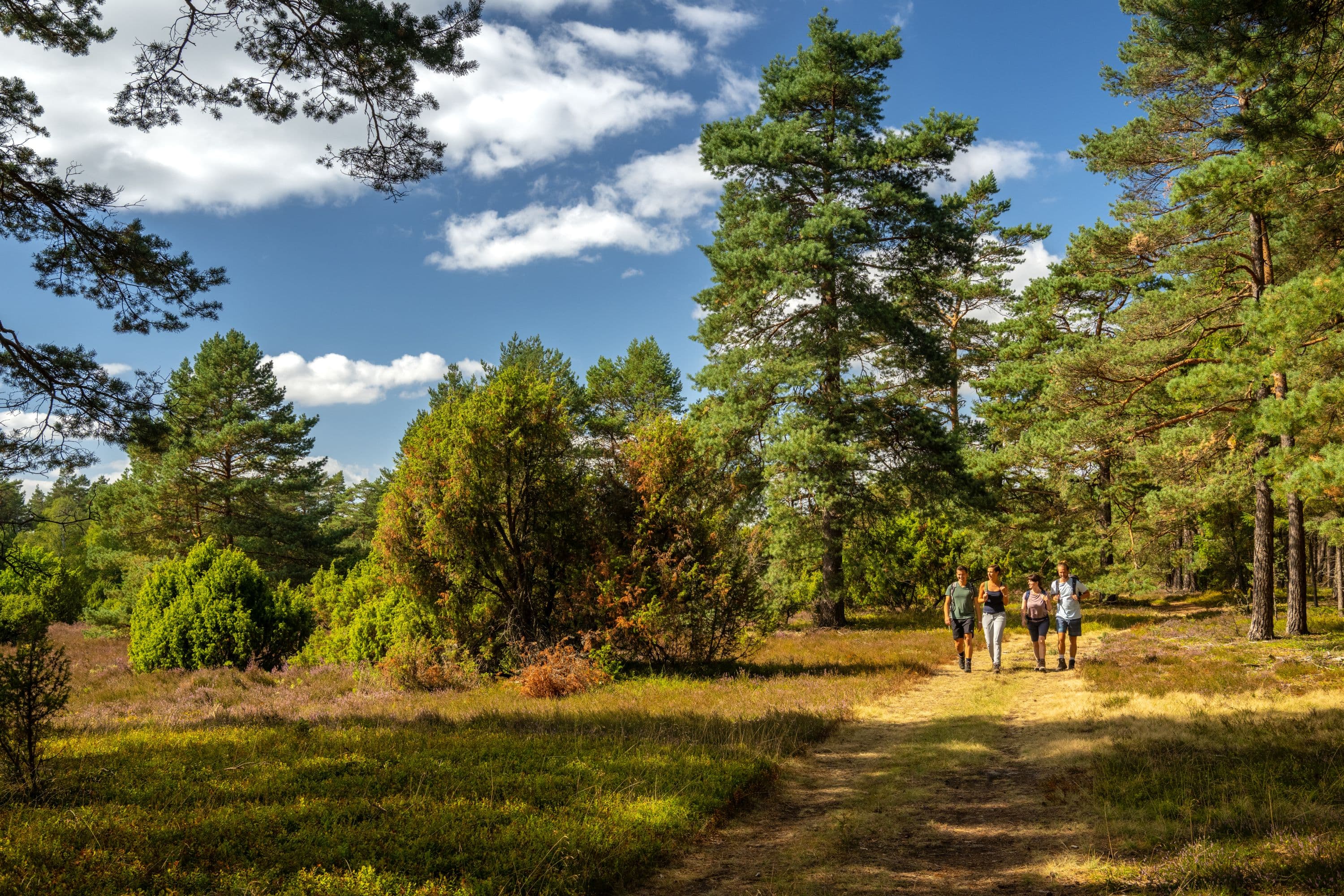
Hermannsburg: Geführte Rad- und Wandertouren
Einheimische Gästeführer bieten Touren zu verschiedenen Themen anAuf unseren geführten Touren erfahren Sie Interessantes über Land und Leute, Wissenswertes über die Geschichte der Gemeinde und erleben die Schönheit der Landschaft im Naturpark Südheide mitten in der Lüneburger Heide. Entdecken Sie Handwerkskunst oder erleben Sie Fledermäuse bei ihrer Jagd. Freuen…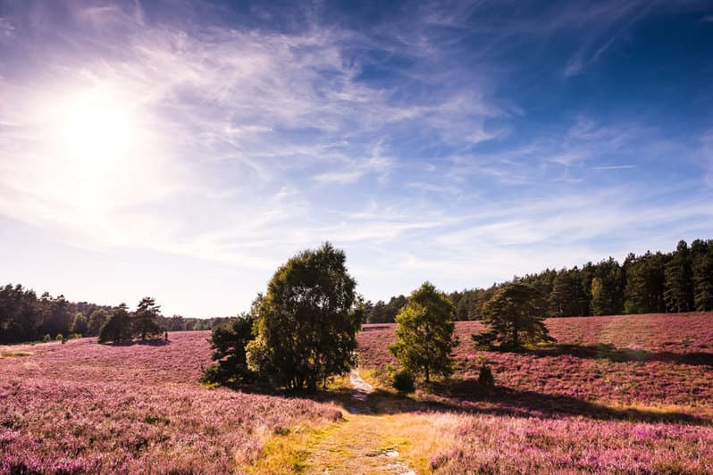
Im Reich der Heidschnucken (Rundwege 1,2km, 2km, 7,6km, 13 km)
HermannsburgDie Wanderwege des W10 "Im Reich der Heidschnucken" führen durch eines der schönsten Wandergebiete des Naturparks Südheide.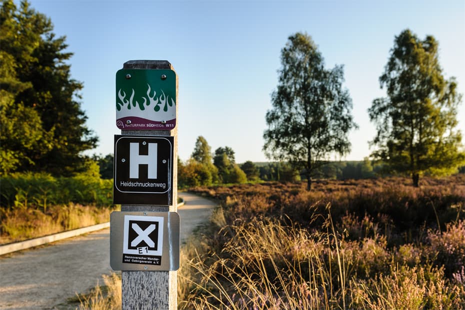
Heidschnuckenweg Etappe 12: Weesen - Dehningshof (13 km)
HermannsburgWandern auf dem Heidschnuckenweg. Die 12. Etappe führt von Weesen nach Dehningshof.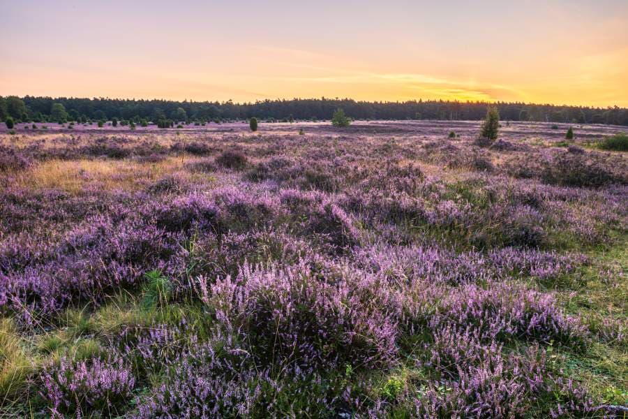
Wanderweg: Heideschleife Misselhorner Heide
HermannsburgAuf sandigen Pfaden ins tiefe Tal (8,1 km) Die weite Misselhorner Heide bietet fantastische Naturerlebnisse, die man auf einer Wanderung auf der Heideschleife Misselhorner Heide erleben kann.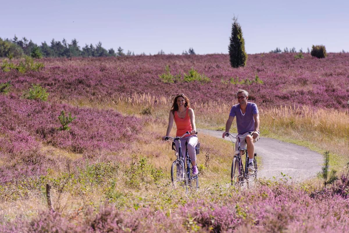
Hermannsburg: Große Heidetour (39 km)
HermannsburgDie Radtour "Große Heidetour" verbindet ab Hermannsburg die schönsten Heideflächen im Naturpark Südheide. Am Wegesrand sind zahlreiche Sehenswürdigkeiten zu erkunden. Vor allem im Monat August, zur Zeit der Heideblüte, ist diese Fahrradtour in der Lüneburger Heide ein landschaftlicher Hochgenuss.