
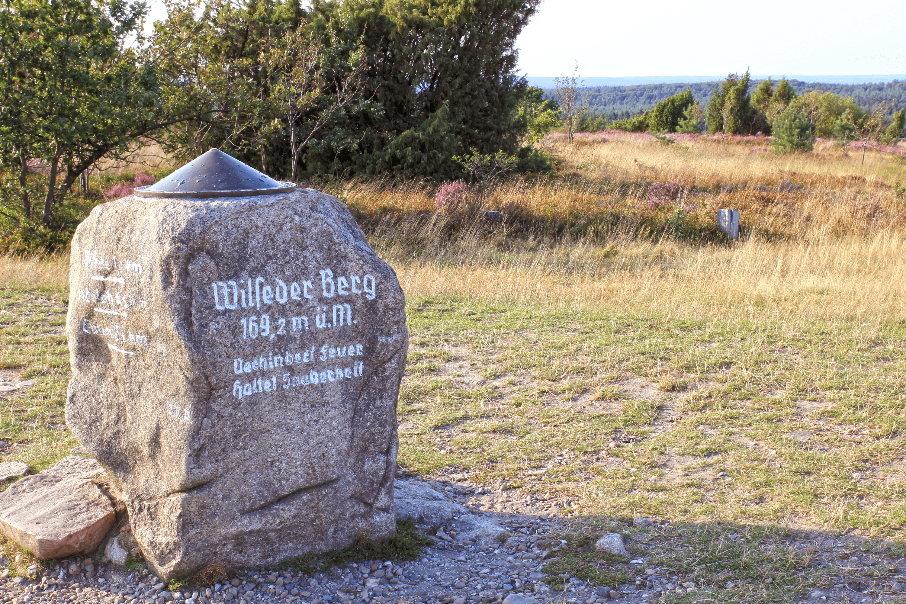
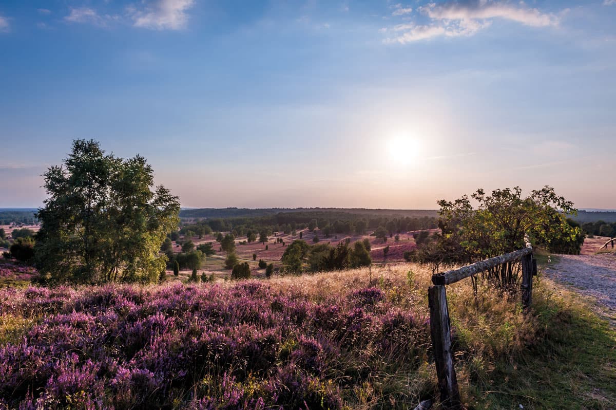
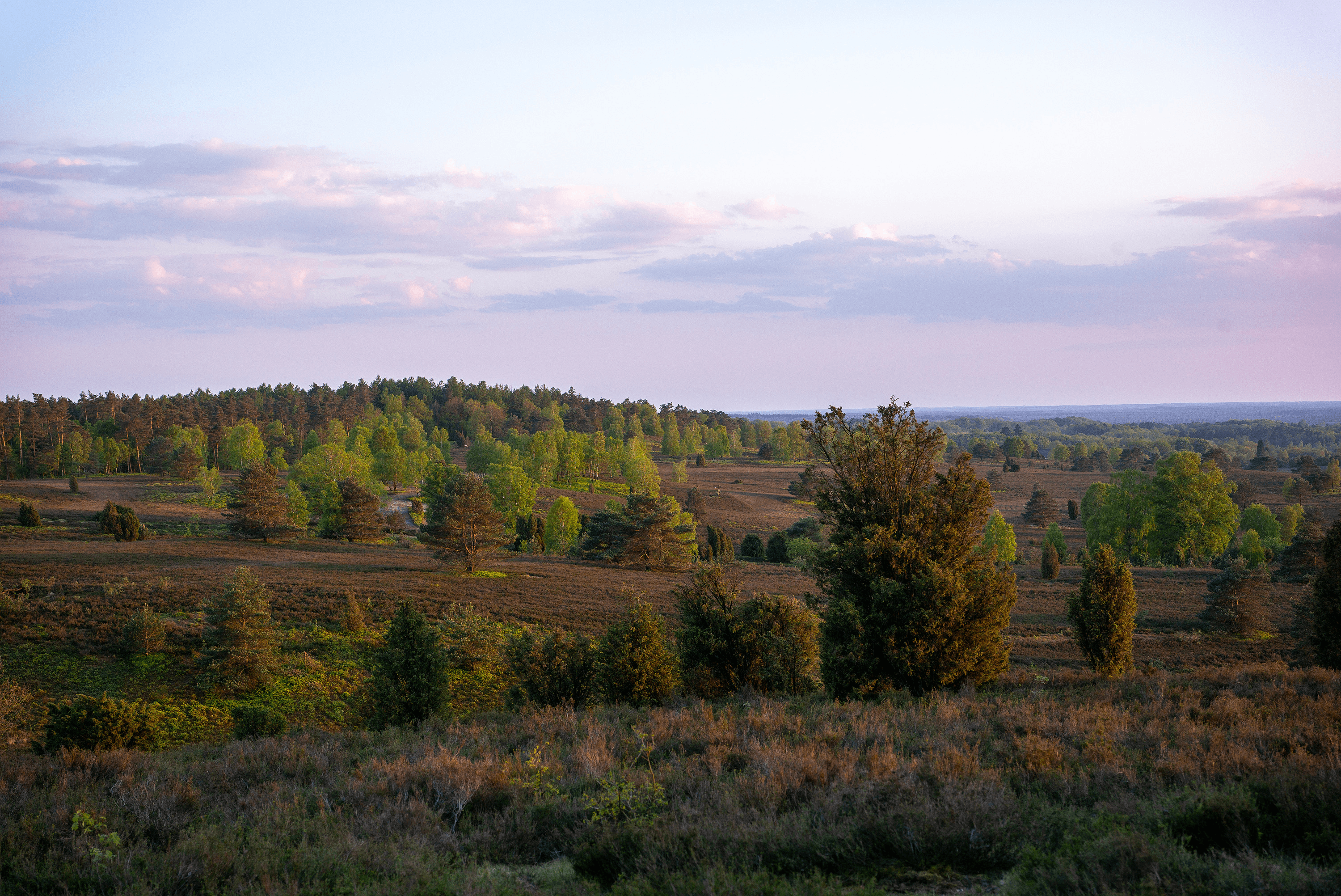
Wilseder Berg - die höchste Erhebung der nordwestdeutschen Tiefebene
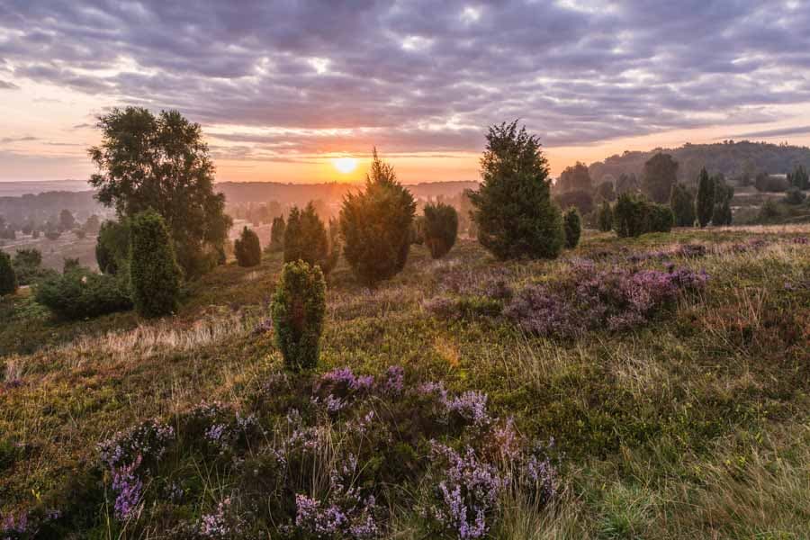
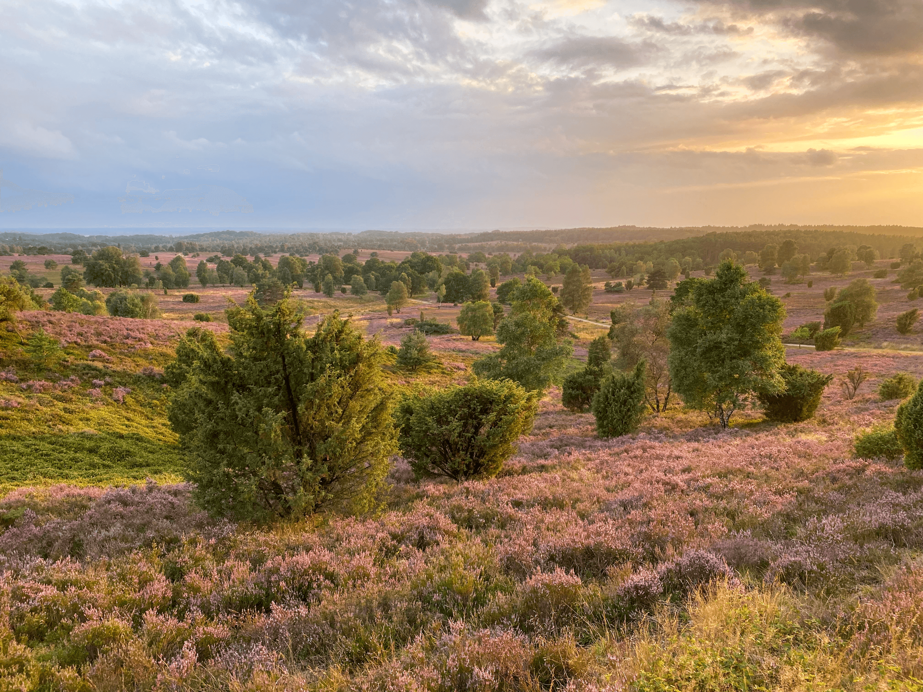
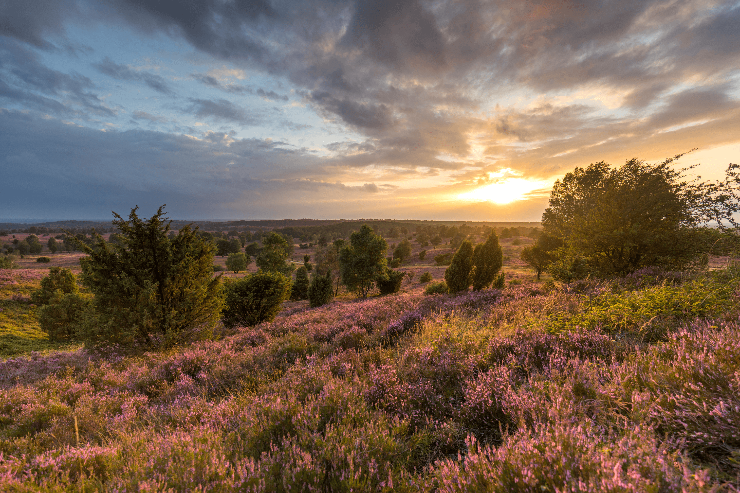
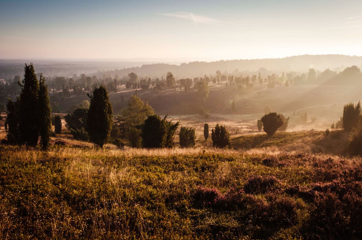
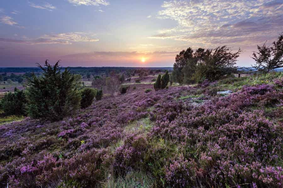
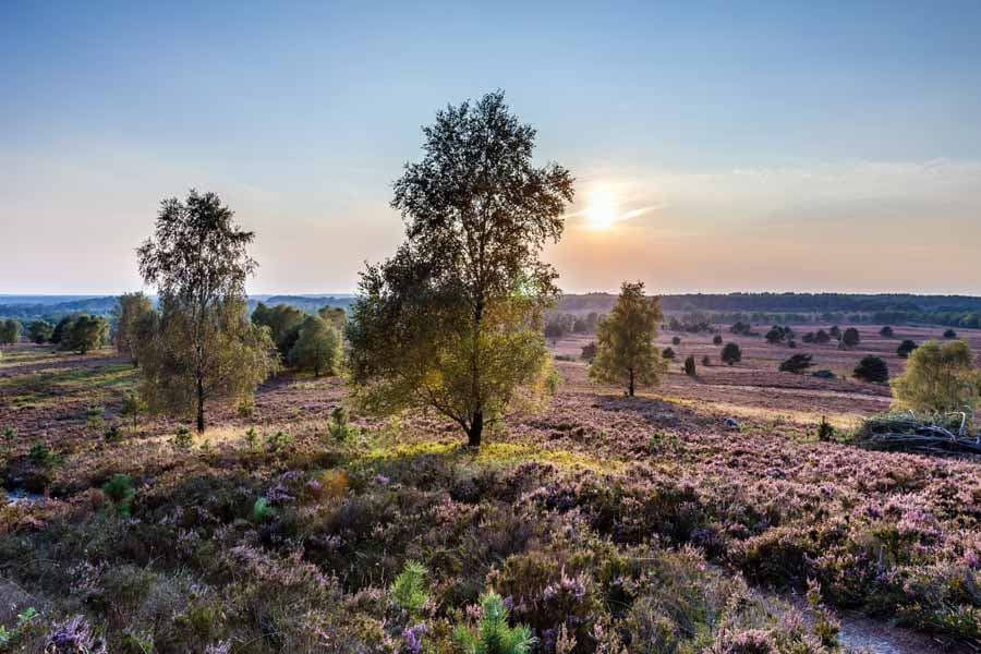
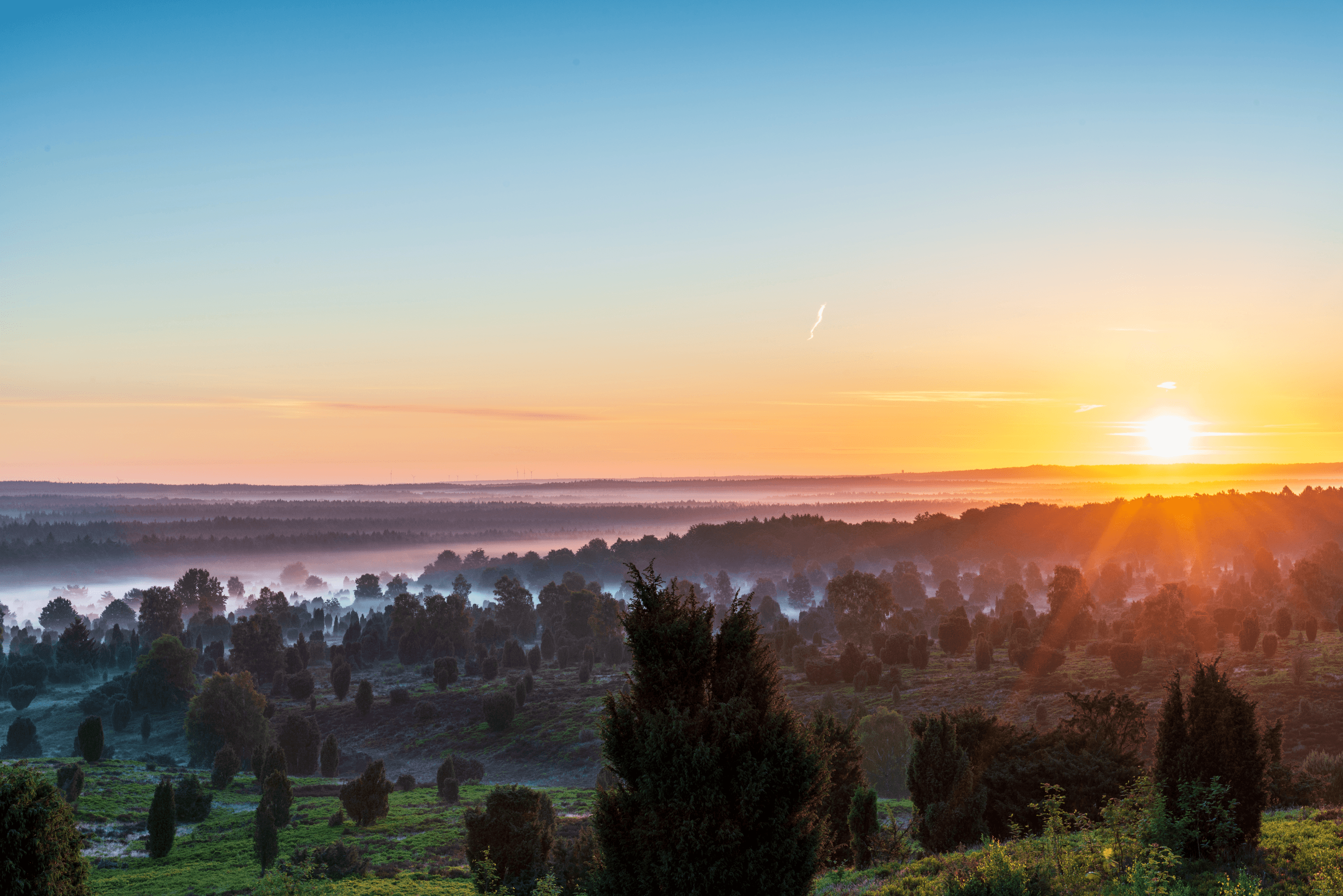
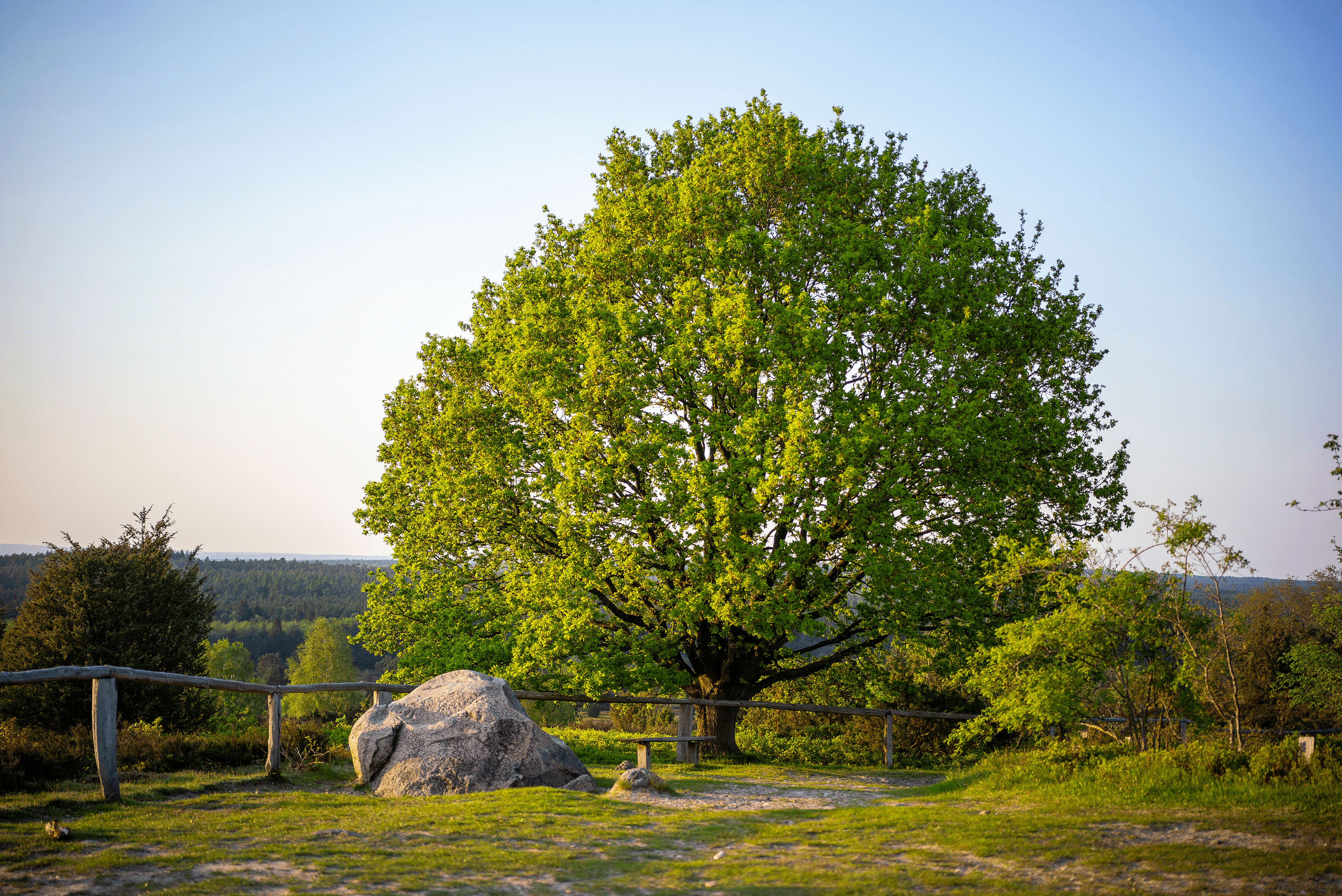
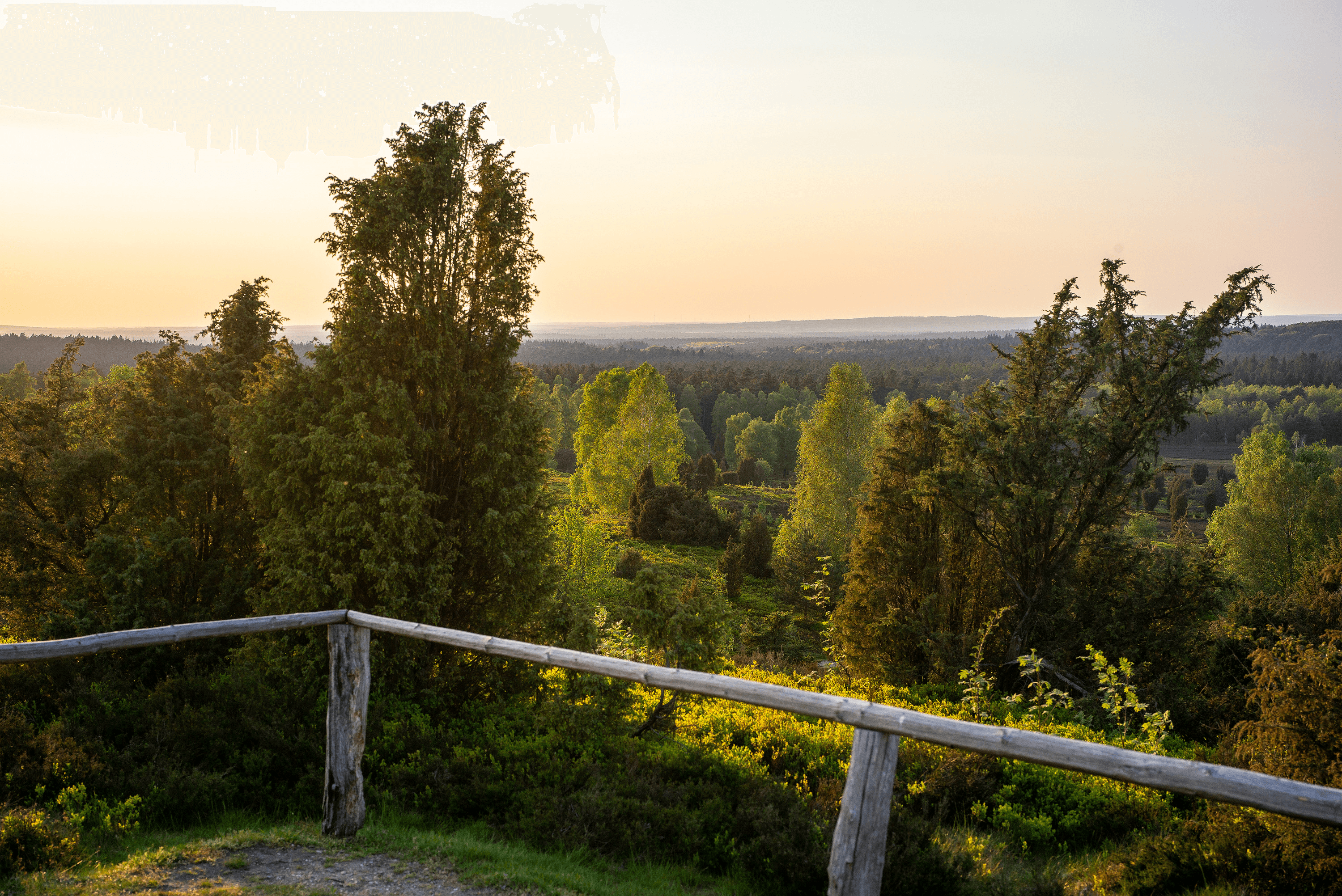
Der Wilseder Berg ist das Herz der Heide. Hier, auf dem mit 169 Metern höchsten Berg der norddeutschen Tiefebene, kann man bei klarer Sicht bis Hamburg schauen. Jeder Naturliebhaber sollte einmal den Blick vom Wilseder Berg auf die schier unendlichen Heideflächen genossen haben. Ein Sonnenuntergang ist ein ganz besonderes Erlebnis.
Im Zentrum des Naturschutzgebietes Lüneburger Heide
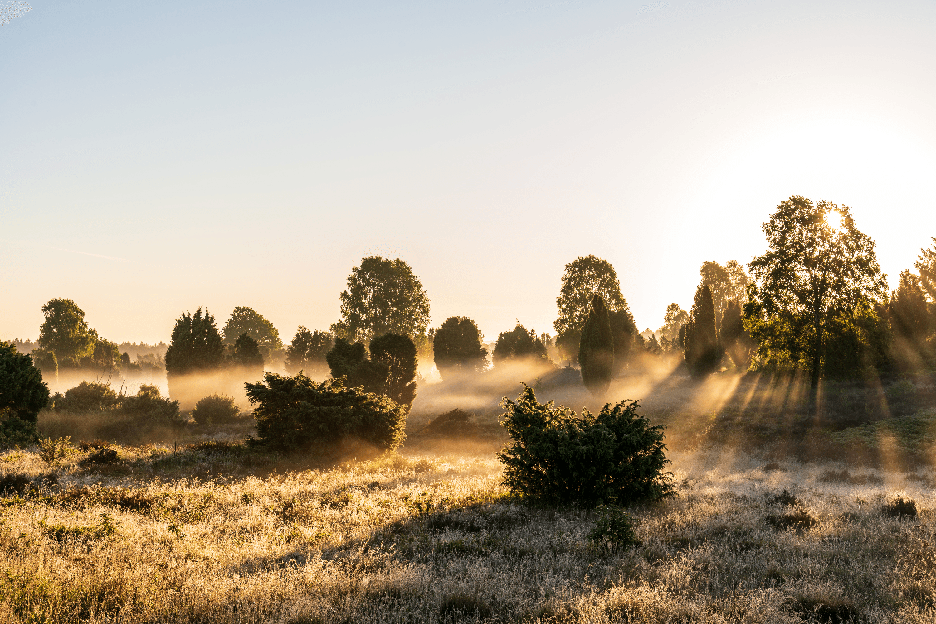
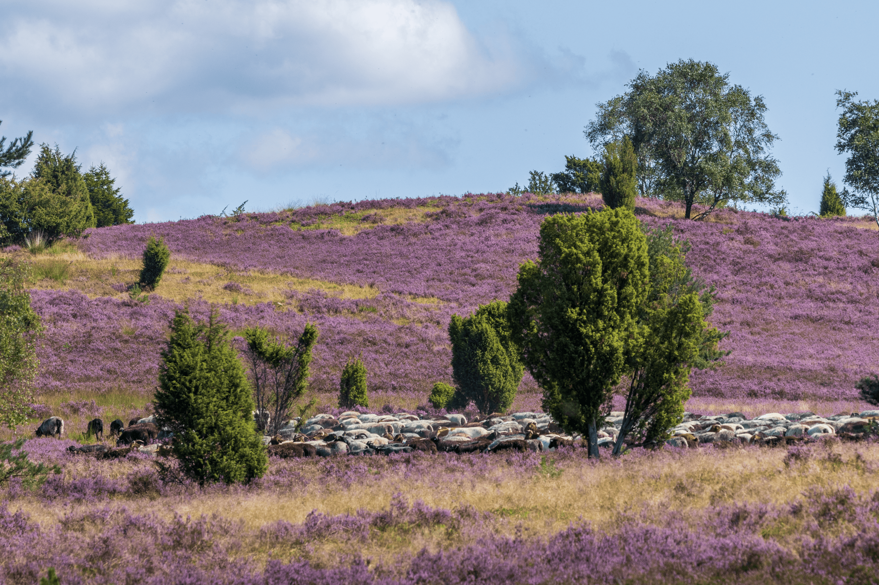
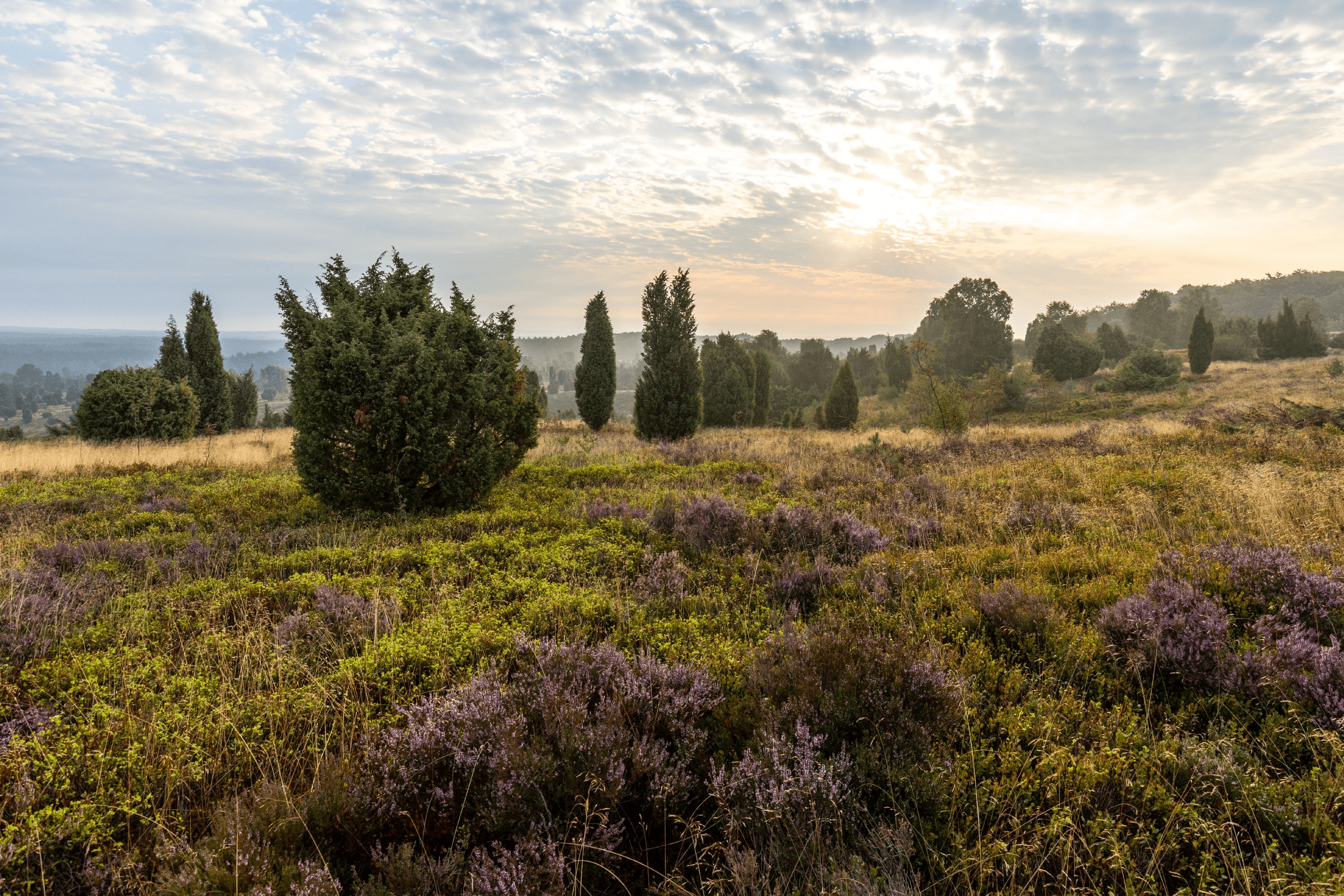
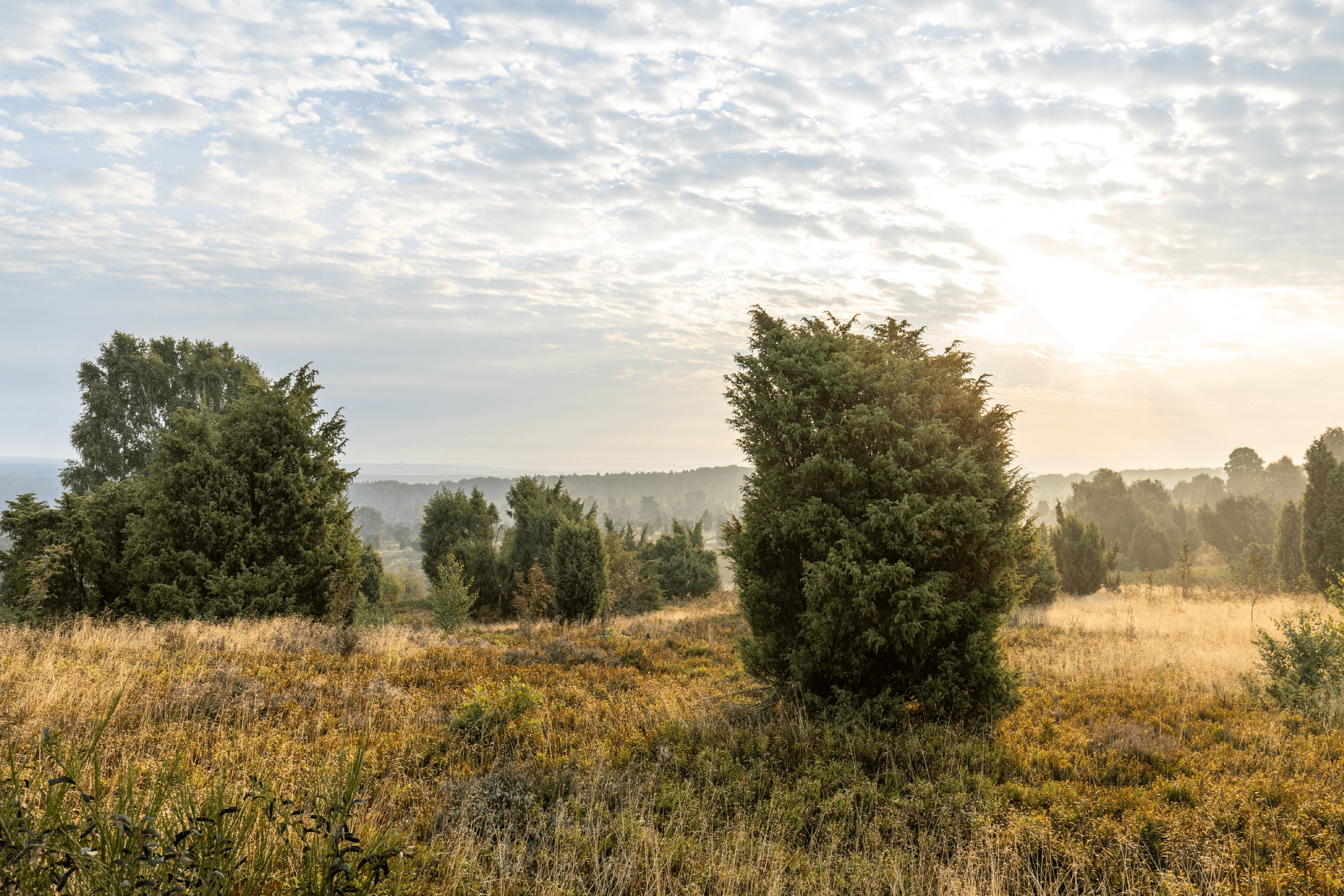
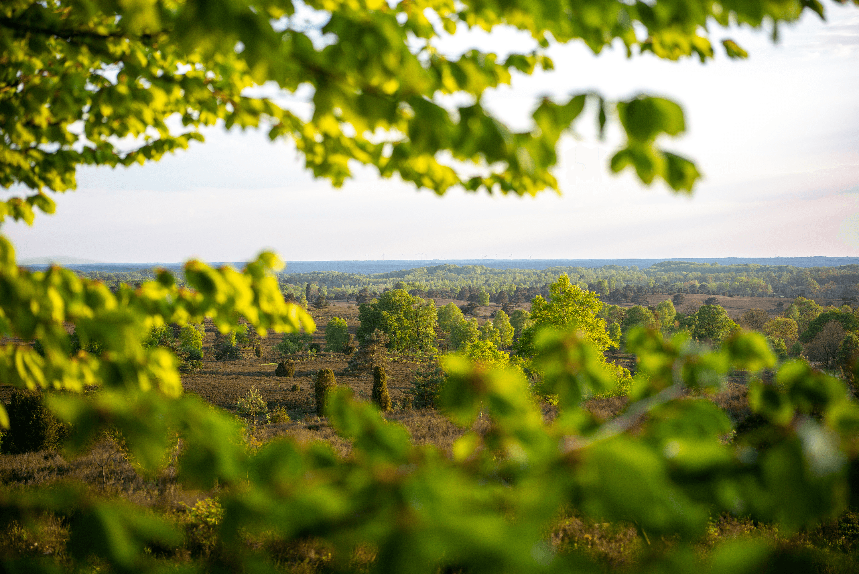
Der Wilseder Berg ist das Zentrum der größten Heideflächen Europas, von hier aus hat man einen fantastischen Blick auf die weite, blühende Landschaft. Die Heideflächen erstrecken sich auf insgesamt 230 qkm. Bereits seit 1921 sind sie unter Schutz gestellt, weil sie auch Revier für seltene Tiere und Pflanzen geworden sind.
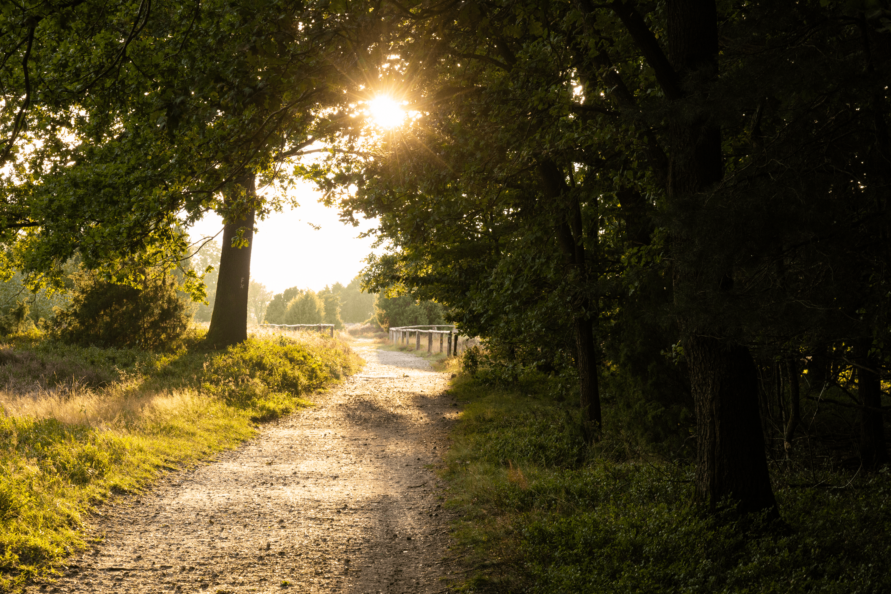
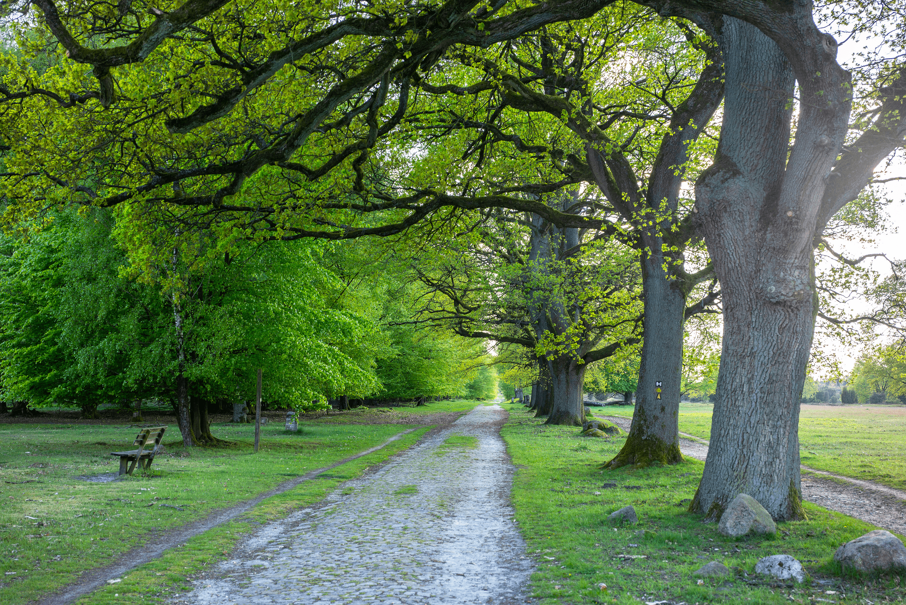
Die Gegend um den Wilseder Berg ist nahezu autofrei, nur Zufahrtstraßen zu Parkplätzen an den Orten rund um das Naturschutzgebiet erlauben Pkw-Verkehr. Ansonsten wandert oder radelt man am Wilseder Berg ungestört und nur mit Geräuschen der Natur. Ein großartiges Erlebnis.
Der Wilseder Berg ist eines der ersten Grundstücke des heutigen Naturschutzgebietes, das der bekannte Heidepastor Wilhelm Bode aus Egestorf für den Verein Naturschutzpark e.V. (VNP) im Jahre 1910 erwarb. Bis heute ist das Naturschutzgebiet Lüneburger Heide eines der ersten und größten in Deutschland.
Da der Wilseder Berg ein sensibler Bereich des Naturschutzgebietes ist, bitten wir Sie, auf Besuche vor Tagesanbruch zu verzichten.
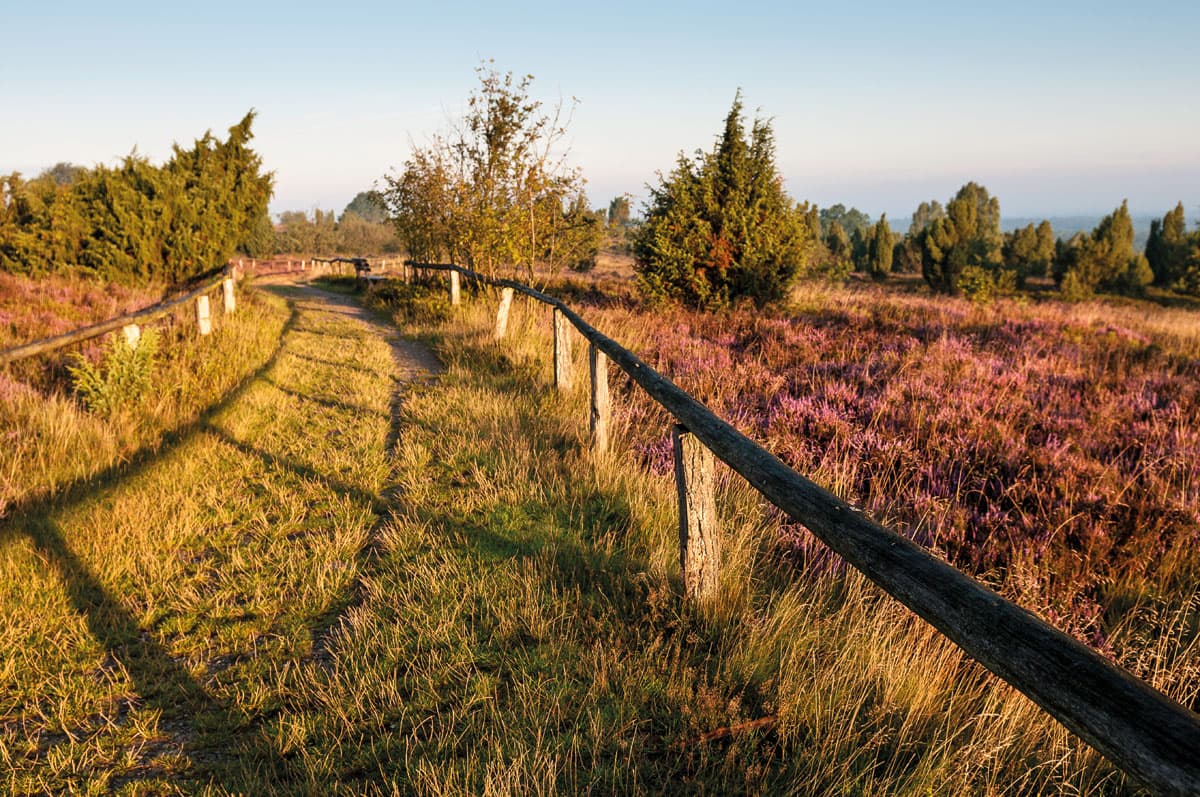
Wandern zum Wilseder Berg
Wenn Sie zum Wilseder Berg wandern möchten, haben Sie folgende Möglichkeiten:
Parken Sie Ihr Auto in Niederhaverbeck auf dem Parkplatz. Von dort aus ist der Wilseder Berg überall ausgeschildert (direkter Weg ca. 4,5 km, 60 min), es gibt zahlreiche Wanderwege.
In der Regel macht man einen Stopp zur Einkehr im kleinen Heidedorf Wilsede mit seinen Restaurants. Von hier aus sind es zu Fuß noch 20 Minuten zum Wilseder Berg. Wanderungen rund um den Wilseder Berg sind ausgeschildert, es gibt sie in unterschiedlicher Länge.
Es gibt auch die Möglichkeit, von Oberhaverbeck zum Wilseder Berg zu wandern. Parken Sie ihr Auto auf dem großen Parkplatz in Oberhaverbeck und laufen Sie am Turmberg vorbei Richtung Wilsede. Von dort aus sind es wieder ca. 20 Minuten Wanderung zum Wilseder Berg. Der Parkplatz Oberhaverbeck ist meistens in der Saison voller, als der in Niederhaverbeck.
Wanderkarte vom Wilseder Berg auf Amazon bestellen
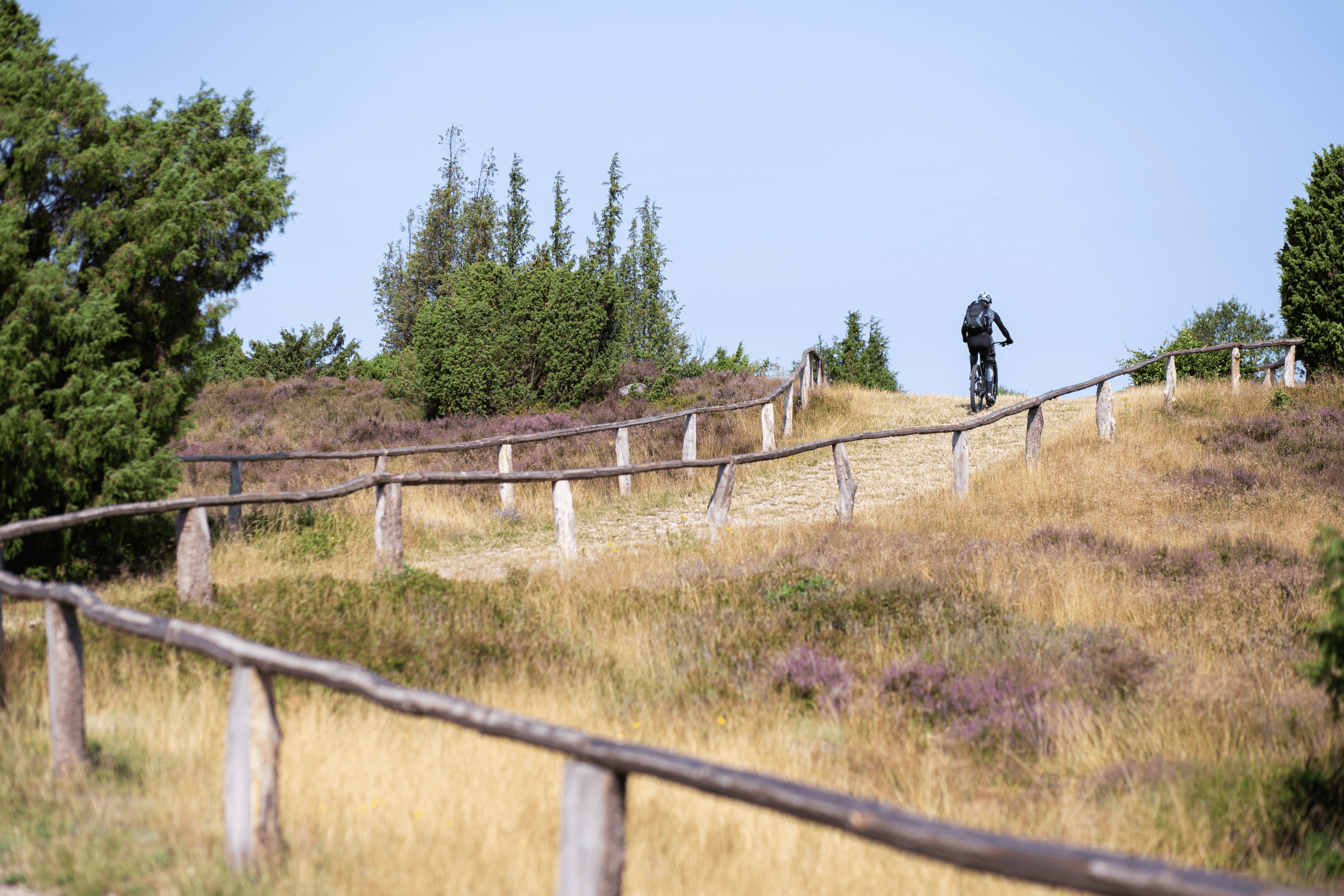
Radfahren zum Wilseder Berg
Von allen Orten rund um den Wilseder Berg gibt es Radwege. Bitte achten Sie darauf, kein zu dünnes Profil auf den Radreifen zu haben, Sie fahren im Naturschutzgebiet in der Regel auf naturbelassenen Wegen oder Sandwegen.
Kutsche fahren zum Wilseder Berg
Kutschfahrten in der Lüneburger Heide sind ein absolutes "Muss". Gerade im autofreien Naturschutzgebiet macht es besonders viel Spaß. Von fast allen Parkplätzen rund um den Wilseder Berg können Sie mit Kutschen fahren - eine Vorabreservierung ist nötig. Hier finden Sie eine interaktive Karte mit allen Kontaktdaten und Kutschabfahrtsstellen.
Mit den berühmten Heide-Kutschen kann man von fast allen Orten rund um den Wilseder Berg ins Naturschutzgebiet bis zum Ort Wilsede fahren. Die Fahrten dauern in der Regel 60 bis 90 Minuten pro Strecke. Der kleine Ort Wilsede, den man nur zu Fuß, per Fahrrad oder Kutsche erreichen kann, lädt mit einigen Ausflugslokalen zu einer gemütlichen Rast ein.
Restaurant am Wilseder Berg
Die gesamte Gegend um den Wilseder Berg ist Naturschutzgebiet. Es gibt das nächste Restaurant in Wilsede, ca. 20 Minuten Wanderung entfernt. Auch am Rand des Naturschutzgebietes, in Niederhaverbeck, oder Oberhaverbeck, gibt es Restaurants, ebenfalls in Undeloh. Wenn Sie ein Picknick mitnehmen, denken Sie bitte daran, Ihren Müll wieder mitzunehmen. Es gibt im Naturschutzgebiet auch keine Mülleimer.
Urlaubsorte rund um den Wilseder Berg
- Bispingen
- Behringen
- Volkwardingen
- Ober- und Niederhaverbeck
- Undeloh
- Egestorf
- Hanstedt
- Handeloh
- Schneverdingen
Hier finden Sie auch die passenden Hotels und Ferienwohnungen. Schauen Sie in unser Buchungsportal Lüneburger Heide.
Anreise zum Wilseder Berg
Hinweis:
Der Wilseder Berg und der Heideort Wilsede liegen im autofreien Naturschutzgebiet Lüneburger Heide und können nicht mit dem Auto angefahren werden.
Anreise mit dem Auto:
Fahren Sie bitte mit dem Auto zu den Besucherparkplätzen in Niederhaverbeck, Oberhaverbeck, Volkwardingen, Döhle und Undeloh. Die Parkplätze sind alle ausgeschildert, unten finden Sie die Navigationsadressen. Von den Besucherparkplätzen können Sie zu Fuß auf den Wilseder Berg wandern oder mit dem Rad oder mit der Kutsche bis nach Wilsede fahren und von dort aus auf den Wilseder Berg wandern!
Navi-Adressen der Parkplätze am Ausgangspunkt des Naturschutzgebietes:
- Besucherparkplatz Undeloh: Wilseder Straße, 21274 Undeloh (Parkplatz ist am Ende der Straße). Koordinaten: N53.192311 E9.977018
- Besucherparkplatz Döhle: Dorfstraße - Ecke Hörpeler Weg, 21272 Döhle. Koordinaten: N53.163745 E10.035300
- Besucherparkplatz Niederhaverbeck: direkt an der L121, Niederhaverbeck 14, 29646 Niederhaverbeck. Koordinaten: N53.150891 E9.908516
- Besucherparkplatz Oberhaverbeck: direkt an der L121, 29646 Oberhaverbeck. Koordinaten: N53.143027 E9.919340 (wenn voll, bitte nach Niederhaverbeck weiterfahren)
- Besucherparkplatz Volkwardingen: an der K34 im Ort Volkardingen, 29646 Volkwardingen. Koordinaten: N53.134477 E9.997257
Anreise mit der Bahn
Das dürfte Sie interessieren
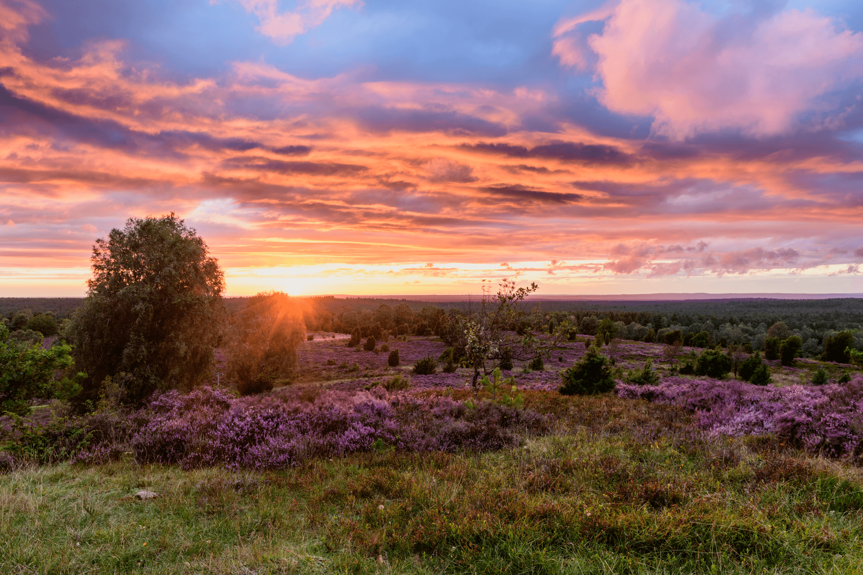
Mein Erlebnis: Sonnenuntergang auf dem Wilseder Berg
Die Sonne versinkt in der HeidelandschaftIch bin der Tourismuschef der Lüneburger Heide, ich teile gerne meine Erlebnisse, damit möglichst viele Menschen sie auch erleben können. Heute schreibe ich Euch vom Wilseder Berg.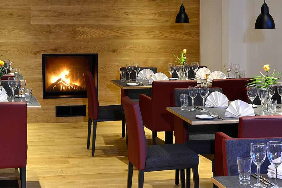
42 Hotels und Ferienwohnungen in Schneverdingen mit Preisvergleich
Hotels, Pensionen und Ferienwohnungen in Schneverdingen für Ihren UrlaubSchneverdingenUnsere Empfehlung für online buchbare Hotels in Schneverdingen: Hotel Camp Reinsehlen Schneverdingen: naturnahe Lage an den Heideflächen Hotel Schäferhof Schneverdingen: zwischen Osterheide und Pietzmoor Hotel Landhaus Schnuck Schneverdingen: mit viel Sport Hotel Hof Tütsberg Schneverdingen: ei…
8 ausgesuchte Hotels in Bispingen
Bispingen Hotel für Ihren UrlaubBispingenUrlaub in Bispingen Die Gemeinde Bispingen ist bekannt durch ihre Lage am Naturschutzgebiet Lüneburger Heide und die Attraktionen SnowWorld, Kart Bahn, Abenteuerland, Modellbaueisenbahn, Abenteuerlabyrinth, Battle Kart und verrücktes Haus. Die Natur-Attraktionen Wilseder Berg und Totengrund sind Hö…
Heidekutscher Lüneburger Heide
Romantische Kutschfahrt durch die Lüneburger Heide mit Insider-Wissen vom HeidekutscherSo erkennen Sie Ihren Heidekutscher Lüneburger Heide Schild "Heidekutscher" auf der Kutsche Hier kommen Sie zur interaktiven Übersichtkarte aller Heidekutscher-Betriebe Genießen Sie Ihre Kutschfahrt durch die Lüneburger Heide. Es ist eine herrliche Fortbewegungsart durch die weite Heidelandschaft.