
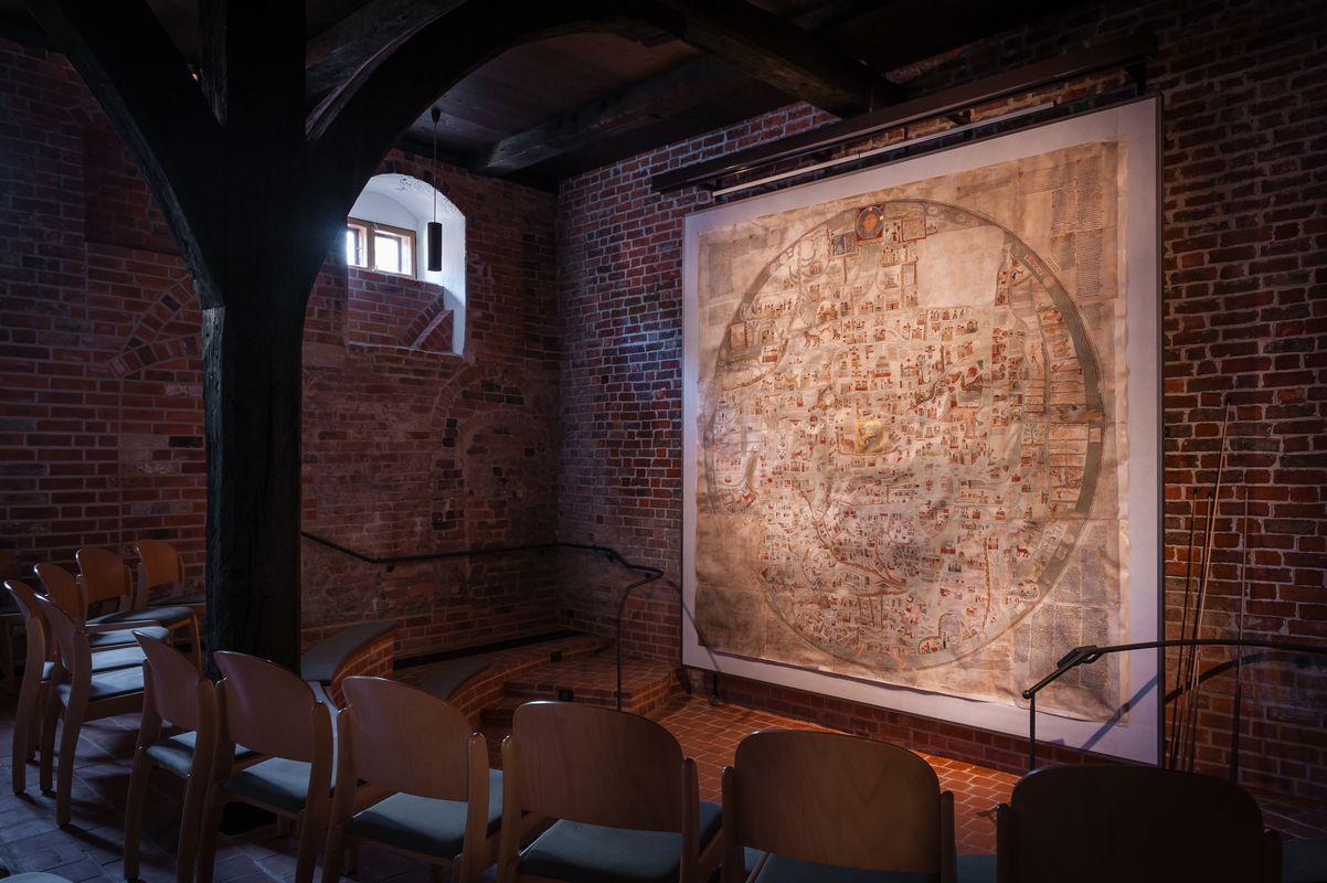
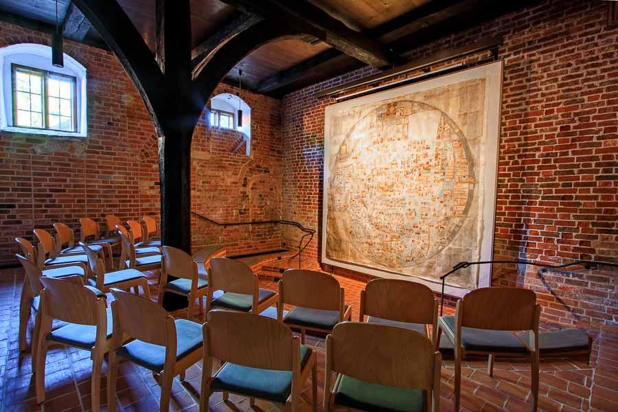
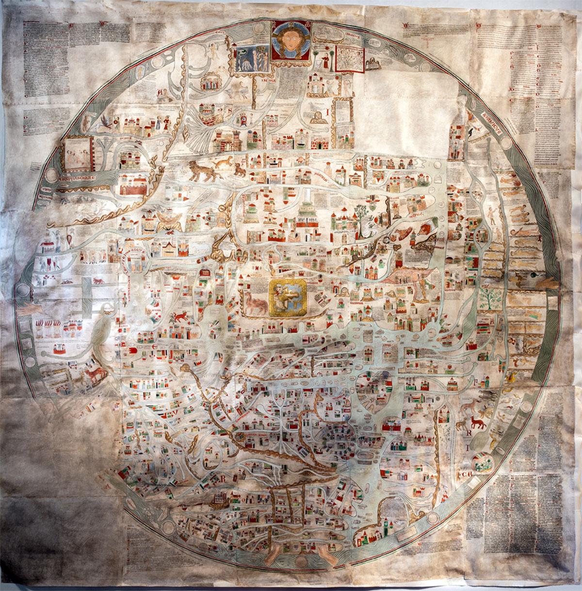
The largest circular mappa mundi from the Middle Ages
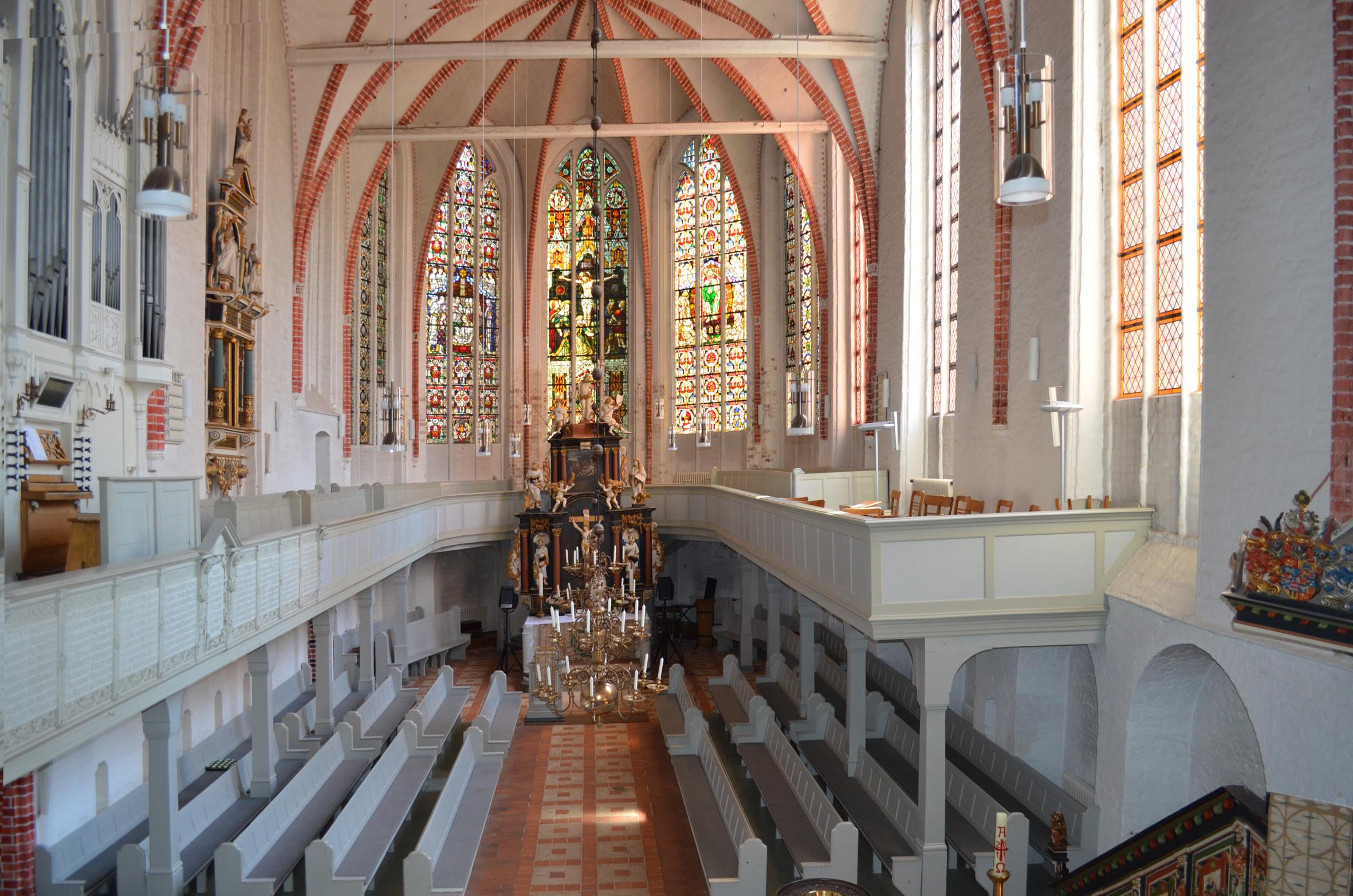
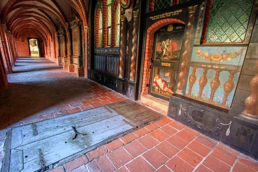
The Ebstorf world map counts among the most valuable treasures of Ebstorf cloister and all of the other cloisters on the heath.
It is the most famous, comprehensive and by far the largest illustrated medieval map of the world still in existence and can be viewed within the scope of a guided tour.
The map itself is a copy true to the original that was destroyed by fire during World War II.
Discovery
The map was found in a dank, windowless utility room in 1830 by Charlotte von Lassberg, a conventual of Ebstorf cloister. The value of the map was soon recognised.
Following the deliberate removal and theft of a part of the map, it was finally added to the map collection of the Historical Society of Lower Saxony. It fell victim to an air raid in 1943.
Fortunately, smaller copies had already been produced at an earlier date by way of anastatic printing, making it possible to create the copies on display today during the years 1950-55.
The map
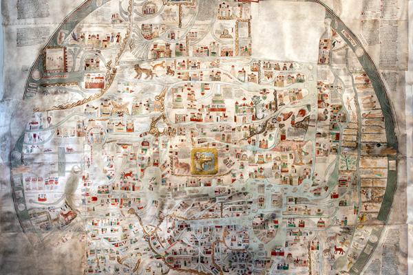
The circular mappa mundi represents an image of the world from the time around 1300, depicting the continents of Asia, Africa and Europe on a vellum surface measuring 12.75 m² (3.5 x 3.5 m) consisting of 30 tanned goatskins. The world is represented as a disc surrounded by ocean.
Around 1,600 drawings and explanations in Latin convey the medieval view of the world. It is more akin to a painting of the world rather than a map. Its cartographic form provides the basis for the intended depiction of the knowledge of geography and natural history, but also of biblical and ancient mythological concepts. Stating the exact dimensions of countries, rivers and towns, etc., was unimportant.
Map contents
According to the map’s convention, east is uppermost, Asia occupies the upper half of the circle, Europe and Africa share the bottom half. The Mediterranean Sea runs between the two from top to bottom, interspersed with small islands.
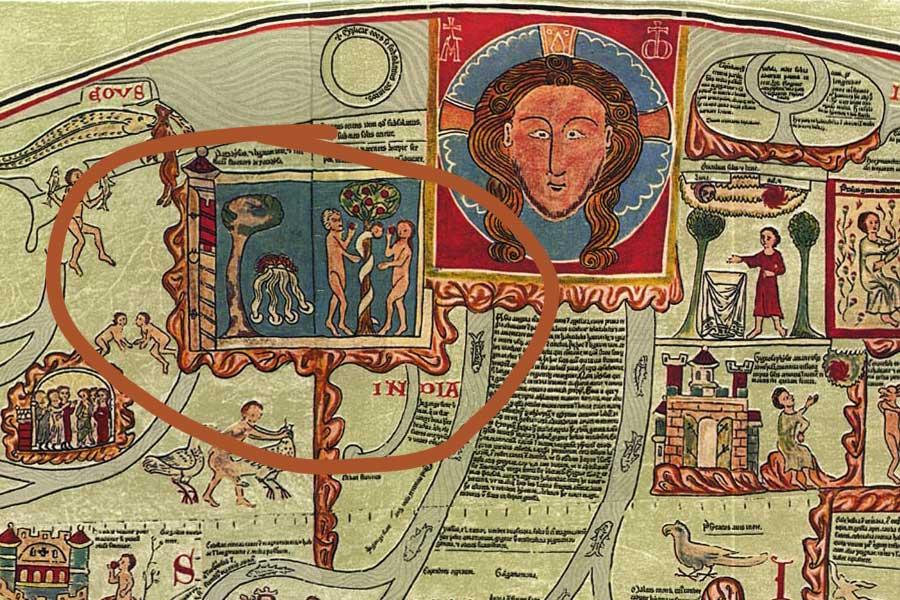
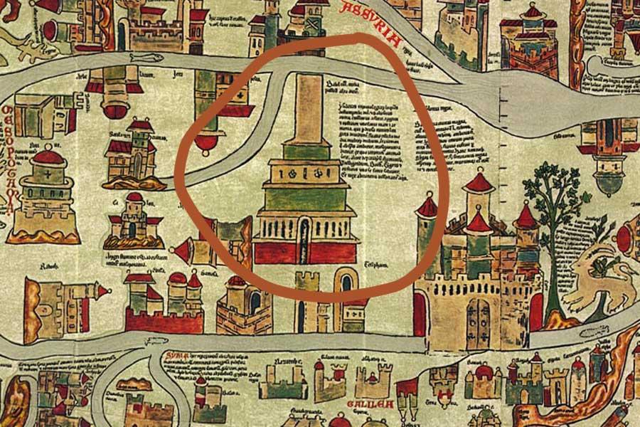
The subordination of the entire world beneath the image and body of Christ with his head at the top, his hands to the left and right and his feet at the bottom of the map is significant. The map’s religious and sacral purpose is made clear by the depiction of Jerusalem at its centre, presented with a golden wall as described in the revelation of St. John. The emphasis is on biblical motifs such as Noah’s Ark, the Tower of Babylon, the Garden of Paradise, and so on.
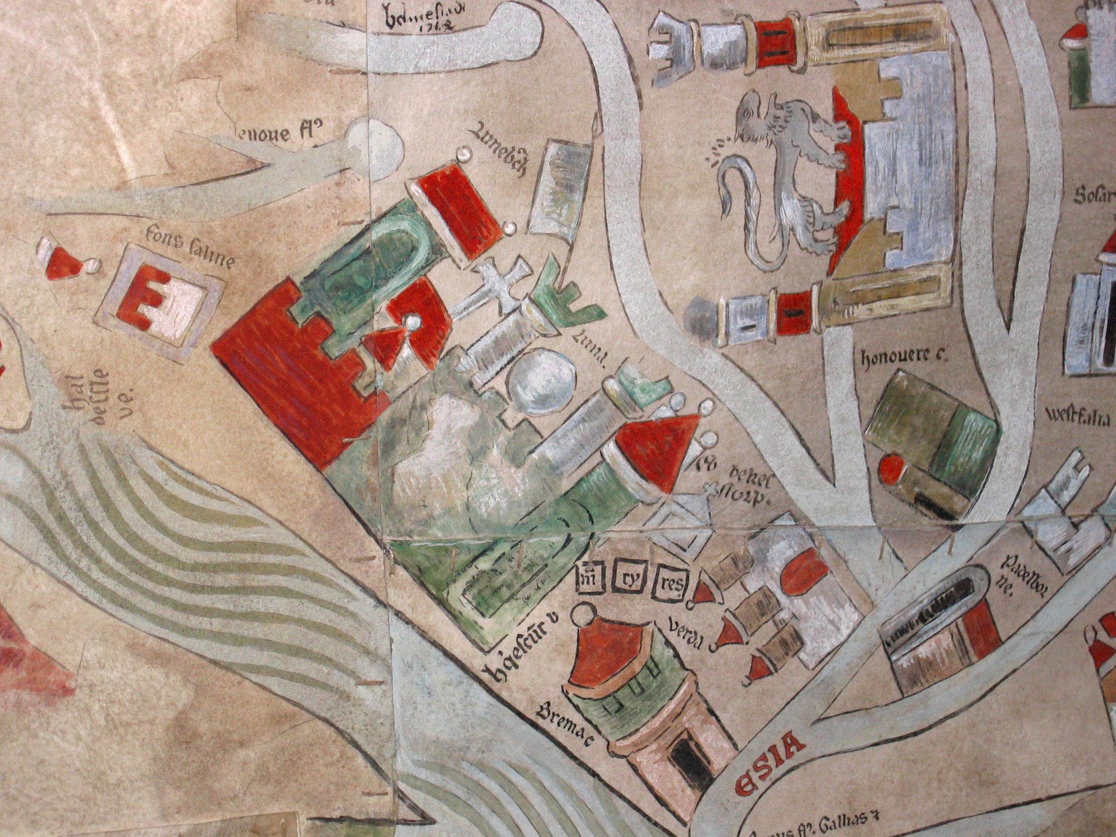
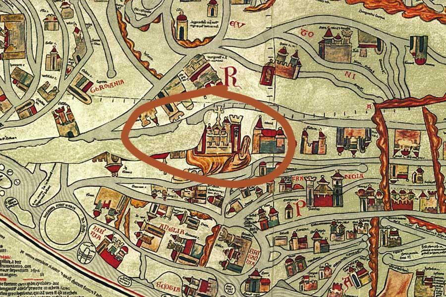
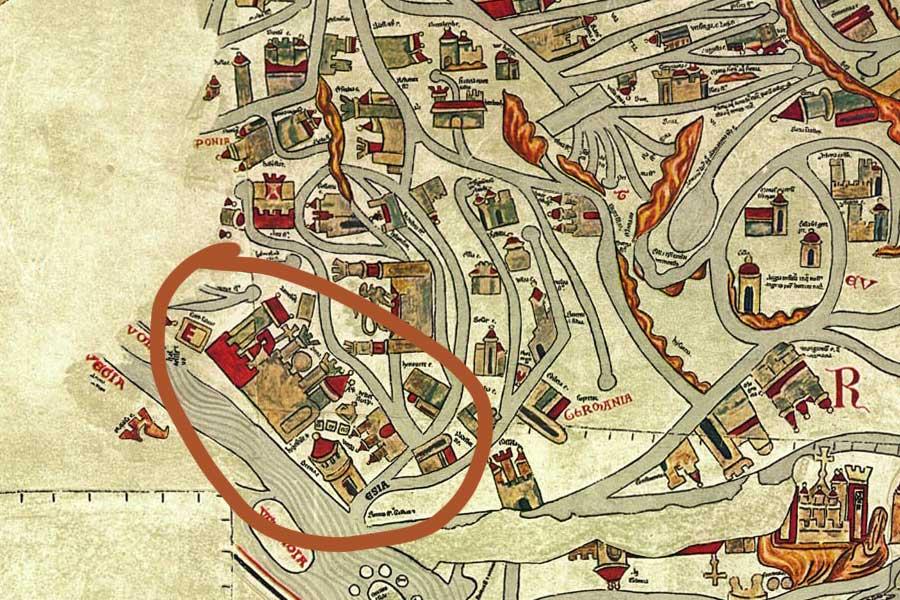
However, the countries of Europe with their towns, rivers and mountains are also depicted, as are those of Asia and Africa to the extent known at the time. Especially detailed descriptions can be found in the region of Lower Saxony.
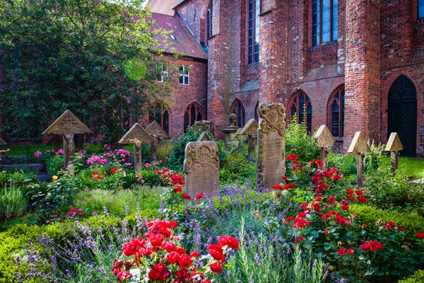
The town of Braunschweig and its emblem, the lion, are recognisable, as is - slightly smaller - the town of Hanover, the bishop’s see of Bremen, Lueneburg and its thermal spring and, of course, Ebstorf or Ebbekestorpe, as it is named on the map, along with the graves of the three martyrs.
Of extraordinary detail are depictions of the animal world, of Greek mythology, ancient legends and folkloric fables, but also from the life of Alexander the Great.
It is impossible to show everything that has been incorporated in the Ebstorf mappa mundi as a true chronicle of the world at that time.
It is therefore all the more astounding to see the love of detail, fantasy and extraordinary opulence with which those who created the map have visually expressed their knowledge.
Cloister Ebstorf cordially invites you to be amazed by the medieval map of the world.